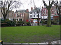
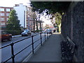
Area Overview for NW6 1NB
Photos of NW6 1NB


Area Information
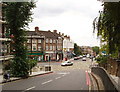
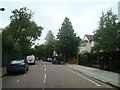
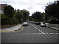
Living in postcode sector NW6 1NB means residing within a compact residential cluster that spans just over 4,200 square metres. This small area in north London is defined by its density and its position within a broader network of amenities and transport links. With a population of 1,480, the neighbourhood maintains a residential character while remaining tightly connected to the wider city. The sheer concentration of people in such a limited space creates an environment where daily convenience often outweighs the need for extensive travel. Residents navigate a landscape where specific local clusters offer immediate access to services without the noise and congestion of larger urban districts. The area's size restricts large open green spaces within immediate boundaries, meaning the daily rhythm relies heavily on the surrounding districts for outdoor pursuits. For those considering homes in NW6 1NB, the reality is a focus on efficiency and proximity rather than expansive private grounds. The community here is established, with individuals who have chosen this specific postcode for its location relative to major transport hubs like Kilburn Dean and Finchley End. You are buying into a slice of London that prioritises logistical efficiency.
- Area Type
- Postcode
- Area Size
- 4210 m²
- Population
- 1480
- Population Density
- 17310 people/km²
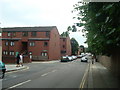
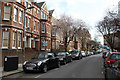
The property market in NW6 1NB is distinctly shaped by its accommodation type, which consists almost entirely of flats. This structural characteristic dictates the nature of every potential purchase in this postcode sector. With 57 per cent of residents owning their homes, the area leans significantly towards an owner-occupied model. This high ownership rate often implies a more stable neighbourhood where original owners may have lived for decades, allowing them to shape the local culture. The predominance of flats means buyers should expect vertical living arrangements rather than starting properties with private gardens. You will likely encounter buyers looking for secure, well-maintained blocks that offer the convenience of urban living without the perimeter of a detached house. The small area size of 4,210 square metres reinforces the idea that homes here are space-efficient. Prospective homeowners looking at houses in NW6 1NB must be prepared for the specific challenges and benefits of shared wall living in a compact zone. The market is not a sprawling housing market but a concentrated one focused on quality flats within a tight community boundary.
House Prices in NW6 1NB
Showing 44 properties
| Address | Type | Beds | Baths | Last Sale Price | Last Sale Date | |
|---|---|---|---|---|---|---|
| Flat A, 59 Mill Lane, London, NW6 1NB | Flat | 3 | 2 | - | - | |
| Flat 1ST Floor, 77 Mill Lane, London, NW6 1NB | Retail | 1 | 1 | - | - | |
| Flat A, 35 Mill Lane, London, NW6 1NB | Flat | 3 | - | - | - | |
| Flat 1, 61A Mill Lane, London, NW6 1NB | Flat | - | - | - | - | |
| 49 Mill Lane, London, NW6 1NB | Flat | - | - | - | - | |
| Berns & Company, 43 Mill Lane, London, NW6 1NB | Office | - | - | - | - | |
| Flat 1, 43 Mill Lane, London, NW6 1NB | Flat | - | - | - | - | |
| Flat 1, 47 Mill Lane, London, NW6 1NB | Flat | - | - | - | - | |
| Flat 2, 43 Mill Lane, London, NW6 1NB | Flat | - | - | - | - | |
| Flat 3, 47 Mill Lane, London, NW6 1NB | Flat | - | - | - | - |
Energy Efficiency in NW6 1NB
Your lifestyle in NW6 1NB benefits from an immediate ring of high-quality amenities that are within practical walking or short transit distance. For grocery shopping, you have three major options nearby including Waitrose Little, Tesco Fortune, and Sainsburys West. The presence of a Waitrose specifically suggests a neighbourhood with a focus on premium quality goods for higher spending residents. Transport enthusiasts will find themselves surrounded by five railway stations and five metro stations, making the area a major transit node. Waterbus services at London Zoo, Little Venice, and Camden Lock offers a unique leisure option just moments from the area. For those relying on coaches, three major bus hubs including London Victoria Coach Station provide direct links to the south. With a population of 1,480, you are part of a small community that is nonetheless well-served by world-class infrastructure. The cluster size of 4,210 square metres allows these amenities to feel intimate yet accessible. You do not need a car to navigate this area effectively. The concentration of stations and shops creates a self-contained lifestyle where daily needs are met without travel delays.
Amenities
Schools
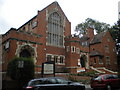
Families considering NW6 1NB have access to Emmanuel Church of England Primary School, which is located in close proximity to the postcode. This institution holds an Ofsted rating of good, a classification that signals a standard of education above the baseline national average. With this named school as the primary option on your doorstep, you know exactly where your children would attend if they lived in NW6 1NB. The presence of a single primary school with a 'good' rating simplifies the search for quality education in this immediate vicinity. While the data lists only one primary school, it sits comfortably within the practical reach of any home in this cluster. The 'good' rating provides reassurance without the need for further investment in private tuition or long commutes to outer borough academies. For parents living in homes in NW6 1NB, this school acts as a central pillar of the community's daily routine. It is a local asset that supports the average age of 47 years found in the local population.
| Rank | School | Type | Entry gender | Ages |
|---|
Explore more schools in this area
Go to Schools tabDemographics
The community in NW6 1NB reflects a settled population with a median age of 47 years. This figure indicates that the majority of residents are well past the typical renting years of their early adulthood. Adults aged between 30 and 64 years represent the most common age range, suggesting a neighbourhood dominated by established households and individuals with significant disposable income. Nearly 57 per cent of the population in this area own their homes, pointing towards an owner-occupied market rather than a transient rental economy. The predominant ethnic group identified is White, which aligns with the character of many traditional north London residential sectors. The accommodation type is primarily flats, a feature that suits the high population density of 351,510 people per square kilometre reported for this specific postcode data point. Such density statistics indicate that you will be sharing buildings and streets with many others in a vertical living arrangement. This demographic profile suggests a quiet, stable environment rather than a bustling, youthful scene. Families and empty nesters form the bedrock of this community.
Household Size
Accommodation Type
Tenure
Ethnic Group
Religion
Household Composition
Age
Household Deprivation
NS-SEC
Explore more demographic insights in this area
Go to Demographics tabPlanning
Planning Constraints
- Flood RiskPremium
- Ramsar Wetland SitesPremium
- Area of Outstanding Natural BeautyPremium
- Protected Nature ReservePremium
- Protected WoodlandPremium