Area Overview for NW6 1LB
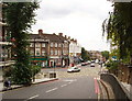
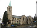
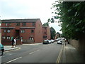
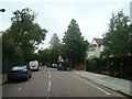
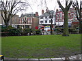
Photos of NW6 1LB
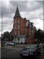
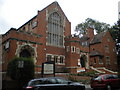
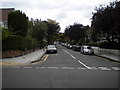
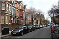

Area Information
Living in NW6 1LB means occupying a 7059 m² residential cluster with a tightly knit community. This specific postcode covers a population of 1480 people, creating a population density of 209,664 people per km². Such high density characterises a small residential cluster within a larger urban context where space is at a premium. Every day, residents navigate an environment defined by its compact footprint and proximity to major London thoroughfares. The area serves as a hub for people who value being close to transport links and retail outlets without commuting from the inner city. You will find your daily journey revolves around these immediate surroundings, where the distinction between local and national amenities blurs. The sheer number of residents per square kilometre suggests a neighbourhood where neighbours are likely to know one another, even in this high-rise setting. This density is not random; it reflects a deliberate planning choice typical of London, where vertical living maximises accessibility to the capital's heart.
- Area Type
- Postcode
- Area Size
- 7059 m²
- Population
- 1480
- Population Density
- 17310 people/km²
The property market in NW6 1LB is defined by a high proportion of owner-occupiers, with 57% of residents owning their homes outright or with a mortgage. This statistic confirms that this is not primarily a speculative rental market but a settled residential zone where people have put down roots. The accommodation type is overwhelmingly flats, which is a direct response to the extreme population density of 209,664 people per square kilometre. You are looking at an area where vertical construction is the norm, meaning your search should focus on apartment blocks rather than terraced houses. This distinction matters for buyers who require ground access or garden space, as these features are rare in this high-density cluster. The 7059 m² area size indicates a concentration of housing that serves a large number of people within a very small geographical boundary. For a buyer, this suggests higher potential demand and a vibrant property market driven by the need for convenient living close to transport hubs. The mix of owners indicates stability, which often correlates with steady property values and a reliable community fabric.
House Prices in NW6 1LB
Showing 53 properties
| Address | Type | Beds | Baths | Last Sale Price | Last Sale Date | |
|---|---|---|---|---|---|---|
| 31 Lyncroft Gardens, London, NW6 1LB | Terraced | 5 | 3 | £3,150,000 | May 2025 | |
| 35 Lyncroft Gardens, London, NW6 1LB | Terraced | 7 | 4 | £2,900,000 | Jul 2019 | |
| 3 Lyncroft Gardens, London, NW6 1LB | house | 5 | - | £2,700,000 | Aug 2018 | |
| 33 Lyncroft Gardens, London, NW6 1LB | Terraced | 5 | 3 | £1,480,000 | Jan 2010 | |
| 23 Lyncroft Gardens, London, NW6 1LB | Flat | - | - | £1,499,950 | Jun 2007 | |
| Flat Basement And Ground Floor, 21 Lyncroft Gardens, London, NW6 1LB | Flat | 1 | 2 | - | - | |
| Basement Flat, 37 Lyncroft Gardens, London, NW6 1LB | Flat | 1 | - | - | - | |
| 13 Lyncroft Gardens, London, NW6 1LB | Semi-detached | 3 | 1 | - | - | |
| 39 Lyncroft Gardens, London, NW6 1LB | Flat | - | - | - | - | |
| 27 Lyncroft Gardens, London, NW6 1LB | Flat | 2 | 1 | - | - |
Energy Efficiency in NW6 1LB
Your daily life in NW6 1LB is supported by an extensive network of amenities within practical reach. Retail options include Waitrose Little, Tesco Fortune, and Sainsburys West, ensuring you can access international and everyday groceries without travelling far. Transport connectivity is excellent, with five nearby stations including West Hampstead Thameslink Railway Station, West Hampstead Overground Station, and West Hampstead Railway Station. The Waterloo and Northern lines, accessible via Hampstead, Kilburn, and Finchley Road Stations, are also close by. For those wishing to travel by water, the London Zoo Waterbus Stop, Camden Lock Waterbus, and Little Venice Waterbus Stop offer unique waterfront access. Bus services, though fewer in number with nine listed routes, include major connections like London Victoria Coach Station Arrivals and the Green Line Coach Station. This density of services means you rarely need to leave the area for basic needs or leisure activities. The presence of so many transport hubs within a 7059 m² cluster highlights how central this location is to the wider city network.
Amenities
Schools
Families residing in NW6 1LB have convenient access to quality education, starting with Emmanuel Church of England Primary School. This primary institution holds a 'good' Ofsted rating, offering parents a secure foundation for their children's early education. With a median age of 47 in the area, many parents will rely on local schooling alongside broader London options. The existence of a primary school within practical reach is a significant factor for households with younger children, even though the age profile skews towards older adults. You should verify if any secondary schools lie within reasonable commuting distance, as the provided data only confirms the primary option. The 'good' rating of Emmanuel Church of England Primary School reflects consistent educational standards that meet the requirements of London's rigorous schooling framework. For new residents, knowing that a reputable primary school exists nearby provides reassurance regarding the long-term viability of the area for families. The concentration of educational opportunities, even limited to this one named school in the immediate vicinity, contributes to the overall appeal of the NW6 1LB postcode for those considering school-led moves.
| Rank | School | Type | Entry gender | Ages |
|---|
Explore more schools in this area
Go to Schools tabDemographics
The community in NW6 1LB is predominantly adult, with a median age of 47 years. Most households fall into the 30-64 years age range, indicating a neighbourhood populated by established families and dual-income professionals rather than students or retired couples. You will encounter a society where stability is common, reflected in a home ownership rate of 57%. This figure suggests that the majority of residents have secured their property rather than renting, pointing to a desire for long-term stability in this district. The accommodation stock consists primarily of flats, a design necessary to accommodate the high population density of over 200,000 people per square kilometre. Diversity is present but secondary to the dominant group; White residents form the predominant ethnic group within this specific cluster. Understanding these demographics helps you picture the daily rhythm of the area, where mature adults share spaces designed for efficient, multi-level living. The high ownership rate also implies a community that has invested significantly in their local environment, which often translates into better-maintained shared areas and a stronger sense of local responsibility.
Household Size
Accommodation Type
Tenure
Ethnic Group
Religion
Household Composition
Age
Household Deprivation
NS-SEC
Explore more demographic insights in this area
Go to Demographics tabPlanning
Planning Constraints
- Flood RiskPremium
- Ramsar Wetland SitesPremium
- Area of Outstanding Natural BeautyPremium
- Protected Nature ReservePremium
- Protected WoodlandPremium