Area Overview for NW6 1JL
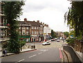
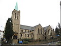
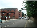
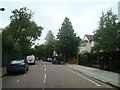
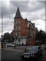
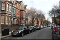
Photos of NW6 1JL


Area Information
NW6 1JL represents a specific postcode cluster within London, serving a resident population of 1,924 people. This neighbourhood defines itself as a small residential area distinct from the broader borough. It sits at the intersection of extensive public transport networks, including railways, the Underground, and waterbus services. Daily life here revolves around high convenience and accessibility rather than expansive green spaces within the immediate cluster. Residents benefit from proximity to major retail hubs and healthcare centres like the West London Mental Health NHS Trust. The location appeals to those who prioritise short commutes and urban amenities over suburban sprawl. You will find that the area's character is shaped by its density and its role as a residential node connecting to wider London districts. The neighbourhood functions efficiently as part of a larger metropolitan system. Practicality drives the daily rhythm of life in this postcode sector, where every essential service is within walking distance or a short tube ride away. Living in NW6 1JL means embracing a lifestyle defined by connectivity and immediate access to the city's core facilities without the sprawl of neighbouring zones.
- Area Type
- Postcode
- Area Size
- Not available
- Population
- 1924
- Population Density
- 16473 people/km²
The housing stock in NW6 1JL is defined by a specific type of accommodation: flats. Unlike areas dominated by detached houses, this postcode cluster specialises in multi-unit residential buildings. This structural reality influences both the property market and the lifestyle of inhabitants. With only 23% home ownership, the majority of flats in this sector are rented properties. This high rental proportion makes the area attractive to tenants seeking flexible living arrangements. Buyers looking for freehold properties in NW6 1JL face a more limited selection compared to owner-occupier dominated zones. The market here caters primarily to landlords and investors who manage portfolios of rental units. For prospective buyers in this small area, the prevalence of flats means you are likely to purchase or invest in purpose-built residential blocks. The concentration of rental properties also supports high demand from individuals or couples needing London housing without homeownership status. Understanding that flats predominate assists you in configuring your search criteria correctly for this postcode sector.
House Prices in NW6 1JL
No properties found in this postcode.
Energy Efficiency in NW6 1JL
Residents of NW6 1JL enjoy immediate access to a wide array of retail, transport, and leisure facilities. Five notable retail outlets serve the local cluster, including Waitrose Little, Sainsburys West, and Tesco West. These stores provide daily necessities within practical reach of every home. Transport connectivity is exceptional, with five railway stations, five Underground stations, and five waterbus stops located nearby. West Hampstead Thameslink Railway Station and Brondesbury Station offer direct rail links, while Kilburn Station and Hampstead Station provide Underground access. The iconic London Zoo Waterbus Stop and Camden Lock Waterbus add a unique dimension to local travel. You can also reach London Victoria Coach Station and Green Line Coach Station for inter-regional journeys. Despite the density of amenities, the area avoids the chaotic feel of central London. The presence of nearby retail and transport hubs means you rarely need to travel far for daily errands. Living in NW6 1JL offers a balanced lifestyle where urban convenience meets residential calm.
Amenities
Schools
| Rank | School | Type | Entry gender | Ages |
|---|
Explore more schools in this area
Go to Schools tabDemographics
The community residing in NW6 1JL has a median age of 47 years. The most common age range for adults living here spans from 30 to 64 years old. This demographic profile indicates a neighbourhood populated by established households rather than young professionals or retirees. Family structures tend to be settled, reflecting the age distribution. Home ownership is a minority experience in this cluster, with only 23% of residents owning their property outright. The majority of the population lives in rented accommodation. This imbalance suggests a significant rental sector alongside the smaller home-owners group. The local households vary significantly in size, ranging from one person living alone to larger families of five members. The predominant ethnic group in NW6 1JL identifies as White, forming the major demographic majority. Despite this, the area accommodates a mix of household types within its small footprint. Understanding these figures helps you gauge the type of neighbours and family dynamics prevalent in this specific postcode. The population stability offered by the age range supports a quiet, mature environment for family life.
Household Size
Accommodation Type
Tenure
Ethnic Group
Religion
Household Composition
Age
Household Deprivation
NS-SEC
Explore more demographic insights in this area
Go to Demographics tabPlanning
Planning Constraints
- Flood RiskPremium
- Ramsar Wetland SitesPremium
- Area of Outstanding Natural BeautyPremium
- Protected Nature ReservePremium
- Protected WoodlandPremium