Area Overview for NW6 1DP
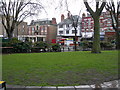
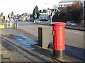
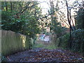
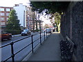
Photos of NW6 1DP
Area Information
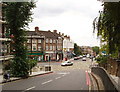
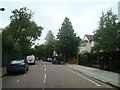
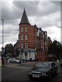
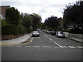
Buying a home in NW6 1DP means choosing a very specific residential cluster rather than a broad district. This postcode covers a small geographic footprint of just 1,394 square metres, housing a total population of 1,657 people. The result is an extremely dense community where you are in close proximity to your neighbours. Daily life here is defined by high connectivity and accessibility, as the area sits at a major transport nexus. You can reach three different railway stations and three metro stations within a short distance, alongside access to the London Zoo Waterbus and Camden Lock. The location sits firmly within the Greater London area, offering immediate access to the East London and West London bus networks. While the physical area is tiny, the surrounding infrastructure supports a wide range of activities. You will find yourself surrounded by significant retail hubs and transport gates that make commuting or local errands convenient. The character of the area is shaped by its function as a transit point, yet it retains a distinct residential identity with a strong presence of ownership. Living in this specific cluster offers a unique balance of urban convenience and a tightly knit community structure.
- Area Type
- Postcode
- Area Size
- 1394 m²
- Population
- 1657
- Population Density
- 5412 people/km²
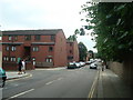
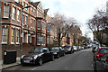
When you look at the housing stock in NW6 1DP, the picture is clear: flats dominate the landscape. The accommodation data explicitly identifies flats as the primary type, meaning you will rarely find detached houses or semi-detached homes in this specific postcode. This structure supports the area's character as a high-density urban enclave rather than a suburban sprawl. A striking 57% of residences are owner-occupied, which signals that this is largely an owner-driver market rather than a private rental scheme. If you are considering buying, you should expect prices to reflect the premium of owning in a prime London location, even within a small cluster. The prevalence of flats creates a specific buying environment where you are purchasing a share of freehold or leasehold rather than a standalone plot of land. This reality means you must consider service charges and management fees alongside your purchase price. The mix is not split between new builds and period properties in the data, so you are dealing with an established stock that has seen many changes of hand since construction. For investors, this implies a demand for yield in flats where owner-occupiers may be less likely to move frequently.
House Prices in NW6 1DP
Showing 22 properties
Energy Efficiency in NW6 1DP
Your lifestyle in NW6 1DP is supported by a dense network of amenities located within easy reach. For shopping needs, you have five major retail points close by, including Tesco Fortune, Waitrose Little, and Co-op Childs. These supermarkets provide you with daily essentials without the need for a long car journey. Dining options are plentiful, as these retail outlets often host cafes and restaurants that serve the local population. Transport drives the lifestyle here, as you are surrounded by five rail stations and five metro stations. You do not need a car to navigate your day, as the Green Line Coach Station and London Victoria Coach Station Arrivals also serve the area. For leisure, the area offers distinct points of interest like the London Zoo Waterbus Stop. You can visit Camden Lock Waterbus or the Little Venice Waterbus Stop to enjoy water-based recreation in the city centre. The proximity to these venues means you can mix local errands with weekend outings seamlessly. The availability of three bus links further ensures that if you miss a train, your day still gets on schedule.
Amenities
Schools
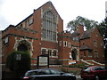
Families living in NW6 1DP have access to specific educational options nearby. The nearest school listed is Hampstead School, which operates as a primary institution. The Ofsted rating for Hampstead School is good, confirming a standard of education that meets government expectations. Because this is your only listed option in the immediate vicinity, you must look slightly further afield for secondary or tertiary education. The presence of a primary school with a good rating suggests that younger families are a known part of the local tapestry, even if the area itself consists mostly of older adults. When planning your children's education, you should prioritise transports routes from this postcode to the nearest primary hub. The single entry for schools means you cannot rely on a wide choice within the single square kilometre. However, Hampstead School's good rating provides a solid foundation for early education. You should verify catchment areas carefully, as the small size of NW6 1DP means boundaries are rigid and distance from the rail stations might factor into your commute to other schools.
| Rank | School | Type | Entry gender | Ages |
|---|
Explore more schools in this area
Go to Schools tabDemographics
The community profile for NW6 1DP reflects a mature, established population. You will find that 57% of residents own their homes outright, indicating a strong preference for stability over renting. The dominant housing stock consists of flats, which aligns with the high-density nature of the postcode. Socially, the area is predominantly White, contributing to a settled demographic environment. The median age stands at 47 years, meaning you are looking at a resident base where most people fall between 30 and 64 years old. This age group typically drives a stable local economy through steady employment and long-term tenures. The concentration of adults in this bracket suggests a neighbourhood where residents value established surroundings over rapid development. You are not entering a transient area; instead, you are joining a group likely to have lived in similar flats for many years. The high home ownership rate of 57% further cements the idea that this is a community where people put down roots. With a median age of 47, the social atmosphere is likely quiet and focused, lacking the chaos often associated with younger transient populations.
Household Size
Accommodation Type
Tenure
Ethnic Group
Religion
Household Composition
Age
Household Deprivation
NS-SEC
Explore more demographic insights in this area
Go to Demographics tabPlanning
Planning Constraints
- Flood RiskPremium
- Ramsar Wetland SitesPremium
- Area of Outstanding Natural BeautyPremium
- Protected Nature ReservePremium
- Protected WoodlandPremium