Area Overview for NW5 4RB
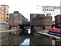
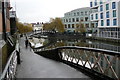
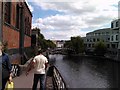
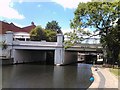
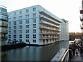
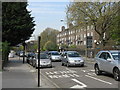
Photos of NW5 4RB


Area Information
Living in NW5 4RB places you within a specific postcode area that covers a small residential cluster of exactly 3,061 square metres. This compact footprint supports a population of 1,971 people, resulting in a notably high density of 643,961 people per square kilometre. Such concentration creates an intense urban experience where space is at a premium and communal living is inherent to the environment. The area functions as a dense urban node rather than a sprawling suburb, meaning daily life revolves around proximity to connectivity and shared resources. Residents navigate a neighbourhood where individuals live very close together, fostering a fast-paced rhythm typical of central London locations. You can expect a residential environment dominated by flats, reflecting the physical constraints of the land and the historical development patterns of Greater London. The sheer volume of residents relative to the square footage means noise and movement will be constant features of your daily routine. Despite the high population density, the area avoids major planning constraints such as Areas of Outstanding Natural Beauty or protected woodlands, allowing for straightforward urban management. Safety assessments indicate a medium crime risk, which you should factor into your expectations for evening walks or night-time activities. This postcode represents a snapshot of intense city living where every square metre holds significant value.
- Area Type
- Postcode
- Area Size
- 3061 m²
- Population
- 1971
- Population Density
- 18630 people/km²
The property market in NW5 4RB is heavily skewed towards rental arrangements, evidenced by a home ownership rate of only 15%. This statistic paints a clear picture of the housing stock, which is predominantly composed of flats. Such accommodation types are standard in high-density postcodes where land value precludes large family homes. You are primarily looking at a landlord-tenant dynamic rather than a market of private equity buyers occupying their own residences. The presence of 1,971 residents within just 3,061 square metres reinforces the classification of this space as a high-intensity urban cluster. For buyers considering homes in NW5 4RB, the low ownership percentage suggests limited stock available for purchase compared to rental yield opportunities for investors. The absence of protected planning constraints like Ramsar wetland sites or Areas of Outstanding Natural Beauty means the land is designated purely for residential and potentially commercial use without environmental restrictions. This lack of planning barriers often supports a fluid market where flats change hands frequently or remain in long-term institutional management. The accommodation type is exclusively flats, which dictates the physical layout of every potential property you might view. You should expect properties to be vertically stacked with shared structural walls rather than detached or semi-detached houses that benefit from significant open space.
House Prices in NW5 4RB
Showing 21 properties
| Address | Type | Beds | Baths | Last Sale Price | Last Sale Date | |
|---|---|---|---|---|---|---|
| Flat 6, Ashington, Warden Road, London, NW5 4RB | Flat | - | - | - | - | |
| Flat 8, Ashington, Warden Road, London, NW5 4RB | Flat | - | - | - | - | |
| Flat 19, Ashington, Warden Road, London, NW5 4RB | Flat | - | - | - | - | |
| Flat 7, Ashington, Warden Road, London, NW5 4RB | Flat | - | - | - | - | |
| Flat 12, Ashington, Warden Road, London, NW5 4RB | Flat | - | - | - | - | |
| Flat 9, Ashington, Warden Road, London, NW5 4RB | Flat | - | - | - | - | |
| Flat 15, Ashington, Warden Road, London, NW5 4RB | Flat | - | - | - | - | |
| Flat 4, Ashington, Warden Road, London, NW5 4RB | Flat | - | - | - | - | |
| Flat 2, Ashington, Warden Road, London, NW5 4RB | Flat | - | - | - | - | |
| Flat 13, Ashington, Warden Road, London, NW5 4RB | Flat | - | - | - | - |
Energy Efficiency in NW5 4RB
Daily life in NW5 4RB is characterised by immediate access to a wide array of amenities, all within practical reach. You are surrounded by five railway stations, five tube stations, and five bus stops, ensuring that travel is never a barrier to your daily routine. For shopping needs, five retail outlets are nearby, specifically including Tesco Kentish, Co-op Kentish, and Sainsburys Kentish, providing essential groceries and household goods. Leisure options include five ferry-style waterbus connections, notably the Camden Lock Waterbus, London Zoo Waterbus Stop, and Little Venice Waterbus Stop, adding a unique dimension to your local commute. Health and emergency transport are also well represented, with three major bus terminals serving as key interchange points. These include the London Victoria Coach Station Arrivals, Green Line Coach Station, and Victoria Coach Station itself, offering long-distance travel links beyond the immediate city. The proximity of these major venues means you can access international connections or domestic travel directly from your neighbourhood without needing to venture far into central commercial districts. Your lifestyle is defined by convenience, as daily necessities from fresh food to social excursions via waterbus are all integrated into a compact area. The concentration of transport and retail infrastructure creates an environment where errands and leisure activities blend seamlessly into your day.
Amenities
Schools
Education options for families living in NW5 4RB are limited by the small geographical scale of the postcode. The nearest educational facility listed is Sherborne Nursery School, which operates as a nursery rather than a primary or secondary institution. This designation means there are no state primary schools, comprehensives, or selective academies explicitly recorded within the immediate vicinity of this specific cluster. A nursery provides care for infants and toddlers, typically for those aged up to five years, preparing them for formal schooling elsewhere in the city. The absence of listed primary or secondary schools means your search for schools near NW5 4RB must extend beyond the immediate postcode boundary. Families must look to neighbouring zones for the full range of educational stages from reception through to A-levels. While Sherborne Nursery School offers early years care, it does not cover the compulsory education years for older children. You might find that parents prioritize location less for school proximity here and more for the availability of other amenities or transport links. The presence of only one named educational facility indicates a residential enclave where daily school runs likely involve significant travel to other populated districts of London.
| Rank | School | Type | Entry gender | Ages |
|---|
Explore more schools in this area
Go to Schools tabDemographics
The community within NW5 4RB is defined by a demographic profile where the median age sits at 47 years. Adults aged between 30 and 64 years constitute the most common age range, indicating a population that has accumulated stability rather than consisting of transient young professionals or families. This age distribution suggests a residential area where residents have likely settled long-term, seeking permanence over mobility. Home ownership remains relatively low at just 15%, implying that the vast majority of homes in this cluster are rented properties. This low level of ownership correlates directly with the predominant accommodation type, which consists of flats. Flats are often tenanted in such high-density zones because they are easier to lease to short-term tenants than to sell to owners seeking private control. The predominant ethnic group in the area is White, which shapes the local cultural fabric and social interactions. With a population density of 643,961 people per square kilometre, the social fabric is tightly knit yet impersonal in a traditional sense. You will encounter neighbours who are living in close quarters, but the high turnover associated with rental markets may prevent the formation of deep-rooted multi-generational community bonds found in owner-occupied neighbourhoods.
Household Size
Accommodation Type
Tenure
Ethnic Group
Religion
Household Composition
Age
Household Deprivation
NS-SEC
Explore more demographic insights in this area
Go to Demographics tabPlanning
Planning Constraints
- Flood RiskPremium
- Ramsar Wetland SitesPremium
- Area of Outstanding Natural BeautyPremium
- Protected Nature ReservePremium
- Protected WoodlandPremium