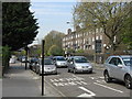
Area Overview for NW5 4EX
Photos of NW5 4EX


Area Information
The postcode NW5 4EX defines a very specific residential cluster in north London covering just 2,935 square metres. With a population of 1,692 people, this small area maintains a relatively tight-knit community feel despite its urban setting. You live in a neighbourhood where every street corner is reachable within minutes, creating an environment that balances density with accessibility. The population density here is exceptionally high, reflecting the compact nature of the land usage typical of central London postcodes. Living in NW5 4EX means sharing a small geographic footprint with nearly 1,700 neighbours. This concentration ensures that local amenities are immediately accessible without the need for extensive travel. The area serves as a distinct pocket within the broader Camden borough, offering residents a sense of locality while remaining connected to wider transport networks. Daily life revolves around the immediate vicinity, where limited physical space necessitates efficient use of resources and shared public routes. For those considering homes in NW5 4EX, understanding the confined scale of the postcode helps manage expectations regarding garden space and private outdoor areas. The specific boundaries of this cluster create a micro-community where local knowledge and practical neighbourly interactions play a significant role in daily living.
- Area Type
- Postcode
- Area Size
- 2935 m²
- Population
- 1692
- Population Density
- 17005 people/km²
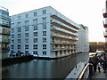
The property market in NW5 4EX is defined by a housing stock where flats dominate the landscape. With only 34 percent home ownership, the area functions largely as a rental market or a mix of short-term leases and longer tenancies rather than a settled owner-occupied estate. This low ownership percentage means that investment buyers should approach the market with an understanding that resale within this specific postcode may involve navigating tenancy agreements or a higher proportion of leasehold properties. The prevalence of flats is a direct consequence of the small total area size of 2,935 square metres, which cannot support large detached houses or expansive gardens. Homebuyers looking at NW5 4EX should prepare for limited square footage and vertical living arrangements. The housing landscape prioritises density over horizontal expansion, offering convenience and proximity to transport at the cost of traditional suburban features. You will find fewer larger family homes compared to surrounding postcodes with higher land availability. This market structure suits investors seeking rental yields or individuals who prefer low-maintenance urban living. However, the high turnover implied by low ownership rates means community integration may require more effort for new arrivals than in established owner-occupied neighbourhoods.
House Prices in NW5 4EX
Showing 22 properties
| Address | Type | Beds | Baths | Last Sale Price | Last Sale Date | |
|---|---|---|---|---|---|---|
| 13B St Thomass Gardens, London, NW5 4EX | Flat | 2 | 1 | £680,000 | Jun 2024 | |
| 4 St Thomass Gardens, London, NW5 4EX | Terraced | 5 | 1 | £1,700,000 | Jul 2021 | |
| 10 St Thomass Gardens, London, NW5 4EX | Terraced | 4 | 2 | £1,250,000 | Dec 2016 | |
| 1 St Thomass Gardens, London, NW5 4EX | Terraced | 3 | - | £1,300,000 | Feb 2015 | |
| 8 St Thomass Gardens, London, NW5 4EX | Flat | - | - | £1,000,000 | Mar 2009 | |
| 7 St Thomass Gardens, London, NW5 4EX | Terraced | - | - | £962,500 | Oct 2008 | |
| 12 St Thomass Gardens, London, NW5 4EX | Terraced | 5 | 2 | £925,000 | Dec 2007 | |
| Flat A, 9 St Thomass Gardens, London, NW5 4EX | Flat | - | - | £525,000 | Aug 2006 | |
| 6 ST THOMASS GARDENS, London, NW5 4EX | Maisonette | 3 | 2 | £250,000 | Sep 1998 | |
| Flat B, 9 St Thomass Gardens, London, NW5 4EX | Terraced | 4 | 3 | - | - |
Energy Efficiency in NW5 4EX
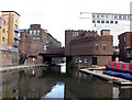
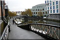
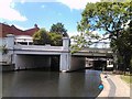
Living in NW5 4EX offers immediate access to a dense network of retail, leisure, and transport amenities. Five major supermarkets operate within practical reach, including Tesco Chalk, Amazon Fresh, and Sainsburys Chalk. This selection means you can find all daily groceries and household essentials without venturing far from home. Five metro stations provide direct links to key parts of the city, while five rail stations offer regional connectivity. The area also supports active travel with five locations along the water bus route, including Camden Lock Waterbus and Little Venice Waterbus Stop. These water transport options connect you to little Venice and the surrounding parkland without using a car. Beyond supermarkets, London Victoria Coach Station, Green Line Coach Station, and Victoria Coach Station are reachable via local bus services. Local leisure options are concentrated around these transport nodes. The character of the area is defined by this high convenience; you do not need to plan long journeys for basic needs. Dining, shopping, and socialising happen within your immediate streets or a short walk away. This density makes daily life efficient and reduces dependency on vehicle ownership.
Amenities
Schools
Families in NW5 4EX have access to a small selection of highly rated educational institutions within close reach. Ryhl Community Primary School stands out as the nearest primary school option. Inspected by Ofsted, this school holds an outstanding rating, indicating high standards of education and student care. The presence of an outstanding-rated primary school is a significant asset for families with young children considering homes in NW5 4EX. While there are no secondary schools or nursery schools listed in the immediate vicinity of this specific postcode, the outstanding rating of the local primary option provides a strong foundation for early education. The reliance on a single named nearby school suggests a focused local catchment area. Parents looking at NW5 4EX must plan for a wider catchment strategy if they require secondary education options beyond the immediate postcode. The outstanding status of Ryhl Community Primary School ensures that young residents receive a high-quality local education without needing to cross significant distances for daily schooling. This concentration of educational quality in a small radius adds considerable value to the local property market.
| Rank | School | Type | Entry gender | Ages |
|---|
Explore more schools in this area
Go to Schools tabDemographics
The community in NW5 4EX reflects a mature demographic profile with a median age of 47 years. Most residents fall into the adult age range of 30 to 64 years, suggesting an area populated by established individuals and families rather than young students or retired residents. Home ownership stands at 34 percent, indicating that a significant majority of residents rent their property. This rental dominance hints at a transient element within the population or a market preference for tenancy in this specific location. Flats constitute the predominant accommodation type, aligning with the high population density and limited land area available in the postcode. The predominant ethnic group is White, though the multi-ethnic nature of modern London means diverse cultures coexist within these boundaries. About one-third of households own their homes, while the remaining two-thirds remain renters. This housing split influences the stability of the local community, with potentially lower barriers to entry compared to owner-occupied zones. The age profile suggests that many residents are likely career-focused professionals or parents actively engaged in local school districts. Understanding these demographics helps you gauge the likely character of the streets and the types of neighbours you might encounter.
Household Size
Accommodation Type
Tenure
Ethnic Group
Religion
Household Composition
Age
Household Deprivation
NS-SEC
Explore more demographic insights in this area
Go to Demographics tabPlanning
Planning Constraints
- Flood RiskPremium
- Ramsar Wetland SitesPremium
- Area of Outstanding Natural BeautyPremium
- Protected Nature ReservePremium
- Protected WoodlandPremium