Area Overview for NW5 4EP
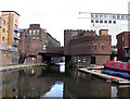
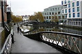
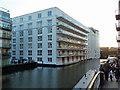
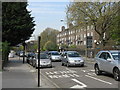
Photos of NW5 4EP


Area Information
Living in NW5 4EP means residing within a postcode that covers a specific residential cluster measuring 2100 m². This small footprint houses 1692 people, creating a tightly knit environment where neighbours are often close. The density is exceptionally high at 805558 people per km², indicating that space is at a premium. People in this location enjoy immediate access to a network of transport links, including Chalk Farm Station, Belsize Park Station, and Camden Town Station on the metro. You can also find Kentish Town West Station, Gospel Oak Station, and Hampstead Heath Station within walking or cycling distance for rail commuters. The area offers diverse commuting options with five bus services connecting to major hubs like London Victoria Coach Station and the Green Line Coach Station. Water bus services operate from Camden Lock, London Zoo, and Little Venice Waterbus Stops, providing a unique way to travel across the North London landscape. Domestic tranquility is complemented by five nearby retail outlets, including Tesco Chalk, Amazon Fresh, and Sainsburys Chalk. Digital infrastructure supports modern remote working demands, while local amenities ensure daily needs are met without needing to travel far. This postcode represents a convenient slice of urban life where efficiency and connectivity define the rhythm of daily existence.
- Area Type
- Postcode
- Area Size
- 2100 m²
- Population
- 1692
- Population Density
- 17005 people/km²
The property market in NW5 4EP is defined by a distinct lack of owner-occupancy, with only 34% of residents owning their homes outright. This low ownership figure indicates that the market is heavily skewed towards the private rental sector or shared living arrangements. Flats are the predominant accommodation type, which aligns with the dense residential cluster covering a mere 2100 m². You are looking at a stock where space is efficient and vertical rather than expansive. This housing profile typically appeals to professionals, young families, and sharers who prioritise location over property size. The high population density of 805558 people per km² reinforces the expectation of smaller living units and frequent movement of residents. Buyers should understand that purchasing a home here often involves navigating leasehold terms common to flats rather than freehold land ownership typical of suburban areas. The concentration of flats in NW5 4EP suggests that those living here have chosen compact urban living for its proximity to transport hubs like Chalk Farm and Camden Town. If home ownership is a primary goal, the low percentage of owner-occupied properties in this specific postcode warrants careful consideration of long-term costs and resale values compared to traditional neighborhoods.
House Prices in NW5 4EP
Showing 11 properties
| Address | Type | Beds | Baths | Last Sale Price | Last Sale Date | |
|---|---|---|---|---|---|---|
| Flat, Former 2, Queens Crescent, London, NW5 4EP | Flat | - | - | £468,000 | Feb 2025 | |
| Flat 3, Cloverleaf House, 2 Queens Crescent, London, NW5 4EP | Flat | 2 | 2 | - | - | |
| Flat 9, Cloverleaf House, 2 Queens Crescent, London, NW5 4EP | Flat | 2 | - | - | - | |
| Flat 2, Cloverleaf House, 2 Queens Crescent, London, NW5 4EP | Flat | 2 | 2 | - | - | |
| Flat 6, Cloverleaf House, 2 Queens Crescent, London, NW5 4EP | Flat | 1 | 1 | - | - | |
| Flat 4, Cloverleaf House, 2 Queens Crescent, London, NW5 4EP | Flat | - | - | - | - | |
| Flat 7, Cloverleaf House, 2 Queens Crescent, London, NW5 4EP | Flat | 1 | 1 | - | - | |
| Flat 1, Cloverleaf House, 2 Queens Crescent, London, NW5 4EP | Maisonette | - | - | - | - | |
| Flat 8, Cloverleaf House, 2 Queens Crescent, London, NW5 4EP | Flat | - | - | - | - | |
| Flat 10, Cloverleaf House, 2 Queens Crescent, London, NW5 4EP | house | - | - | - | - |
Energy Efficiency in NW5 4EP
Daily life in NW5 4EP is characterised by immediate access to essential services and leisure options within practical reach. You can satisfy your grocery needs at Tesco Chalk, Amazon Fresh, or Sainsburys Chalk, all located just nearby. For entertainment or longer journeys, travel hubs include London Victoria Coach Station Arrivals, Green Line Coach Station, and the Victoria Coach Station itself. The area's charm extends to its water connections, with services available at Camden Lock Waterbus, London Zoo Waterbus Stop, and Little Venice Waterbus Stop. Sports lovers might use the Green Line Coach Station or travel directly to Hampstead Heath Station to explore local green spaces. Dining and culture are accessible through the vicinity of Chalk Farm Station, Belsize Park Station, and Camden Town Station. Retail therapy is a short walk away with five shopping outlets supporting local commerce. These amenities create a lifestyle where work, leisure, and daily necessities converge in a compact radius. Residents benefit from the convenience of having supermarkets, coach stations, and water transport all within reaching distance. This密度 of amenities ensures that life in NW5 4EP is both stimulating and self-contained, reducing the time spent travelling for routine activities.
Amenities
Schools
Families living in NW5 4EP have access to excellent educational provision nearby, with Rhyl Community Primary School named in the local data. This facility operates as a primary school and holds an outstanding Ofsted rating, setting a high standard for early education. While this specific school stands in a category of its own, the data provided only confirms the presence of this single primary institution in the immediate vicinity. The absence of secondary schools in the provided data suggests that residents often look to institutions beyond the immediate local cluster for older children. The outstanding rating of Rhyl Community Primary School indicates a strong commitment to educational quality, which is a significant factor for parents considering homes in NW5 4EP. If you are a parent, the reputation of this school provides reassurance regarding the educational environment your children might attend. The proximity of such a highly-rated establishment makes the area attractive for school-run households, despite the lack of detailed data on secondary options or distance metrics for this particular school.
| Rank | School | Type | Entry gender | Ages |
|---|
Explore more schools in this area
Go to Schools tabDemographics
The community profile for NW5 4EP reflects a mature population with a median age of 47 years. Adults aged between 30 and 64 years constitute the most common age range, suggesting a neighbourhood dominated by established families and working professionals. Home ownership stands at 34%, meaning a significantly larger portion of the 1692 residents likely rent their homes. Flats are the primary accommodation type, aligning with the high density and central location of the postcode. The predominant ethnic group identifies as White, which shapes the cultural fabric of the local streets. While specific deprivation statistics are not available in the current data, the age profile suggests a population that may have stable careers and varying investment strategies in property. The mix of owner-occupiers and renters indicates a dynamic housing market catering to different financial circumstances. Families and couples in this age bracket often value location and transport links over large square footage, making the flat-heavy stock of NW5 4EP a practical fit. The demographic data paints a picture of a settled community where professionals balance work and life within compact urban living. Understanding this age and housing profile helps you assess whether the local services and neighbourly vibe match your personal requirements for community life.
Household Size
Accommodation Type
Tenure
Ethnic Group
Religion
Household Composition
Age
Household Deprivation
NS-SEC
Explore more demographic insights in this area
Go to Demographics tabPlanning
Planning Constraints
- Flood RiskPremium
- Ramsar Wetland SitesPremium
- Area of Outstanding Natural BeautyPremium
- Protected Nature ReservePremium
- Protected WoodlandPremium