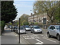
Area Overview for NW5 4EH
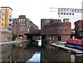
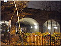
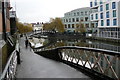
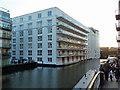
Photos of NW5 4EH


Area Information
The postcode area of NW5 4EH represents a compact residential cluster in north-west London, covering just 9,131 square metres. Despite its small physical footprint, this densely packed location accommodates a population of 1,692 people. Living in NW5 4EH means navigating a tight-knit environment where residents live in close proximity to one another. The area is situated within London, placing it at the heart of a major global city while maintaining a high density of occupancy. With a population density of 185,310 people per square kilometre, this location typifies a large urban settlement where space is at a premium. You will find that daily life here revolves around this concentrated community. The area functions as a small residential pocket integral to the wider London neighbourhood structure. Buyers considering this specific cluster should note its scale and how it fits within the broader London property network. This postcode serves as a distinct entry point for those seeking a specific sector within the LNWP borough.
- Area Type
- Postcode
- Area Size
- 9131 m²
- Population
- 1692
- Population Density
- 17005 people/km²
The property market in NW5 4EH is defined by a specific housing stock characterised almost entirely by flats. With accommodation types listed as flats, buyers will find a landscape dominated by apartment living rather than detached or semi-detached houses. Only 34% of residents own their homes, which frames this postcode as a market where rentals likely hold significant sway alongside owned properties. This low ownership figure in a small area of 9,131 square metres suggests a high turnover of tenancy or a prevalence of leasehold structures common in London. Prospective buyers exploring homes in NW5 4EH must adjust their expectations toward urban apartment living. The density of the population further supports a market driven by smaller, stackable living units within the dense urban fabric. Those searching for detached family homes with private gardens may find limited suitability in this specific postcode. Instead, the market here caters to those comfortable with flat living, whether they are renting or purchasing leasehold units. This property type dominance dictates the construction age and architectural style throughout the immediate cluster.
House Prices in NW5 4EH
Showing 26 properties
| Address | Type | Beds | Baths | Last Sale Price | Last Sale Date | |
|---|---|---|---|---|---|---|
| Flat 8, Halstow, Queens Crescent, London, NW5 4EH | Flat | 1 | 1 | - | - | |
| Flat 22, Halstow, Queens Crescent, London, NW5 4EH | Maisonette | 5 | 1 | - | - | |
| Flat 14, Halstow, Queens Crescent, London, NW5 4EH | house | - | - | - | - | |
| Flat 13, Halstow, Queens Crescent, London, NW5 4EH | house | - | - | - | - | |
| Flat 12, Halstow, Queens Crescent, London, NW5 4EH | Flat | - | - | - | - | |
| Flat 11, Halstow, Queens Crescent, London, NW5 4EH | Flat | - | - | - | - | |
| Flat 24, Halstow, Queens Crescent, London, NW5 4EH | Flat | - | - | - | - | |
| Flat 9, Halstow, Queens Crescent, London, NW5 4EH | Flat | - | - | - | - | |
| Flat 10, Halstow, Queens Crescent, London, NW5 4EH | Maisonette | - | - | - | - | |
| Flat 17, Halstow, Queens Crescent, London, NW5 4EH | Detached | 3 | 1 | - | - |
Energy Efficiency in NW5 4EH
Residents of NW5 4EH enjoy extensive access to amenities across multiple categories. The lifestyle here is supported by five nearby retail locations, including Tesco Chalk, Amazon Fresh, and Sainsburys Chalk. Transport options are equally diverse, with five metro stations including Chalk Farm Station, Belsize Park Station, and Camden Town Station. Rail connections are served by Kentish Town West Station, Gospel Oak Station, and Hampstead Heath Station. Additionally, five ferry and waterbus stops provide routes via Camden Lock, London Zoo, and Little Venice. Three major bus hubs, including London Victoria Coach Station, serve the broader network beyond the immediate cluster. This density of facilities means you are never far from shopping, dining, or transit. The proximity of Amazon Fresh and major supermarkets simplifies grocery shopping significantly. Access to Chalk Farm and Camden Town makes commuting or leisurely London exploration convenient. The waterbus options add a unique mode of transport for residents wanting to explore London's waterways. Your daily life in NW5 4EH is serviced by a wide array of high-functioning amenities within practical reach.
Amenities
Schools
Families living in NW5 4EH benefit from access to immediately neighbouring educational institutions. The primary school option available in the vicinity is Rhyl Community Primary School. This institution holds an outstanding Ofsted rating, providing a high-quality education for young children. The data confirms no secondary schools are listed in the immediate immediate proximity to this specific postcode. For families with older children, you will need to look beyond this immediate cluster for secondary education options. The presence of an outstanding primary school suggests a focus on early childhood education in the surrounding area. Homebuyers considering schools near NW5 4EH will find this academic strength is largely restricted to the primary sector within the defined data scope. The single primary option listed indicates a reliance on specific catchment zones for early schooling. Parents should verify secondary catchment areas separately as no secondary institutions are enumerated in the current information for this precise postcode.
| Rank | School | Type | Entry gender | Ages |
|---|
Explore more schools in this area
Go to Schools tabDemographics
The community profile for NW5 4EH reveals a mature demographic landscape centred on adults aged 30 to 64 years. The median age in this area is 47, indicating a population that has largely moved past young adulthood. Home ownership stands at 34%, suggesting that the majority of residents are tenants rather than landlords. Flats constitute the predominant form of accommodation within this residential cluster. Demographically, the White ethnic group represents the most common category among the local population. Nearly two-thirds of residents fall into the 30-64 age bracket, shaping a stable environment without a large cohort of school-age children or young retirees. This age distribution suggests an area settled by established households or couples. A lower home ownership rate relative to the median age implies a potentially high level of rental dependency or shared ownership schemes invisible in the broad figures. The accommodation mix of flats aligns with the urban density, catering to professional adults and small families seeking proximity to central London amenities.
Household Size
Accommodation Type
Tenure
Ethnic Group
Religion
Household Composition
Age
Household Deprivation
NS-SEC
Explore more demographic insights in this area
Go to Demographics tabPlanning
Planning Constraints
- Flood RiskPremium
- Ramsar Wetland SitesPremium
- Area of Outstanding Natural BeautyPremium
- Protected Nature ReservePremium
- Protected WoodlandPremium