Area Overview for NW5 2SU
Photos of NW5 2SU


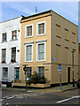
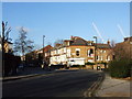
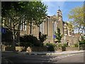
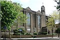


100 photos from this area
Area Information
Key information about the NW5 2SU including its size, population, and administrative classification.
- Area Type
- Postcode
- Area Size
- 4676 m²
- Population
- 1472
- Population Density
- 15896 people/km²
House Prices in NW5 2SU
72
Properties
£369,556
Average Sold Price
£133,000
Lowest Price
£549,950
Highest Price
Showing 72 properties
| Address | Type | Beds | Baths | Last Sale Price | Last Sale Date | |
|---|---|---|---|---|---|---|
| Flat 29, Long Meadow, Torriano Avenue, London, NW5 2SU | Flat | - | - | £465,000 | Sep 2023 | |
| Flat 60, Long Meadow, Torriano Avenue, London, NW5 2SU | Flat | - | - | £487,500 | May 2023 | |
| Flat 58, Long Meadow, Torriano Avenue, London, NW5 2SU | Flat | 2 | 1 | £526,000 | Jan 2023 | |
| Flat 54, Long Meadow, Torriano Avenue, London, NW5 2SU | Flat | 2 | 1 | £465,000 | Jun 2018 | |
| Flat 63, Long Meadow, Torriano Avenue, London, NW5 2SU | Flat | - | - | £549,950 | Mar 2016 | |
| Flat 22, Long Meadow, Torriano Avenue, London, NW5 2SU | Flat | - | - | £133,000 | Jan 2005 | |
| Flat 25, Long Meadow, Torriano Avenue, London, NW5 2SU | Flat | - | - | £186,000 | Sep 2004 | |
| Flat 47, Long Meadow, Torriano Avenue, London, NW5 2SU | Flat | - | - | £144,000 | Jan 2004 | |
| Flat 61, Long Meadow, Torriano Avenue, London, NW5 2SU | Flat | 3 | 1 | - | - | |
| Flat 34, Long Meadow, Torriano Avenue, London, NW5 2SU | Flat | 3 | 1 | - | - |
Page 1 of 8
Energy Efficiency in NW5 2SU
Amenities
Schools
| Rank | School | Type | Entry gender | Ages |
|---|
Explore more schools in this area
Go to Schools tabDemographics
Household Size
Family (3-5 people)
most common
Accommodation Type
Flats
most common
Tenure
26
majority
Ethnic Group
White
most common
Religion
N/A
most common
Household Composition
N/A
most common
Age
47
median
Adults (30-64 years)
most common
Household Deprivation
N/A
with no deprivation
NS-SEC
42
in Lower managerial occupations
Explore more demographic insights in this area
Go to Demographics tabPlanning
Planning Constraints
- Flood RiskPremium
- Ramsar Wetland SitesPremium
- Area of Outstanding Natural BeautyPremium
- Protected Nature ReservePremium
- Protected WoodlandPremium