Area Overview for NW5 2QE
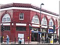
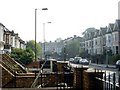
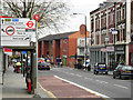
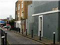
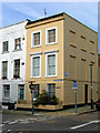
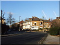
Photos of NW5 2QE


Area Information
NW5 2QE represents a small but dense residential cluster in the heart of London, covering an area of just 9577 square metres. With a population of 1495 people, this postcode serves as a concentrated node within the wider Kentish Town district. The density here is significant, standing at 156098 people per square kilometre, which creates a lively urban environment. Living in this specific postcode means embracing a high-intensity city lifestyle where residential spaces are tightly packed. This area functions as a microcosm of North West London, offering immediate access to major transport hubs while maintaining its character as a distinct residential pocket. The population profile suggests a community dominated by adults, reflecting the area's integration into the broader professional heart of the capital. Residents here balance the convenience of city living with the compactness typical of this neighbourhood. The sheer number of inhabitants in such a limited footprint highlights the desirability of this location for those seeking proximity to amenities and transport links. Understanding the sheer scale of 1495 residents helps explain the vibrancy and noise levels you might expect in daily life within these boundaries.
- Area Type
- Postcode
- Area Size
- 9577 m²
- Population
- 1495
- Population Density
- 18056 people/km²
The property market in NW5 2QE is characterised by a heavy reliance on the rental sector, as evidenced by the home ownership standing at just 18%. This statistic confirms that the vast majority of the 1495 residents rent their accommodation. Flats are the predominant accommodation type across this 9577 square metre area, meaning single-storey detached homes or semi-detached houses are not the primary feature here. For buyers looking at homes in this postcode, it is important to note that they will largely be viewing flats or considering a property on the highly competitive rental market. The low ownership percentage suggests that purchase opportunities are relatively scarce or intensely sought after compared to other parts of London. If you are looking to buy, you will need to act quickly when options arise, as the demand for flats in this high-density zone is strong. The housing stock is designed for urban living, prioritising vertical space and access over garden areas. This market dynamic means that price per square metre remains significant, and equity building for new buyers rents rather than of purchases unless they manage to break into the small minority of owner-occupied homes.
House Prices in NW5 2QE
Showing 37 properties
| Address | Type | Beds | Baths | Last Sale Price | Last Sale Date | |
|---|---|---|---|---|---|---|
| 38 Leighton Road, London, NW5 2QE | house | - | - | £1,300,000 | Jun 2021 | |
| 40 Leighton Road, London, NW5 2QE | Terraced | 2 | 2 | £825,500 | Jun 2020 | |
| 68 Leighton Road, London, NW5 2QE | Terraced | 3 | 2 | £1,080,000 | Apr 2018 | |
| 78 Leighton Road, London, NW5 2QE | house | - | - | £1,300,000 | Dec 2015 | |
| 48 Leighton Road, London, NW5 2QE | Terraced | 4 | 2 | £1,080,000 | Apr 2015 | |
| 66 Leighton Road, London, NW5 2QE | Terraced | 4 | 2 | £1,400,000 | Feb 2015 | |
| 54 Leighton Road, London, NW5 2QE | Terraced | 3 | 1 | £755,000 | Mar 2013 | |
| 20 Leighton Road, London, NW5 2QE | house | 2 | 2 | £699,000 | Mar 2010 | |
| 64 Leighton Road, London, NW5 2QE | house | 4 | - | £575,000 | Jul 2001 | |
| 74 Leighton Road, London, NW5 2QE | Flat | - | - | £269,950 | Sep 1999 |
Energy Efficiency in NW5 2QE
Daily life in NW5 2QE is shaped by the immediate proximity of extensive amenities within practical reach. You have five retail options close by, including Sainsburys Kentish, Co-op Kentish, and Co-op Fortress, ensuring you never lack for groceries or daily essentials. Transport connectivity is further enhanced by five metro stations, five rail stations, and five waterbus stops, allowing you to travel by tube, train, or boat. You can also access major coach terminal facilities including London Victoria Coach Station Arrivals, Green Line Coach Station, and Victoria Coach Station. This dense network of services means you can shop, eat, and commute without needing a car. The presence of Sainsburys and the Co-op ensures that household shopping is convenient, while the multiple transport stops offer flexibility for your journeys. This concentration of amenities supports a lifestyle where everything is accessible on foot or a short ride away. Whether you are stocking up on food or catching a train, the infrastructure supports a busy, convenient routine.
Amenities
Schools
| Rank | School | Type | Entry gender | Ages |
|---|
Explore more schools in this area
Go to Schools tabDemographics
The community in NW5 2QE is defined by a mature resident base, with a median age of 47 years. Most commonly, the population consists of adults falling within the 30 to 64 years range, indicating a neighbourhood populated by working professionals and families in their middle years. Home ownership stands at a low 18%, which points to a market dominated by long-term tenants rather than property owners. This high rental rate is consistent with the accommodation type, where flats are the predominant housing stock. When you look at the diversity of the area, the predominant ethnic group is White, though the high population density often brings cultural variety to close quarters. The age profile and housing mix suggest a stable community, yet the low ownership rate means many residents may have different priorities regarding stability compared to owner-occupiers. Understanding that nearly two-thirds of households do not own their homes helps frame the transient nature of some streets while acknowledging the deep-rooted presence of others. This demographic snapshot paints a picture of a city-centric community focused heavily on rental living arrangements.
Household Size
Accommodation Type
Tenure
Ethnic Group
Religion
Household Composition
Age
Household Deprivation
NS-SEC
Explore more demographic insights in this area
Go to Demographics tabPlanning
Planning Constraints
- Flood RiskPremium
- Ramsar Wetland SitesPremium
- Area of Outstanding Natural BeautyPremium
- Protected Nature ReservePremium
- Protected WoodlandPremium