Area Overview for NW5 2HF
Photos of NW5 2HF


Area Information
Living in NW5 2HF offers a snapshot of life within a specific residential cluster that forms part of the wider London postcode landscape. This postcode area encompasses a population of 1,447 residents, creating an intimate sense of community rather than the vast anonymity found in larger districts. The location sits comfortably amidst a network of transport hubs, yet retains a distinct character defined by its smaller scale. Daily life here revolves around immediate access to major tube lines, allowing you to reach central London and key business districts without significant travel times. The immediate surroundings feature a blend of retail giants and local coaching stations, ensuring that your daily needs—from grocery shopping to long-distance travel—are met without venturing far from your door. Because this is a defined postcode cluster, you will notice that the streets are less expansive than neighbouring boroughs, giving the neighbourhood a curated feel. You are living in an environment where distance to amenities like Camden Underground or Kentish Town West Station is measured in minutes rather than miles. The area functions as a practical residential base, ideal for those who prioritise connectivity and convenience over sprawling green spaces or large detached properties. Your daily routine will be shaped by this high accessibility, allowing you to navigate the city with a straightforward, efficient transit system at your fingertips.
- Area Type
- Postcode
- Area Size
- Not available
- Population
- 1447
- Population Density
- 16944 people/km²
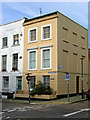
The property market in NW5 2HF is characterised primarily by flats, which dominate the local housing stock. This concentration suggests that the area is best suited for buyers seeking multi-storey living or those looking to purchase within a development that offers vertical space rather than expansive gardens. With a home ownership rate of 44%, the area presents a mix of owned homes and rental units, creating a dynamic market where both first-time buyers and investors have opportunities. The small population size of 1,447 residents limits the total number of transactions, meaning you may find fewer listings compared to a mainstream suburb, but potentially more meaningful engagement with local agents and sellers. In this context, purchasing homes in NW5 2HF often involves negotiating with individuals who understand the specific nuances of the postcode cluster. The prevalence of flats indicates that you will encounter properties designed for efficiency and convenience rather than traditional suburban layouts. Buyers looking for this post code should be prepared to consider leasehold arrangements common with flat living in London. The market here is not defined by vast semi-detached houses but by compact, well-located units that maximise urban potential. Whether you choose to buy a flat or seek a rental, the sheer size of the area means inventory is limited, requiring you to act quickly when a suitable property arises.
House Prices in NW5 2HF
Showing 3 properties
| Address | Type | Beds | Baths | Last Sale Price | Last Sale Date | |
|---|---|---|---|---|---|---|
| Flat 2, Fortess House, 9-10 Fortess Grove, London, NW5 2HF | Flat | - | - | - | - | |
| Flat 1, Fortess House, 9-10 Fortess Grove, London, NW5 2HF | Flat | 2 | 1 | - | - | |
| Flat 3, Fortess House, 9-10 Fortess Grove, London, NW5 2HF | Flat | 2 | - | - | - |
Energy Efficiency in NW5 2HF
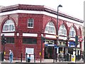
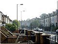
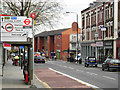
Daily life in NW5 2HF is anchored by a diverse range of amenities that cater to practical needs and leisure pursuits. You will find five stores in the retail category, including Co-op Fortress, Sainsburys Kentish, and Co-op Kentish, ensuring that your grocery shopping and household essentials are never far away. Transport enthusiasts will appreciate the sheer density of stations nearby, with Tufnell Park Station, Chalk Farm Station, and Camden Town Station providing quick tube access. Rail commuters benefit from Kentish Town West Station, Gospel Oak Station, and Camden Road Station, which connect you to broader network lines. For alternative travel methods, the nearby London Victoria Coach Station arrivals area, Green Line Coach Station, and Victoria Coach Station offer options for inter-city travel. Water lovers can access Camden Lock Waterbus, London Zoo Waterbus Stop, and Little Venice Waterbus Stop, adding a scenic dimension to your travels. Bus connections to London's heart are supported by London Victoria Coach Station Arrivals and local stops. The coexistence of major high streets, parkland access, and major transport nodes means you have the convenience of city living without the distance. You can enjoy a fresh meal at a nearby eatery, grab supplies at Sainsburys Kentish, or catch the 15-minute tube ride at Tufnell Park. This density of options ensures that your lifestyle remains vibrant and self-sufficient, regardless of the weather or time of day.
Amenities
Schools
| Rank | School | Type | Entry gender | Ages |
|---|
Explore more schools in this area
Go to Schools tabDemographics
The community residing in NW5 2HF reflects a mature demographic profile dominated by adults aged between 30 and 64 years. The median age here is 47, indicating a settled population that has likely chosen this location for stability and proximity to work. Home ownership stands at 44%, meaning nearly half of the residents own their properties outright, while the remaining population is likely part of the rental market or shares housing. Flats represent the predominant accommodation type in this postcode, suggesting a housing stock designed for urban living rather than large family homes. The area is predominantly white, though the specific breakdown of ethnic groups is not detailed in the available statistics. With a median age of 47, the neighbourhood likely hosts professionals, empty nesters, and long-term tenants who value a quiet residential environment. The concentration of adults in the 30-64 year range means you will engage with a peer group that actively participates in the local economy and community structures. This demographic skew also implies that the local schools and facilities cater to families with children who are either already settled or in a position to make educational decisions. When considering living in this postcode, you should expect a neighbourly atmosphere where residents have established roots and a clear understanding of local dynamics. The steady age profile supports a stable market where properties are often held for the medium to long term rather than being churned frequently.
Household Size
Accommodation Type
Tenure
Ethnic Group
Religion
Household Composition
Age
Household Deprivation
NS-SEC
Explore more demographic insights in this area
Go to Demographics tabPlanning
Planning Constraints
- Flood RiskPremium
- Ramsar Wetland SitesPremium
- Area of Outstanding Natural BeautyPremium
- Protected Nature ReservePremium
- Protected WoodlandPremium