Area Overview for NW5 1RG
Photos of NW5 1RG

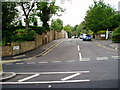
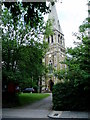
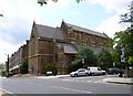
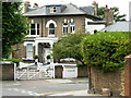
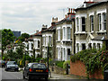
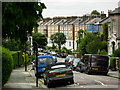
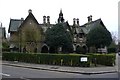
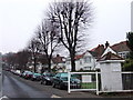
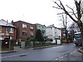
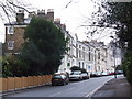
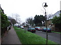
100 photos from this area
Area Information
Key information about the NW5 1RG including its size, population, and administrative classification.
- Area Type
- Postcode
- Area Size
- 6157 m²
- Population
- 1549
- Population Density
- 6776 people/km²
House Prices in NW5 1RG
9
Properties
£2,286,111
Average Sold Price
£900,000
Lowest Price
£3,620,000
Highest Price
Showing 9 properties
| Address | Type | Beds | Baths | Last Sale Price | Last Sale Date | |
|---|---|---|---|---|---|---|
| 25 St Albans Road, London, NW5 1RG | Detached | 4 | 1 | £2,750,000 | Aug 2024 | |
| 31 St Albans Road, London, NW5 1RG | house | - | - | £2,895,000 | Mar 2020 | |
| 11 St Albans Road, London, NW5 1RG | Semi-detached | 4 | 2 | £3,125,000 | Feb 2019 | |
| 29 St Albans Road, London, NW5 1RG | Semi-detached | 7 | 2 | £2,510,000 | Aug 2017 | |
| 9 St Albans Road, London, NW5 1RG | Semi-detached | 4 | 3 | £3,620,000 | Mar 2016 | |
| 27 St Albans Road, London, NW5 1RG | Semi-detached | 6 | - | £1,999,999 | Aug 2013 | |
| 35 St Albans Road, London, NW5 1RG | Flat | - | - | £1,850,000 | Apr 2007 | |
| 33 St Albans Road, London, NW5 1RG | Flat | - | - | £925,000 | Aug 2002 | |
| 7 St Albans Road, London, NW5 1RG | house | - | - | £900,000 | Jun 2001 |
Energy Efficiency in NW5 1RG
Amenities
Schools
| Rank | School | Type | Entry gender | Ages |
|---|
Explore more schools in this area
Go to Schools tabDemographics
Household Size
Family (3-5 people)
most common
Accommodation Type
Flats
most common
Tenure
63
majority
Ethnic Group
White
most common
Religion
N/A
most common
Household Composition
N/A
most common
Age
47
median
Adults (30-64 years)
most common
Household Deprivation
N/A
with no deprivation
NS-SEC
61
in Lower managerial occupations
Explore more demographic insights in this area
Go to Demographics tabPlanning
Planning Constraints
- Flood RiskPremium
- Ramsar Wetland SitesPremium
- Area of Outstanding Natural BeautyPremium
- Protected Nature ReservePremium
- Protected WoodlandPremium