Area Overview for NW5 1JN
Photos of NW5 1JN

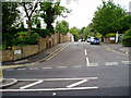


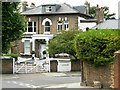
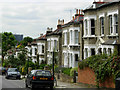
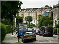

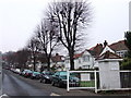
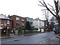
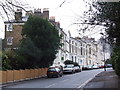
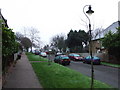
100 photos from this area
Area Information
Key information about the NW5 1JN including its size, population, and administrative classification.
- Area Type
- Postcode
- Area Size
- 8535 m²
- Population
- 1438
- Population Density
- 16322 people/km²
House Prices in NW5 1JN
44
Properties
£1,204,995
Average Sold Price
£85,000
Lowest Price
£3,025,000
Highest Price
Showing 44 properties
| Address | Type | Beds | Baths | Last Sale Price | Last Sale Date | |
|---|---|---|---|---|---|---|
| 32 Dartmouth Park Avenue, London, NW5 1JN | Flat | - | - | £410,000 | Feb 2021 | |
| 18 Dartmouth Park Avenue, London, NW5 1JN | Semi-detached | 5 | 3 | £3,025,000 | Oct 2019 | |
| 26 Dartmouth Park Avenue, London, NW5 1JN | Semi-detached | 5 | - | £2,225,000 | Mar 2015 | |
| 4 Dartmouth Park Avenue, London, NW5 1JN | house | 6 | - | £2,000,000 | Jul 2013 | |
| 16 Dartmouth Park Avenue, London, NW5 1JN | Maisonette | 2 | 1 | £2,500,000 | Jan 2008 | |
| 2 Dartmouth Park Avenue, London, NW5 1JN | Flat | - | - | £1,325,000 | Mar 2004 | |
| 64 Dartmouth Park Avenue, London, NW5 1JN | Flat | - | - | £160,000 | Sep 2003 | |
| 14 Dartmouth Park Avenue, London, NW5 1JN | Flat | - | - | £230,000 | Feb 2002 | |
| 68 Dartmouth Park Avenue, London, NW5 1JN | Flat | - | - | £89,950 | Dec 1998 | |
| 62 Dartmouth Park Avenue, London, NW5 1JN | Flat | - | - | £85,000 | Oct 1997 |
Page 1 of 5
Energy Efficiency in NW5 1JN
Amenities
Schools
| Rank | School | Type | Entry gender | Ages |
|---|
Explore more schools in this area
Go to Schools tabDemographics
Household Size
One person
most common
Accommodation Type
Flats
most common
Tenure
43
majority
Ethnic Group
White
most common
Religion
N/A
most common
Household Composition
N/A
most common
Age
47
median
Adults (30-64 years)
most common
Household Deprivation
N/A
with no deprivation
NS-SEC
47
in Lower managerial occupations
Explore more demographic insights in this area
Go to Demographics tabPlanning
Planning Constraints
- Flood RiskPremium
- Ramsar Wetland SitesPremium
- Area of Outstanding Natural BeautyPremium
- Protected Nature ReservePremium
- Protected WoodlandPremium