Area Overview for NW4 4RP
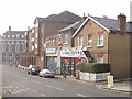
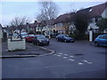
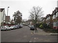
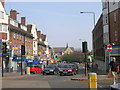
Photos of NW4 4RP
Area Information
Living in NW4 4RP means settling into a very compact residential cluster covering just 3,510 square metres. This specific postcode serves 2,165 residents, creating a neighbourhood with high population density compared to many wider UK boroughs. The location sits within the London Borough of Barnet, a region historically known for its strong transport links and affluent demographic. You are living in a defined pocket of the Hendon area, where the immediate surroundings are intimate and close-knit. The small physical footprint distinguishes this from broader neighbourhoods, suggesting a tightly wound urban fabric where distances between homes are short. Daily life here involves navigating a space where community interaction is naturally frequent due to the concentration of people. While the area functions as a self-contained residential zone, its location closest to Brent Cross and Hendon means you retain easy access to wider London resources. The character of NW4 4RP is that of a dense urban enclave rather than a sprawling suburb. Prospective buyers looking for a sense of place within a highly convenient location will find this postcode delivers that immediate proximity. The area represents a slice of suburban convenience within a larger metropolitan context. It is a practical choice for those prioritising accessibility and proximity to major road networks and rail lines over extensive green space.
- Area Type
- Postcode
- Area Size
- 3510 m²
- Population
- 2165
- Population Density
- 11786 people/km²
The property market in NW4 4RP is defined by the statistic that 34% of residents own their homes. Consequently, 66% of the 2,165 population operates within the rental sector. This skew towards renting suggests a dynamic housing stock where turnover can be frequent compared to owner-occupied suburbs. Flats are the predominant accommodation type, reflecting the need for high-density living within the limited 3,510 square metre footprint of this postcode. Buyers looking specifically for a house in this location would face significant challenges, as the data identifies flats as the standard dwelling form. For investors or landlords, the market may present steady demand driven by the high number of renters. However, county council regulations and the density of the flats mean purchasing a freehold property could be difficult. Properties here are likely to focus on interior quality and efficient space utilisation rather than extensive outdoor grounds. The low home ownership percentage creates a landscape where leaseholders or tenants make up the majority, potentially influencing local improvements and council tax collection dynamics. If you are purchasing a flat in NW4 4RP, you are entering a market characterised by urban convenience. The limited area size reinforces that homes will be efficient units rather than sprawling family residences. This profile appeals to professionals requiring central access without the high price tag of larger suburban homes.
House Prices in NW4 4RP
Showing 9 properties
| Address | Type | Beds | Baths | Last Sale Price | Last Sale Date | |
|---|---|---|---|---|---|---|
| 17 Fuller Street, Hendon, London, NW4 4RP | Terraced | 3 | 1 | £410,000 | Apr 2015 | |
| 9 Fuller Street, Hendon, London, NW4 4RP | Terraced | 3 | 1 | £305,000 | Sep 2010 | |
| 7 Fuller Street, Hendon, London, NW4 4RP | Terraced | - | - | £240,000 | Feb 2004 | |
| 5 Fuller Street, Hendon, London, NW4 4RP | Terraced | 3 | - | £122,500 | Jul 1999 | |
| 11 Fuller Street, Hendon, London, NW4 4RP | Semi-detached | 3 | 1 | £110,000 | Mar 1998 | |
| 3 Fuller Street, Hendon, London, NW4 4RP | Terraced | 3 | 1 | £85,000 | Sep 1996 | |
| 1 Fuller Street, Hendon, London, NW4 4RP | Terraced | 3 | 1 | £29,925 | Jun 1996 | |
| 15 Fuller Street, Hendon, London, NW4 4RP | Terraced | - | - | - | - | |
| 13 Fuller Street, Hendon, London, NW4 4RP | Terraced | 4 | 1 | - | - |
Energy Efficiency in NW4 4RP
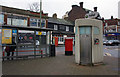
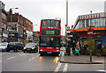
The lifestyle in NW4 4RP is centred on walkable access to key retail and leisure hubs. Within practical reach of the postcode, you can visit 5 retail locations, including the Co-op Church, M&S Finchley Ln BP, and Farmfoods Hendon. These shops provide daily necessities, so you do not need to travel far for groceries or essentials. Transport links allow you to easily expand your shopping range to larger centres at Brent Cross or Hendon Interchange if larger stores are required. Your leisure options are extensive, with 5 metro stations and 5 rail stations nearby facilitating quick trips to London or local attractions. Uniquely, the area is close to 3 ferry stops, such as the London Zoo Waterbus Stop and Little Venice Waterbus Stop. This access allows residents to visit the London Zoo or enjoy the Regent's Canal towpath without needing a car. The proximity to these waterbus highlights a lifestyle that blends urban density with access to green and blue spaces. Dining and social activities are supported by the high footfall near Brent Cross Station, which serves as a major commercial hub. Living in NW4 4RP means you have public transport as a primary lifestyle asset rather than car dependency. The combination of local food stores and major transport nodes creates a practical, non-isolated environment suitable for walking or cycling.
Amenities
Schools
Families living in NW4 4RP have access to several educational institutions in the immediate vicinity. St Mary's CofE High School is identified as a primary school option near this postcode. Residents also have access to Nancy Reuben Primary School, which operates as an independent institution and holds a 'good' Ofsted rating. The presence of both a Church of England maintained school and an independent provider offers parents variety in educational philosophy and curriculum structure. Having a 'good' rated independent school nearby is a specific advantage for those seeking recognised academic standards without residing exclusively in the catchment area of state schools. St Mary's CofE High School provides a traditional maintained school alternative, likely focusing on faith-based education alongside the national curriculum. For residents moving into NW4 4RP, the proximity of these two institutions means school-run logistics are manageable. There is no designated secondary school data in the provided information for this specific cluster, so families will need to check commissioning zones beyond the immediate localities for older children. The mix of schooling options indicates a community supportive of diverse educational pathways. When considering homes in NW4 4RP, your assessment of this important location must factor in the commute times to these specific named schools and the potential transport links required to reach them.
| Rank | School | Type | Entry gender | Ages |
|---|
Explore more schools in this area
Go to Schools tabDemographics
The community in NW4 4RP reflects a mature population profile with a median age of 47 years. Adults aged between 30 and 64 form the most common age range, indicating a neighbourhood dominated by fully established careers and families. Only 34% of residents own their homes, meaning the majority live in rented accommodation or shared ownership arrangements. Flats constitute the primary form of accommodation, aligning with the high population density of this small 3,510 square metre area. This housing stock suggests a reliance on vertical living rather than detached or semi-detached houses. The predominant ethnic group in this specific postcode is White. The demographic data paints a picture of a stable, mid-to-late career workforce residing in a predominantly flat-based layout. A home ownership rate of 34% is relatively low compared to the UK national average, which implies a high proportion of the population relies on the rental market. For families considering NW4 4RP, the demographic maturity suggests schools nearby will likely be full and established. The concentration of adults over 30 means you are joining a community where neighbours are likely settling down rather than moving frequently. The flat-dominant nature of the area limits yard space but maximises the efficient use of land in a high-density setting.
Household Size
Accommodation Type
Tenure
Ethnic Group
Religion
Household Composition
Age
Household Deprivation
NS-SEC
Explore more demographic insights in this area
Go to Demographics tabPlanning
Planning Constraints
- Flood RiskPremium
- Ramsar Wetland SitesPremium
- Area of Outstanding Natural BeautyPremium
- Protected Nature ReservePremium
- Protected WoodlandPremium