Area Overview for NW4 3EU
Photos of NW4 3EU
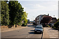
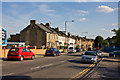
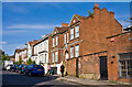
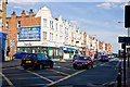
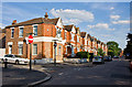
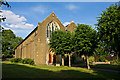
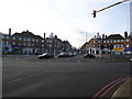
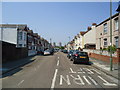
100 photos from this area
Area Information
Key information about the NW4 3EU including its size, population, and administrative classification.
- Area Type
- Postcode
- Area Size
- 6249 m²
- Population
- 1971
- Population Density
- 13445 people/km²
House Prices in NW4 3EU
47
Properties
£334,093
Average Sold Price
£118,150
Lowest Price
£795,000
Highest Price
Showing 47 properties
| Address | Type | Beds | Baths | Last Sale Price | Last Sale Date | |
|---|---|---|---|---|---|---|
| 109 Audley Road, Hendon, London, NW4 3EU | Semi-detached | 5 | 3 | £795,000 | Dec 2020 | |
| 93A Audley Road, Hendon, London, NW4 3EU | Flat | - | - | £220,000 | Jan 2011 | |
| 101 Audley Road, Hendon, London, NW4 3EU | Semi-detached | 3 | 2 | £405,000 | Sep 2010 | |
| 93B Audley Road, Hendon, London, NW4 3EU | Flat | - | - | £212,500 | Mar 2008 | |
| 75 Audley Road, Hendon, London, NW4 3EU | Maisonette | 2 | 2 | £308,000 | Jun 2004 | |
| 95 Audley Road, Hendon, London, NW4 3EU | house | 3 | - | £280,000 | Dec 2003 | |
| 107 Audley Road, Hendon, London, NW4 3EU | house | 5 | 2 | £118,150 | Oct 1996 | |
| 113 Audley Road, Hendon, London, NW4 3EU | Detached | 3 | 1 | - | - | |
| 85 Audley Road, Hendon, London, NW4 3EU | Detached | 3 | 1 | - | - | |
| 59 Audley Road, Hendon, London, NW4 3EU | Flat | 2 | 1 | - | - |
Page 1 of 5
Energy Efficiency in NW4 3EU
Amenities
Schools
| Rank | School | Type | Entry gender | Ages |
|---|
Explore more schools in this area
Go to Schools tabDemographics
Household Size
Family (3-5 people)
most common
Accommodation Type
Houses
most common
Tenure
47
majority
Ethnic Group
White
most common
Religion
N/A
most common
Household Composition
N/A
most common
Age
47
median
Adults (30-64 years)
most common
Household Deprivation
N/A
with no deprivation
NS-SEC
25
in Lower managerial occupations
Explore more demographic insights in this area
Go to Demographics tabPlanning
Planning Constraints
- Flood RiskPremium
- Ramsar Wetland SitesPremium
- Area of Outstanding Natural BeautyPremium
- Protected Nature ReservePremium
- Protected WoodlandPremium