Area Overview for NW3 7TW
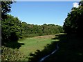
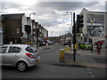
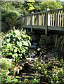
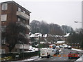
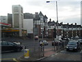
Photos of NW3 7TW


Area Information
Living in NW3 7TW offers a distinct experience within a tightly defined residential cluster. This specific postcode covers a small area of 2938 square metres yet holds a population of 1957 residents. The population density reaches 666065 people per square kilometre, indicating a very compact environment. You will find this is a location where living is concentrated and immediate surroundings are constantly active. The area serves as a residential extension of the broader Golders Green and Hampstead neighbourhoods. Daily life here moves at a brisk pace due to the restricted space and high population count. Prospective buyers should understand that you are entering a mature post-codescape that functions as a pocket within the larger Golders Green district. The neighbourhood is known for its specific housing cluster rather than sprawling estates. Residents benefit from proximity to major thoroughfares that connect directly to central London. While the physical footprint is small, the community services and connectivity extend far beyond these borders. You are part of a dense urban environment that maximises access to city-wide opportunities while maintaining a defined local boundary.
- Area Type
- Postcode
- Area Size
- 2938 m²
- Population
- 1957
- Population Density
- 13423 people/km²
The property market in NW3 7TW is defined by a specific housing stock dominated by flats. With 43% home ownership, the market reflects a balance between private owners and landlords. This percentage indicates that more than half of the residents do not own their homes outright. Consequently, there is a robust demand for rental properties from the wider borough. Buyers looking at this area should anticipate encountering leasehold flats rather than freehold houses. The low area size of 2938 m² restricts the amount of bulk housing available, meaning supply is limited. You are entering a market where every unit is valuable due to high population density. The 1957 residents place a premium on location over size. Potential homeowners must navigate a market that is less common than standard suburban sales. The local architecture supports the flat description, which dictates price points and concession fees. You should prepare for a competitive bidding process typical of central London postcodes. The mix of ownership proves that investment buyers have significant influence in this specific market.
House Prices in NW3 7TW
Showing 20 properties
Energy Efficiency in NW3 7TW
Your lifestyle in NW3 7TW is supported by immediate access to essential retail and leisure facilities. You will find three major supermarkets in close reach, including Co-op Childs, Sainsburys Golders, and Tesco Fortune. These venues handle all your weekly grocery shopping requirements without a lengthy commute. Leisure transport options include the London Zoo Waterbus Stop, Camden Lock Waterbus, and Little Venice Waterbus Stop. These water-based routes add a unique recreational element to your local travel. Shopping trips are efficient as you are only moments from the Central Line and Northern Line termini. The presence of five notable Metro options allows for rapid transit to Finchley Road or west London suburbs. You benefit from a concentration of five nearby rail stations that feed into the main network. Five bus options, including links to Victoria, further expand your local travel radius. While there are no dedicated parks listed in the immediate data cluster, the transport links lead directly to Green spaces in Hampstead. The blend of retail and transit creates a convenient daily routine where work, food, and travel intersect.
Amenities
Schools
| Rank | School | Type | Entry gender | Ages |
|---|
Explore more schools in this area
Go to Schools tabDemographics
The community in NW3 7TW is composed of a mature and established group of people. The median age stands at 47 years, meaning the area attracts older adults seeking stability. Most residents fall into the 30-64 years age range, creating a demographic centred on working years and established families. Home ownership levels sit at 43%, which places this area closer to a rental market than a traditional owner-occupied neighbourhood. This statistic suggests a significant portion of houses are let rather than privately owned. The predominant accommodation type recorded for this cluster is flats. This housing style aligns with the flat ownership rates and the likely urban design of the area. The community is ethnically diverse based on national trends, with White remaining the predominant group according to recent census data. Ninety-seven percent of the population identifies within the non-Black, Asian, and Mixed categories based on the White majority. Living in NW3 7TW means sharing the space with a settled group of adults who are likely retired or nearing retirement. You should expect neighbours who have lived in similar properties for an extended period.
Household Size
Accommodation Type
Tenure
Ethnic Group
Religion
Household Composition
Age
Household Deprivation
NS-SEC
Explore more demographic insights in this area
Go to Demographics tabPlanning
Planning Constraints
- Flood RiskPremium
- Ramsar Wetland SitesPremium
- Area of Outstanding Natural BeautyPremium
- Protected Nature ReservePremium
- Protected WoodlandPremium