Area Overview for NW3 3PA
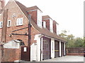
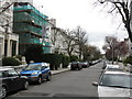
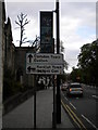
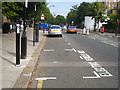
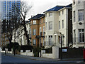
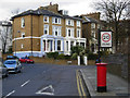
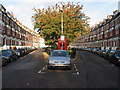
Photos of NW3 3PA

Area Information
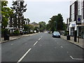
The postcode area NW3 3PA represents a compact residential cluster covering just 2775 square metres within England. This small footprint holds a population of 1599 residents, creating a densely populated environment with over 576,163 people per square kilometre. Living in NW3 3PA means navigating a space where local life occurs at a close quarter. The area sits within Greater London, surrounded by established neighbourhoods that form part of its immediate context. You will find this cluster integrated into a larger urban fabric where individual homes sit near neighbours. The small size of the area means that daily routines often unfold within walking distance of key services. Residents here experience a neighbourhood character defined by its high density and limited physical spread compared to broader boroughs. When considering homes in NW3 3PA, you are entering a specific slice of this city where volume and proximity define the local environment. The total population of 1599 people live close together, influencing how community dynamics play out on the ground. This is a zone where the built environment is tightly packed, reflecting the broader trends of urban living in this part of the capital.
- Area Type
- Postcode
- Area Size
- 2775 m²
- Population
- 1599
- Population Density
- 16201 people/km²
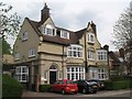
The property market in NW3 3PA is characterised by a distinct lean towards rented accommodation rather than owner-occupied homes. Only 33 percent of residents own their homes, meaning the market offers a limited supply of traditional family properties for purchase. Flats represent the predominant accommodation type, defining the stock available for both rental and purchase within this small postcode. These specific postcodes cover a modest area of 2775 square metres, where individual residential units must fit efficiently into the space. For buyers seeking a flat, the competition may be intense given the high population density of over 576,163 people per square kilometre. The small size of the area constrains the total number of birds available for purchase or rent at any given time. You will find that the majority of housing in NW3 3PA consists of purpose-built blocks rather than detached houses or semi-detached homes. The low ownership rate suggests that many residents access the area through private rentals or shared ownership schemes. When looking for flats in this cluster, you should expect a market focused on urban convenience rather than standalone gardens. The 33 percent ownership figure provides a clear indicator that most transactions involving permanent homes here happen on the rental market.
House Prices in NW3 3PA
Showing 3 properties
| Address | Type | Beds | Baths | Last Sale Price | Last Sale Date | |
|---|---|---|---|---|---|---|
| 170 Adelaide Road, London, NW3 3PA | Semi-detached | 5 | 3 | £1,935,000 | Jun 2013 | |
| 180 Adelaide Road, London, NW3 3PA | Semi-detached | 6 | 3 | £477,000 | Aug 1999 | |
| 160 Adelaide Road, London, NW3 3PA | Terraced | 5 | 4 | - | - |
Energy Efficiency in NW3 3PA
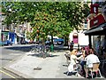
Residents of NW3 3PA enjoy immediate access to a wide range of amenities within practical reach. There are five metro stations nearby, including Swiss Cottage Station, Finchley Road Station, and Belsize Park Station. These stations provide direct links to the wider London network. Retail options include five key shops such as Tesco Swiss, M and S Swiss Cottage SF, and Tesco Belsize. You can easily reach South Hampstead Station, Finchley Road and Frognal Station, and Hampstead Heath Station for further travel. The area also features five waterbus stops, including London Zoo Waterbus Stop and Camden Lock Waterbus. Three coach stations are available, covering services for London Victoria Coach Station Arrivals and Green Line Coach Station. Living in NW3 3PA means having five metro options and five retail outlets just moments away. The presence of multiple transport hubs gives you the flexibility to travel by train, bus, or boat. These nearby amenities define the lifestyle, offering convenience that many larger suburbs lack.
Amenities
Schools
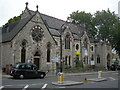
Parents considering education options have only one school listed as immediately adjacent to the NW3 3PA postcode. John Keats Special School stands as the sole educational institution in the immediate vicinity of this area. This facility serves students with special educational needs and disabilities, indicating a specific provision rather than a mainstream primary or secondary setting for all children. The absence of standard primary or secondary schools within direct range means that families in this postcode must look further afield for mainstream schooling. Living in NW3 3PA requires residents to plan transport to colleges outside this specific two square kilometre zone. The presence of a special school nearby suggests that the neighbourhood attracts families with children requiring tailored learning environments. If you are researching schools near NW3 3PA, you must acknowledge that John Keats Special School is the only named option in the data. Local families might integrate these children into the community while commuting to mainstream schools located closer to other postcode areas. The limited school data highlights the need for parents to look beyond this immediate cluster for everyday educational facilities.
| Rank | School | Type | Entry gender | Ages |
|---|
Explore more schools in this area
Go to Schools tabDemographics
The community in NW3 3PA is defined by a clear age profile, with the median age sitting at 47 years. Most households consist of adults aged between 30 and 64 years, indicating a resident base in the middle of their career. Home ownership stands at 33 percent of the total population in this postcode sector. The majority of residents likely rent their properties, as one-third of homes remain owner-occupied. Accommodation type data shows that flats are the predominant form of housing found within this specific area. This aligns with the local density and the typical stock found in London's residential clusters. The predominant ethnic group is White, representing the main demographic component of the neighbourhood. Living in NW3 3PA means residing in an area where one out of three residents owns their home outright. The concentration of flats suggests that many families or professionals share large buildings or live in multi-storey units. This demographic mix shapes the daily rhythm of life here, with a significant portion of the population falling into the adult working age bracket. The area hosts a primarily adult cohort, which influences local demand and community engagement patterns.
Household Size
Accommodation Type
Tenure
Ethnic Group
Religion
Household Composition
Age
Household Deprivation
NS-SEC
Explore more demographic insights in this area
Go to Demographics tabPlanning
Planning Constraints
- Flood RiskPremium
- Ramsar Wetland SitesPremium
- Area of Outstanding Natural BeautyPremium
- Protected Nature ReservePremium
- Protected WoodlandPremium