Area Overview for NW2 7QJ
Photos of NW2 7QJ

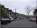
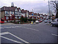
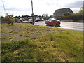
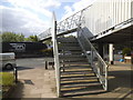
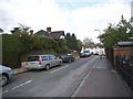
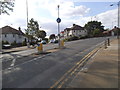
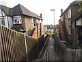
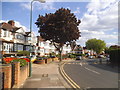
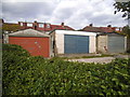
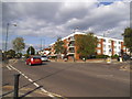
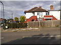
87 photos from this area
Area Information
Key information about the NW2 7QJ including its size, population, and administrative classification.
- Area Type
- Postcode
- Area Size
- 1.1 hectares
- Population
- 1438
- Population Density
- 11087 people/km²
House Prices in NW2 7QJ
100
Properties
£447,860
Average Sold Price
£90,000
Lowest Price
£3,500,000
Highest Price
Showing 100 properties
| Address | Type | Beds | Baths | Last Sale Price | Last Sale Date | |
|---|---|---|---|---|---|---|
| 646 North Circular Road, Neasden, London, NW2 7QJ | house | 3 | - | £280,378 | Nov 2024 | |
| 694 North Circular Road, Neasden, London, NW2 7QJ | house | - | - | £286,245 | Oct 2022 | |
| 672 North Circular Road, Neasden, London, NW2 7QJ | Terraced | 3 | 1 | £490,000 | Sep 2022 | |
| 644 North Circular Road, Neasden, London, NW2 7QJ | house | - | - | £450,000 | Jul 2022 | |
| Former Ground Floor Room 1, 666 North Circular Road, Neasden, London, NW2 7QJ | Unknown | - | - | £3,500,000 | Jun 2021 | |
| 656 North Circular Road, Neasden, London, NW2 7QJ | Terraced | 4 | 1 | £475,000 | Oct 2020 | |
| 658 North Circular Road, Neasden, London, NW2 7QJ | Terraced | 5 | 5 | £600,000 | Sep 2020 | |
| 676 North Circular Road, Neasden, London, NW2 7QJ | Terraced | 3 | 2 | £220,000 | Dec 2009 | |
| 640 North Circular Road, Neasden, London, NW2 7QJ | house | - | - | £258,000 | Feb 2008 | |
| 688 North Circular Road, Neasden, London, NW2 7QJ | house | - | - | £250,000 | Nov 2007 |
Page 1 of 10
Energy Efficiency in NW2 7QJ
Amenities
Schools
| Rank | School | Type | Entry gender | Ages |
|---|
Explore more schools in this area
Go to Schools tabDemographics
Household Size
Family (3-5 people)
most common
Accommodation Type
Houses
most common
Tenure
51
majority
Ethnic Group
White
most common
Religion
N/A
most common
Household Composition
N/A
most common
Age
47
median
Adults (30-64 years)
most common
Household Deprivation
N/A
with no deprivation
NS-SEC
18
in Lower managerial occupations
Explore more demographic insights in this area
Go to Demographics tabPlanning
Planning Constraints
- Flood RiskPremium
- Ramsar Wetland SitesPremium
- Area of Outstanding Natural BeautyPremium
- Protected Nature ReservePremium
- Protected WoodlandPremium