Area Overview for NW2 6RL
Photos of NW2 6RL
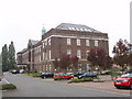
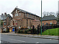
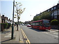
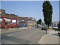
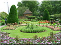
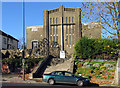

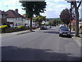
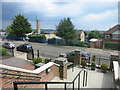
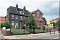
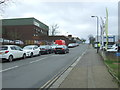
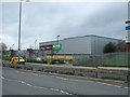
60 photos from this area
Area Information
Key information about the NW2 6RL including its size, population, and administrative classification.
- Area Type
- Postcode
- Area Size
- 2.2 hectares
- Population
- 2093
- Population Density
- 5163 people/km²
House Prices in NW2 6RL
52
Properties
£438,700
Average Sold Price
£96,000
Lowest Price
£915,000
Highest Price
Showing 52 properties
| Address | Type | Beds | Baths | Last Sale Price | Last Sale Date | |
|---|---|---|---|---|---|---|
| 188 Gladstone Park Gardens, London, NW2 6RL | Semi-detached | 3 | - | £805,000 | Mar 2022 | |
| 122 Gladstone Park Gardens, London, NW2 6RL | Semi-detached | 6 | 4 | £688,000 | Mar 2021 | |
| 190 Gladstone Park Gardens, London, NW2 6RL | Semi-detached | 4 | 2 | £685,000 | Feb 2021 | |
| 166 Gladstone Park Gardens, London, NW2 6RL | Semi-detached | 4 | 2 | £660,000 | Aug 2020 | |
| 186 Gladstone Park Gardens, London, NW2 6RL | Semi-detached | 3 | - | £637,000 | Oct 2018 | |
| 132 Gladstone Park Gardens, London, NW2 6RL | Semi-detached | 6 | 3 | £915,000 | Aug 2016 | |
| 170 Gladstone Park Gardens, London, NW2 6RL | Semi-detached | 3 | 1 | £515,000 | Dec 2013 | |
| 116 Gladstone Park Gardens, London, NW2 6RL | Semi-detached | 3 | 2 | £506,500 | Oct 2013 | |
| 172 Gladstone Park Gardens, London, NW2 6RL | Semi-detached | - | - | £415,000 | Oct 2007 | |
| 192 Gladstone Park Gardens, London, NW2 6RL | Semi-detached | 4 | 2 | £433,000 | Jan 2007 |
Page 1 of 6
Energy Efficiency in NW2 6RL
Amenities
Schools
| Rank | School | Type | Entry gender | Ages |
|---|
Explore more schools in this area
Go to Schools tabDemographics
Household Size
Family (3-5 people)
most common
Accommodation Type
Houses
most common
Tenure
44
majority
Ethnic Group
White
most common
Religion
N/A
most common
Household Composition
N/A
most common
Age
47
median
Adults (30-64 years)
most common
Household Deprivation
N/A
with no deprivation
NS-SEC
26
in Lower managerial occupations
Explore more demographic insights in this area
Go to Demographics tabPlanning
Planning Constraints
- Flood RiskPremium
- Ramsar Wetland SitesPremium
- Area of Outstanding Natural BeautyPremium
- Protected Nature ReservePremium
- Protected WoodlandPremium