Area Overview for NW2 6PS
Photos of NW2 6PS
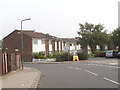
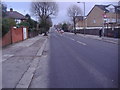


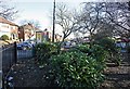

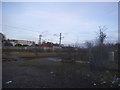


100 photos from this area
Area Information
Key information about the NW2 6PS including its size, population, and administrative classification.
- Area Type
- Postcode
- Area Size
- 3336 m²
- Population
- 1970
- Population Density
- 9091 people/km²
House Prices in NW2 6PS
35
Properties
£314,709
Average Sold Price
£57,800
Lowest Price
£525,000
Highest Price
Showing 35 properties
| Address | Type | Beds | Baths | Last Sale Price | Last Sale Date | |
|---|---|---|---|---|---|---|
| 19 Newton Road, London, NW2 6PS | Flat | - | - | £350,000 | Oct 2025 | |
| 1A Newton Road, London, NW2 6PS | Flat | 3 | 1 | £525,000 | Nov 2022 | |
| 25 Newton Road, London, NW2 6PS | Flat | 2 | 1 | £400,000 | Aug 2021 | |
| 9 Newton Road, London, NW2 6PS | Flat | - | - | £460,000 | Jun 2021 | |
| 17A Newton Road, London, NW2 6PS | Maisonette | 3 | 1 | £495,000 | Mar 2020 | |
| 21A Newton Road, London, NW2 6PS | Flat | 2 | 1 | £460,000 | Jun 2017 | |
| 21 Newton Road, London, NW2 6PS | Flat | - | - | £425,000 | Apr 2017 | |
| 31 Newton Road, London, NW2 6PS | Flat | - | - | £468,000 | Oct 2016 | |
| 19A Newton Road, London, NW2 6PS | Maisonette | 3 | - | £457,000 | Mar 2016 | |
| 13 Newton Road, London, NW2 6PS | Flat | - | - | £455,000 | Sep 2015 |
Page 1 of 4
Energy Efficiency in NW2 6PS
Amenities
Schools
| Rank | School | Type | Entry gender | Ages |
|---|
Explore more schools in this area
Go to Schools tabDemographics
Household Size
Family (3-5 people)
most common
Accommodation Type
Flats
most common
Tenure
44
majority
Ethnic Group
White
most common
Religion
N/A
most common
Household Composition
N/A
most common
Age
47
median
Adults (30-64 years)
most common
Household Deprivation
N/A
with no deprivation
NS-SEC
33
in Lower managerial occupations
Explore more demographic insights in this area
Go to Demographics tabPlanning
Planning Constraints
- Flood RiskPremium
- Ramsar Wetland SitesPremium
- Area of Outstanding Natural BeautyPremium
- Protected Nature ReservePremium
- Protected WoodlandPremium