Area Overview for NW2 6BE
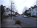
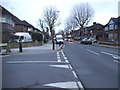
Photos of NW2 6BE


Area Information
Living in NW2 6BE means residing within a very small residential cluster that occupies only 1,378 square metres. This compact footprint results in an extremely high population density of 1,429,704 people per square kilometre, a statistic that reflects the immediate urban surrounds rather than a wide suburban expanse. You will find that 1,970 residents inhabit this specific postcode, creating a lived experience defined by proximity to the wider North West London surroundings. The area is distinct for its concentration within a major transport and commercial corridor, meaning daily life is characterised by easy access to town centres and retail hubs rather than isolation. Residents enjoy direct connections to Cricklewood and Neasden, giving you immediate reach to essential services and shopping options without needing lengthy commutes to central London. While the specific built environment of the postcode cluster itself may vary, its location ensures you are equipped for a standard urban lifestyle with excellent digital infrastructure. The area fits into the broader London property market as a pocket of high accessibility, suitable for those who prioritise connectivity and convenience over open space. Understanding the size and population helps manage expectations regarding noise, footfall, and the character of the immediate neighbourhood. This specific postcode serves as a gateway to the amenities of NW2 and NW10, blending the quietness of a small residential pocket with the energy of the surrounding town.
- Area Type
- Postcode
- Area Size
- 1378 m²
- Population
- 1970
- Population Density
- 9091 people/km²
Homes in NW2 6BE are dominated by flats, reflecting the urban density and the nature of the postcode as a small residential cluster. The specific accommodation type data confirms that you can expect a high proportion of apartment living rather than detached or semi-detached houses. This housing style suits professionals and larger households who require efficient use of space within a busy urban environment. With 44% home ownership recorded within the demographic, there is a significant blend of owner-occupiers and private renters in this market segment. This split suggests a robust rental sector alongside a solid base of permanent residents who are invested in the local community. The small size of the postcode, measuring just 1,378 square metres, limits the variety of housing stock available compared to wider borough averages. You should anticipate a market focused on vertical living solutions with easy access to the nearby tube and rail networks. Buyers looking for traditional family homes with large gardens may find fewer options here, whereas those seeking a flat close to the metro and rail stations will find immediate opportunities. The area acts as a convenient base for accessing the wider NW2 and NW10 property markets, offering high connectivity without the availability of large standalone properties. Understanding this specific typology helps you target the right listing when searching for properties in or near NW2 6BE.
House Prices in NW2 6BE
Showing 8 properties
| Address | Type | Beds | Baths | Last Sale Price | Last Sale Date | |
|---|---|---|---|---|---|---|
| 30, Macmillan House, Oman Avenue, London, NW2 6BE | Flat | 1 | 1 | - | - | |
| 26, Macmillan House, Oman Avenue, London, NW2 6BE | Flat | - | - | - | - | |
| 32, Macmillan House, Oman Avenue, London, NW2 6BE | Flat | - | - | - | - | |
| 28, Macmillan House, Oman Avenue, London, NW2 6BE | Flat | - | - | - | - | |
| 24, Macmillan House, Oman Avenue, London, NW2 6BE | Flat | - | - | - | - | |
| 20, Macmillan House, Oman Avenue, London, NW2 6BE | Flat | - | - | - | - | |
| 34, Macmillan House, Oman Avenue, London, NW2 6BE | Flat | - | - | - | - | |
| 22, Macmillan House, Oman Avenue, London, NW2 6BE | Flat | - | - | - | - |
Energy Efficiency in NW2 6BE
Residents of NW2 6BE enjoy convenient access to a variety of retail and leisure options within practical reach. You can shop at Tesco Cricklewood, Lidl Cricklewood, and Co-op Cricklewood, providing comprehensive daily necessities without a long journey. Transport options are extensive, linking you to five metro stations, five rail stations, and multiple ferry stops including the Camden Lock Waterbus and London Zoo Waterbus Stop. This diversity allows for flexible travel by tube, train, or water. Five bus routes, including the Victoria Coach Station services and Green Line Coach Station, offer additional flexibility for regional travel. The area's proximity to major transport hubs embeds it firmly within the broader commercial and retail network of West London. Living here means you are minutes away from both essential grocery shopping and leisure activities. The combination of supermarkets, public transport, and the unique London Zoo Waterbus Stop creates a balanced lifestyle that blends utility with recreation. You do not need to travel far to access food, leisure, or transit, making this postcode a practical choice for those who value convenience and time efficiency in their daily routine.
Amenities
Schools
Families living in NW2 6BE have several educational options close to their doorstep, centred around the Mora estate. Mora Primary School holds a 'good' Ofsted rating, offering reassurance regarding the quality of education provided. Both Mora Junior School and Mora Infant School are also located nearby, forming a cohesive educational cluster that serves young children and young adults in the primary phase. This trio of schools ensures that residents have multiple choices for their children's early education without needing to travel far into other postcodes or neighbourhoods. The presence of these specific institutions highlights an area with established family infrastructure. You can expect that local housing demand often factors in proximity to these named schools, influencing property prices and rental yields in the immediate vicinity. The mix of school types under the Mora banner supports a steady community where children move seamlessly between infant and junior stages. For parents evaluating this location, the confirmed 'good' rating of Mora Primary School provides a tangible metric for school performance. These facilities anchor the area, ensuring that daily commutes to education are short and reliable for residents in this small residential cluster.
| Rank | School | Type | Entry gender | Ages |
|---|
Explore more schools in this area
Go to Schools tabDemographics
The community within NW2 6BE is mature, with a median age of 47 years. Adults between 30 and 64 years old represent the most common age range, suggesting the area attracts stability over a long period. You will find that 44% of households own their homes outright, while the remainder reside in rented properties or shared ownership arrangements. The prevailing accommodation type consists of flats, which aligns with the urban nature of the postcode and the density of the local infrastructure. This mix indicates a neighbourhood where younger professionals and established families alike can find suitable living arrangements within a compact urban setting. The predominant ethnic group in this specific cluster is White, contributing to a demographic profile that mirrors the broader diversity of North West London in a focused manner. Deprivation indicators are not explicitly quantified in the available data for this code, so you must rely on broader regional context for additional insight. The age profile suggests a community that has settled in permanently, likely valuing quiet and established neighbourhood ties over rapid turnover. With a population concentrated in flats, you will encounter a multi-generational living environment where families and singles share local spaces. This demography supports a steady demand for essential services, shops, and recreational facilities catered to adults and mature households.
Household Size
Accommodation Type
Tenure
Ethnic Group
Religion
Household Composition
Age
Household Deprivation
NS-SEC
Explore more demographic insights in this area
Go to Demographics tabPlanning
Planning Constraints
- Flood RiskPremium
- Ramsar Wetland SitesPremium
- Area of Outstanding Natural BeautyPremium
- Protected Nature ReservePremium
- Protected WoodlandPremium