Area Overview for NW2 6AS
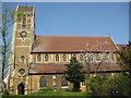
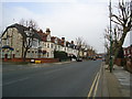
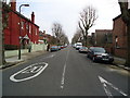
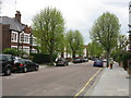
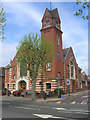
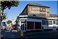
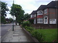
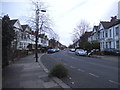
Photos of NW2 6AS


Area Information
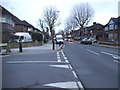
Living in NW2 6AS offers you a specific residential experience within the Cricklewood and Brent Cross corridor. This postcode cluster serves approximately 1,586 residents, creating a tight-knit environment rather than an sprawling suburb. The area functions as a quiet residential node where homes sit within practical reach of major transport connections and high-street retailers. You will find yourself in a setting defined by mature housing stock and a deliberate focus on domestic privacy. The location benefits from being in close proximity to several key stations, including Cricklewood and Brent Cross West. You do not need to travel far to access daily essentials at Tesco Cricklewood or the services provided by a nearby Co-op. The density of 1,586 people means you avoid the noise and congestion of London's busiest districts while maintaining easy access to the wider network. Your morning commute might begin with a short walk to a nearby rail link or a jump on the bus. Life here is characterised by stability. The area lacks the chaos of a major city centre but remains firmly connected to it. You live in an environment where the number of neighbours is sufficient to create local familiarity, yet low enough to preserve peace. The postcode acts as a gateway, merging the quiet of residential streets with the availability of immediate transit options. This balance defines the daily rhythm for anyone securing a property in this specific location.
- Area Type
- Postcode
- Area Size
- Not available
- Population
- 1586
- Population Density
- 7666 people/km²
The property market in NW2 6AS is defined by a significant presence of houses rather than high-rise apartments. This preference for detached or semi-detached homes aligns with the median age of 47 and the fact that 53% of residents own their property. You are looking at a housing stock where individuals have controlled the selection of their dwelling, rather than being allocated a flat. This structure suggests that the market values space and domestic isolation over the density found in central London. Because the population contains nearly half owner-occupiers, buying into this postcode often offers a different transactional dynamic. You might negotiate with long-term residents who understand the value of their homes deeply. The 53% ownership rate indicates that investment buyers will compete with families seeking to settle down. This balance prevents the area from becoming a purely speculative rental zone where landlords chase short-term gains. When you search for properties, expect to see traditional house forms. The data shows that accommodation types are skewed towards houses, making this a distinct choice compared to lighter traffic residential zones. This housing composition means mortgages and maintenance costs may reflect single-family ownership standards. You will find this market appeals to those who want a traditional garden and driveway setup. The stability of the ownership rate supports a predictable market environment where house prices rarely fluctuate wildly due to rapid turnover. Buyers here invest in a lifestyle defined by ownership rather than renting.
House Prices in NW2 6AS
No properties found in this postcode.
Energy Efficiency in NW2 6AS
Your daily life in NW2 6AS revolves around immediate access to shops and leisure facilities without needing a car. You are situated within practical reach of major retailers such as Tesco Cricklewood, the Co-op Cricklewood, and Iceland Cricklewood. These superstores mean you can pick up fresh groceries or household essentials in minutes. The presence of these specific chain stores adds convenience to your routine, removing the need for long shopping excursions into central London. Transport variety further enhances your lifestyle. You have five rail stations nearby, allowing you to choose between bustling terminals like Cricklewood or the quieter Brondesbury Park. For those who prefer the tube, five Metro stations including Neasden and Kilburn are just a short commute away. If you enjoy water-based travel, the Little Venice Waterbus Stop offers a unique way to visit London Zoo or Camden Lock. You do not need to drive to visit these landmarks. You might also consider the bus routes as a convenient local link. Five bus services operate in the vicinity, including connections to London Victoria Coach Station. These transport hubs integrate seamlessly with your residential zone. The area supports a lifestyle where errands and social visits happen with minimal effort. You live in a place where top-tier retail and diverse transport options converge, giving you freedom to manage your time efficiently. This mix of high-street shopping and public transit connectivity defines the everyday character of the neighbourhood.
Amenities
Schools
| Rank | School | Type | Entry gender | Ages |
|---|
Explore more schools in this area
Go to Schools tabDemographics
The community within NW2 6AS reflects a settled population with a median age of 47 years. The most common age group consists of adults aged 30 to 64 years, indicating a neighbourhood dominated by working families and established professionals rather than young singles or empty nesters you might find in London's outer fringe areas. This demographic skew suggests a stable environment where long-term residents often outstay their careers. Home ownership stands at 53%, meaning you are dealing with an area split almost evenly between owners and tenants. This split is typical for a district with a mix of established homes. There is no data on specific deprivation indices, so you should rely on the strong indicators of stability presented here. The population is predominantly formed by people identifying as White, which aligns with traditional housing demographics in parts of North West London. Accommodation types are primarily houses, distinguishing this area from a city centre dominated by flats. This housing style supports the family-focused nature of the demographic. You will likely encounter streets lined with individual properties rather than purpose-built blocks. The age profile and ownership statistics together paint a picture of a self-contained community. People living here are likely looking for permanence over quick urban living. Consequently, buying a home in NW2 6AS often means joining a group of neighbours with deep roots in the locality.
Household Size
Accommodation Type
Tenure
Ethnic Group
Religion
Household Composition
Age
Household Deprivation
NS-SEC
Explore more demographic insights in this area
Go to Demographics tabPlanning
Planning Constraints
- Flood RiskPremium
- Ramsar Wetland SitesPremium
- Area of Outstanding Natural BeautyPremium
- Protected Nature ReservePremium
- Protected WoodlandPremium