Area Overview for NW2 5AN
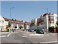
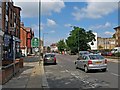
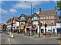
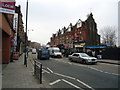
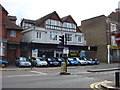
Photos of NW2 5AN


Area Information
Living in NW2 5AN means residing in a specific postcode cluster covering an area of just 9,947 square metres in England. This small residential footprint supports a total population of 2,214 residents, creating a dense living environment. With a population density reaching 222,571 people per square kilometre, the community is tightly packed, yet it benefits from immediate access to broader transport links. The area functions as a distinct residential unit rather than a sprawling district, offering a concentrated neighbourhood experience. Daily life here is defined by proximity to major transport hubs and local retail outlets. Residents navigate a compact space where every facility is within practical reach. The high density suggests a vibrant, active street life, though the small size limits expansive green spaces within the immediate boundary. For those seeking a location with direct access to central London amenities without the sprawl of larger zones, this cluster offers a focused living experience. The sheer number of people per square metre indicates a lively atmosphere where neighbours are closely connected. You are part of a high-density household that values convenience and accessibility above detached suburban living.
- Area Type
- Postcode
- Area Size
- 9947 m²
- Population
- 2214
- Population Density
- 13916 people/km²
The property market in NW2 5AN is characterised by a predominantly flat-based housing stock. Flats form the primary accommodation type within this specific postcode, aligning with the high population density of the area. Only 26% of residents own their homes, which indicates that a substantial portion of the market operates within the private or social rental sector. For buyers looking at this small area, the scarcity of home ownership suggests limited opportunities to purchase a standalone house nearby. Instead, investors or families seeking flats may find the most viable options for renting or purchasing. The housing landscape is designed for those accessing the local transport network rather than for those seeking detached bungalows. This market structure means that price points will reflect the urban flat lifestyle rather than suburban sprawl. When evaluating homes in NW2 5AN, you should expect to navigate a market where density drives value and convenience. The low ownership percentage signals a dynamic market where vacancies may exist, yet purchasing power remains concentrated in a smaller segment of the population.
House Prices in NW2 5AN
Showing 49 properties
| Address | Type | Beds | Baths | Last Sale Price | Last Sale Date | |
|---|---|---|---|---|---|---|
| 15D Park Avenue, London, NW2 5AN | Flat | - | - | £270,000 | Dec 2024 | |
| 27 Park Avenue, London, NW2 5AN | Semi-detached | 5 | 1 | £1,301,000 | Oct 2021 | |
| 31 Park Avenue, London, NW2 5AN | Flat | 1 | 1 | £440,000 | Dec 2002 | |
| 39 Park Avenue, London, NW2 5AN | house | 5 | 2 | - | - | |
| 25A Park Avenue, London, NW2 5AN | Flat | 3 | 1 | - | - | |
| 43B Park Avenue, London, NW2 5AN | Flat | 2 | 1 | - | - | |
| 17A Park Avenue, London, NW2 5AN | Flat | 1 | 1 | - | - | |
| Former, 27A Park Avenue, London, NW2 5AN | Flat | - | - | - | - | |
| Former, 37 Park Avenue, London, NW2 5AN | undefined | - | - | - | - | |
| Former, 18A High Road, London, NW2 5AN | Flat | - | - | - | - |
Energy Efficiency in NW2 5AN
Your lifestyle in NW2 5AN includes convenient access to five retail, metro, rail, ferry, and bus options nearby. You can shop at Sainsburys Willesden, Sainsburys Willesden, and the Co-op Willesden for daily groceries and essentials. Transport links include Dollis Hill Station, Kilburn Station, and Neasden Station just minutes away. Additional rail services connect you to Brondesbury Park Station, Cricklewood, and Kensal Rise Station. Water transport is available via the Little Venice Waterbus Stop, London Zoo Waterbus Stop, and Camden Lock Waterbus. Commuting to London Victoria Coach Station Arrivals, the main Victoria Coach Station, and the Green Line Coach Station is straightforward. These amenities allow you to travel quickly to central London or the wider region. The variety of transport modes means you are never far from a bus, train, tube, or waterbus stop. This connectivity ensures that daily commutes are short and stress-free for residents of this dense postcode.
Amenities
Schools
Families living in NW2 5AN have excellent educational options immediately within their vicinity. St Mary Magdalene's Catholic Junior School offers primary education with an Ofsted rating of good. Nearby families also benefit from Convent of Jesus and Mary RC Infant School, which holds an outstanding Ofsted rating. These institutions provide strong foundations for young learners in the catchment area. The presence of two Catholic primary schools indicates a specific community network focused on religious education for younger children. While the data lists only primary schools, the proximity of these rated institutions suggests a well-supported early education environment. Parents can feel confident regarding the quality of instruction their children will receive at the local level. The combination of good and outstanding ratings ensures that educational standards meet high expectations from the outset.
| Rank | School | Type | Entry gender | Ages |
|---|
Explore more schools in this area
Go to Schools tabDemographics
The community in NW2 5AN is defined by an older demographic profile, with a median age of 47 years. Adults between the ages of 30 and 64 years represent the most common age range within this population. You are likely to live among established households rather than young professional starters or retirees in their later years. The area shows a relatively low rate of ownership, with only 26% of residents owning their homes outright. The predominant accommodation type consists of flats, reflecting the high-density urban nature of the postcode. White residents form the predominant ethnic group in this neighbourhood. Housing tenure statistics suggest a significant proportion of the population rents rather than owns their property. The majority of flats indicate that multi-unit buildings are the standard housing stock. This demographic mix creates a mature community atmosphere where long-term residents form the core of local life. Understanding these figures helps you picture the typical household structure and the stability of the local population. The concentration of adults in their working years suggests a workforce-oriented community with established routines.
Household Size
Accommodation Type
Tenure
Ethnic Group
Religion
Household Composition
Age
Household Deprivation
NS-SEC
Explore more demographic insights in this area
Go to Demographics tabPlanning
Planning Constraints
- Flood RiskPremium
- Ramsar Wetland SitesPremium
- Area of Outstanding Natural BeautyPremium
- Protected Nature ReservePremium
- Protected WoodlandPremium