Area Overview for NW2 5AH
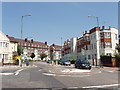
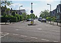
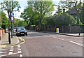
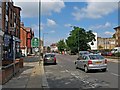
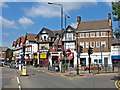
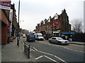
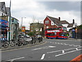
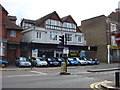
Photos of NW2 5AH


Area Information
This specific postcode cluster at NW2 5AH forms a distinct residential unit within the North West London landscape. It covers a small population of 2,214 people, creating a close-knit environment where daily life moves at a moderate pace. Residents here enjoy immediate access to a comprehensive network of urban facilities without needing extensive travel. The area sits just metres from several major transport hubs, including Dollis Hill Station, Kilburn Station and Neasden Station on the Underground. You will also find yourself steps away from multiple London Overground stations such as Brondesbury Park and Kensal Rise. Daily convenience is defined by the presence of several large supermarket chains within practical walking or short driving distance. Sainsburys locations at Willesden and Brent Willesden provide essential weekly shopping needs. For leisure or water-based commutes, the Little Venice Waterbus Stop and London Zoo Waterbus Stop are situated nearby. This connectivity means you can reach London Victoria Coach Station or Camden Lock quickly via bus or water services. The area balances urban accessibility with a concentrated residential feel, making it a practical choice for those who prioritise proximity to transport corridors and retail parks over expansive green spaces.
- Area Type
- Postcode
- Area Size
- Not available
- Population
- 2214
- Population Density
- 13916 people/km²
Homes in NW2 5AH are characterised by a market heavily skewed towards renting rather than ownership. With home ownership rates sitting at just 26%, the vast majority of properties operate within the private rental market. The predominant accommodation type is flats, meaning the local housing stock consists mainly of blocks of residential apartments rather than standalone family houses. This indicates that the area has developed around density and proximity to transport links rather than private garden spaces or large plots of land. Prospective buyers looking for investment opportunities will find a market where tenants change frequently and lease terms are standard. You are unlikely to encounter traditional suburban family stock like Victorian terraces or modern semi-detached homes in significant numbers. Instead, you will examine second-hand or privately rented flats designed for working-age adults. This structure simplifies the purchase process for investors but offers limited variety for buyers seeking large family homes. The concentration of rental units often correlates with locations near major Employment Zones or transport nodes, reinforcing the appeal for commuters who prioritise location over property size.
House Prices in NW2 5AH
No properties found in this postcode.
Energy Efficiency in NW2 5AH
Living in NW2 5AH places you at the heart of a highly connected retail and leisure network. Five major railway stations including Brondesbury Park and Kensal Rise are within easy reach, making journeying to London Victoria or beyond straightforward. For daily errands, five Sainsburys branches operate nearby, located at Willesden, Brent Willesden and adjacent sectors. This density ensures you never face a situation where your nearest supermarket is kilometres away. Leisure options extend beyond shopping with access to the Little Venice Waterbus Stop and London Zoo Waterbus Stop. These facilities offer unique docking points for water-based recreation and tourism. You can walk to Camden Lock for independent shopping or dine in the surrounding village streets. The presence of Green Line Coach Station and London Victoria Coach Station Arrivals nearby confirms the area's role as a transport corridor for regional travellers. Your lifestyle here is defined by convenience, with essential services and major attractions clustered closely together. This layout rewards daily walkers and cyclists who value accessibility over green space or local boutique shops.
Amenities
Schools
Families considering this area will find two primary schools within close proximity to NW2 5AH. Convent of Jesus and Mary RC Infant School holds an outstanding Ofsted rating and serves as a top-tier educational option for younger children. Further along, St Mary Magdalen's Catholic Junior School carries a good Ofsted rating and caters to the junior school age group. This mix suggests that while there is an outstanding rated infant school available, the immediate catchment for primary education is not entirely comprehensive without including other nearby institutions. The presence of these Catholic-affiliated institutions indicates a specific religious and educational ethos within the local schooling landscape. Living in NW2 5AH means your children have access to these rated facilities, though families should verify if the junior school listed caters to their child's specific year group or if they must look to all-ages Catholic academies nearby. The combination of outstanding and good ratings provides a solid foundation for education, though you must confirm the full age range of each facility to ensure they meet your family's specific needs.
| Rank | School | Type | Entry gender | Ages |
|---|
Explore more schools in this area
Go to Schools tabDemographics
The community composition in NW2 5AH reflects a mature demographic profile with a median age of 47 years. The majority of residents fall within the adult working age range of 30 to 64 years. This suggests the area serves a population established in their careers rather than young professionals or families with very young children. Only 26% of households in this postcode hold ownership of their residences, indicating a significant reliance on the private rental sector. The predominant accommodation type consists of flats, which aligns with the high volume of rental properties and the specific urban layout of the local estate. You will not find detached houses or rows of terraced homes as the primary housing stock; instead, the built environment is defined by multi-unit blocks suitable for renting. The broader community identifies predominantly as White, though the high rental proportion suggests a transient nature where turnover rates may be higher than in owner-occupied zones. This demographic structure creates a living environment suited to individuals or couples who work full time and require flexible, short-term tenancy agreements rather than long-term family housing stability.
Household Size
Accommodation Type
Tenure
Ethnic Group
Religion
Household Composition
Age
Household Deprivation
NS-SEC
Explore more demographic insights in this area
Go to Demographics tabPlanning
Planning Constraints
- Flood RiskPremium
- Ramsar Wetland SitesPremium
- Area of Outstanding Natural BeautyPremium
- Protected Nature ReservePremium
- Protected WoodlandPremium