Area Overview for NW2 4SD
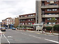
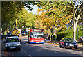
Photos of NW2 4SD


Area Information
Living in NW2 4SD means residing within a specific postcode cluster defined by its high density and compact footprint. This area spans just 971 m² and houses a population of 1,389 people. Consequently, the residential environment is characterised by a concentration of homes rather than sprawling countryside. The character of this neighbourhood reflects a tightly packed community where daily interactions with neighbours are more immediate due to the sheer number of residents within a small space. You are buying into a mature settlement where the demographic weight leans heavily towards middle-aged adults. The location sits firmly in London's urban grid, offering a distinct residential experience separate from the surrounding wider zones. Prospective buyers should expect a landscape dominated by flats and a limited amount of open green space within the immediate postcode boundary. The area serves as a functional node within the London transport network, connecting residents to major hubs via rail and metro lines. Daily life here revolves around the convenience of being close to employment centres and the tube network. The sheer density of 1,430,647 people per square kilometre indicates a built‑up residential zone rather than a low‑rise suburb. You will find a community accustomed to the rhythm of city living, with services and transport links acting as the primary arteries for getting around.
- Area Type
- Postcode
- Area Size
- 971 m²
- Population
- 1389
- Population Density
- 7992 people/km²
The property market in NW2 4SD is characterised almost exclusively by flats, which forms the predominant accommodation type for this postcode. With a home ownership rate of only 36%, the area functions more as a rental hub than a traditional owner‑occupied suburb. This low percentage suggests that most residents are tenants seeking flexible or affordable urban living rather than homeowners building equity. You are looking at a stock of apartments designed to maximise space within the tight 971 m² area size. The low ownership rate typically correlates with higher demand for private rentals or shared living arrangements among the 1,389 residents. If you are considering purchase, you must understand that the majority of transactions here involve securing a property from a landlord or within a multi‑unit building. The market dynamics are shaped by the need to house a large number of people in limited physical space. Expect competition for available flats to be stiffer than in areas where detached houses dominate the landscape. The 36% ownership statistic serves as a clear indicator that this is a market driven by investment and letting rather than buy‑to‑stay. Buyers should verify leasehold terms carefully given the nature of the accommodation type.
House Prices in NW2 4SD
Showing 3 properties
| Address | Type | Beds | Baths | Last Sale Price | Last Sale Date | |
|---|---|---|---|---|---|---|
| 2, Former Whixall House, Exeter Road, London, NW2 4SD | Flat | - | - | - | - | |
| 3, Whixall House, Exeter Road, London, NW2 4SD | Flat | - | - | - | - | |
| Whixall House, Exeter Road, London, NW2 4SD | house | - | - | - | - |
Energy Efficiency in NW2 4SD
Daily life in NW2 4SD is powered by a network of amenities located within practical reach of every resident. You have immediate access to five retail outlets, including Co‑op Cricklewood, Co‑op Willesden, and Iceland Cricklewood for your weekly groceries and essentials. Leisure trips away from the home are straightforward thanks to five nearby metro stations such as Kilburn Station, Dollis Hill Station, and Kilburn Park Station. Rail connectivity is equally strong with five stations including Cricklewood, Brondesbury Station, and Brondesbury Park Station ready for longer journeys outside London. Waterbus services connect you to five stops including Little Venice Waterbus Stop, London Zoo Waterbus Stop, and Camden Lock Water. These water links provide a scenic alternative for commuters who prefer travelling by water to places like London Zoo. Bus connections are integrated with major coach stations like London Victoria Coach Station Arrivals and Green Line Coach Station for national travel. You do not need a car to access major shopping centres, as the density of these five shops covers most routine needs. The concentration of these five transport modes creates a lifestyle where you rarely have to travel far to reach work, leisure, or school.
Amenities
Schools
| Rank | School | Type | Entry gender | Ages |
|---|
Explore more schools in this area
Go to Schools tabDemographics
The community in NW2 4SD is defined by a mature population profile with a median age of 47 years. Most residents fall into the adult bracket between 30 and 64 years old, creating a stable demographic environment largely free from the volatility of young student housing markets. Home ownership stands at 36%, which indicates that a significant portion of the population resides through long‑term tenancies. The predominant accommodation type is flats, reflecting the vertical density required to house 1,389 people across such a small 971 m² footprint. The predominant ethnic group is White, which shapes the cultural make‑up of the local shops and community events. With such a high home ownership percentage among flats, you are likely to encounter older or more established tenants who have settled in this specific cluster. The absence of large family‑oriented housing types suggests a lifestyle geared towards couples or singles rather than growing families seeking detached homes. This demographic data paints a picture of a stable, urban‑centric population that values connectivity and convenience over suburban sprawl. The 36% ownership figure further signals a rental‑heavy market where security of tenure might be a priority for many current occupants.
Household Size
Accommodation Type
Tenure
Ethnic Group
Religion
Household Composition
Age
Household Deprivation
NS-SEC
Explore more demographic insights in this area
Go to Demographics tabPlanning
Planning Constraints
- Flood RiskPremium
- Ramsar Wetland SitesPremium
- Area of Outstanding Natural BeautyPremium
- Protected Nature ReservePremium
- Protected WoodlandPremium