Area Overview for NW2 4BY
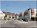
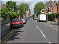
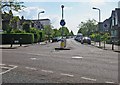
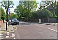
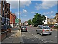
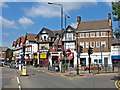
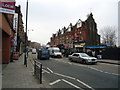
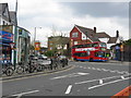
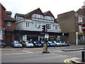
Photos of NW2 4BY


Area Information
NW2 4BY is a specific postcode area covering a small residential cluster measuring 3542 square metres. This compact location houses a population of 1761 people, creating a neighbourhood with a very high population density of 497,205 people per square kilometre. Living in NW2 4BY means navigating a tightly packed environment where every square metre supports a significant community presence. The area functions as a concentrated residential hub rather than a sprawling district. Residents experience daily life within close proximity to one another, which fosters a neighbourhood dynamic distinct from larger, more diffuse areas. The sheer concentration of homes within such a limited space defines the character of this location. You will find a setting where the built environment dominates, offering convenience through proximity but limited open space. This density is consistent with other postcodes in the North West London region. The area represents a specific slice of local property availability for those seeking homes in this densely populated zone. Understanding the scale of NW2 4BY helps contextualise the experience of moving here. It is a place defined by its residential intensity and its specific geographical footprint.
- Area Type
- Postcode
- Area Size
- 3542 m²
- Population
- 1761
- Population Density
- 8034 people/km²
The property market in NW2 4BY is defined by a limited housing stock concentrated within a 3542 square metre area. Flats represent the predominant accommodation type you should expect when browsing homes in NW2 4BY. Only 36% of residents own their homes, indicating a mixed market with a substantial proportion of tenants. This lower ownership rate often correlates with high-demand rental communities or areas where freehold purchase is less common than leasehold arrangements. The small total population of 1761 suggests that there are fewer properties available for sale compared to larger neighbouring districts. When researching NW2 4BY, you will encounter a market characterised by compact residential units rather than large family homes. The dominance of flats aligns with the high population density, as vertical living accommodates more people within the small area size. Potential buyers should note that the scarcity of land limits development opportunities, preserving current stock. Competition for flats may be intense given the population pressure. Whether you seek a flat or are managing a rental portfolio, the specific character of this postcode area dictates your options. Focus your search on the available flats to find suitable homes in NW2 4BY.
House Prices in NW2 4BY
Showing 14 properties
| Address | Type | Beds | Baths | Last Sale Price | Last Sale Date | |
|---|---|---|---|---|---|---|
| 26 Coverdale Road, London, NW2 4BY | Flat | 2 | - | £550,000 | May 2000 | |
| 10, Kingsbridge Court, 28 Coverdale Road, London, NW2 4BY | Flat | 2 | 2 | - | - | |
| 11, Kingsbridge Court, 28 Coverdale Road, London, NW2 4BY | Flat | 2 | 1 | - | - | |
| 3, Kingsbridge Court, 28 Coverdale Road, London, NW2 4BY | Flat | 2 | 2 | - | - | |
| 24 Coverdale Road, London, NW2 4BY | Semi-detached | - | - | - | - | |
| 8, Kingsbridge Court, 28 Coverdale Road, London, NW2 4BY | Flat | - | - | - | - | |
| 2, Kingsbridge Court, 28 Coverdale Road, London, NW2 4BY | Flat | - | - | - | - | |
| 5, Kingsbridge Court, 28 Coverdale Road, London, NW2 4BY | Flat | 2 | 2 | - | - | |
| 4, Kingsbridge Court, 28 Coverdale Road, London, NW2 4BY | Flat | - | - | - | - | |
| 7, Kingsbridge Court, 28 Coverdale Road, London, NW2 4BY | Flat | - | - | - | - |
Energy Efficiency in NW2 4BY
Residents of NW2 4BY benefit from immediate access to a wide array of transport and retail options. Within practical reach, you will find five railway stations including Brondesbury Park Station, Brondesbury Station, and Kensal Rise Station. Commuters also have access to five metro stations such as Kilburn Station, Kilburn Park Station, and Dollis Hill Station. These links connect you to the wider London transport network efficiently. For those preferring surface travel, there are five waterbus stops serving locations like Little Venice Waterbus Stop and Camden Lock Waterbus. Retail choices include Sainsburys Willesden, Tesco Kilburn, and Co-op Willesden, offering daily essentials nearby. Bus connections are available via routes linking to London Victoria Coach Station Arrivals and the Green Line Coach Station. You can walk to local shops or venture slightly further to reach rail terminals. This proximity ensures that running errands in NW2 4BY requires minimal travel time. The blend of rail, metro, and water transport provides multiple choices for your daily journey. Residents enjoy the convenience of having supermarkets and transport hubs without needing to drive extensively.
Amenities
Schools
| Rank | School | Type | Entry gender | Ages |
|---|
Explore more schools in this area
Go to Schools tabDemographics
The community in NW2 4BY reflects a mature demographic with a median age of 47 years. Adults aged between 30 and 64 years make up the most common age range within the population. A significant portion of residents, specifically 36%, own their homes outright. The remaining households likely reside in the rental sector given the lower home ownership rate. Flats are the predominant accommodation type for residents in this postcode. The ethnic composition is predominantly White, forming the majority of the local population. You are moving into a neighbourhood where older residents and families with children under 18 may be less common compared to the adult workforce. The high home ownership figure suggests stability among long-term residents who have established roots in the area. Accessibility for younger buyers might be constrained by the dominance of flats and the relatively high cost implied by ownership rates. The population density further reinforces the feeling of a permanent settlement rather than a transient community. Understanding these figures helps you assess whether NW2 4BY matches your personal lifestyle preferences regarding age and tenure options.
Household Size
Accommodation Type
Tenure
Ethnic Group
Religion
Household Composition
Age
Household Deprivation
NS-SEC
Explore more demographic insights in this area
Go to Demographics tabPlanning
Planning Constraints
- Flood RiskPremium
- Ramsar Wetland SitesPremium
- Area of Outstanding Natural BeautyPremium
- Protected Nature ReservePremium
- Protected WoodlandPremium