Area Overview for NW2 3SH
Photos of NW2 3SH
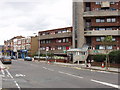
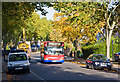
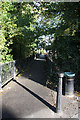
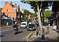


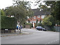
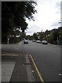
100 photos from this area
Area Information
Key information about the NW2 3SH including its size, population, and administrative classification.
- Area Type
- Postcode
- Area Size
- 6703 m²
- Population
- 1657
- Population Density
- 5412 people/km²
House Prices in NW2 3SH
23
Properties
£1,163,431
Average Sold Price
£570,000
Lowest Price
£1,800,000
Highest Price
Showing 23 properties
| Address | Type | Beds | Baths | Last Sale Price | Last Sale Date | |
|---|---|---|---|---|---|---|
| 55 Minster Road, London, NW2 3SH | Semi-detached | 4 | 2 | £1,700,000 | Sep 2021 | |
| 53 Minster Road, London, NW2 3SH | Semi-detached | 4 | 3 | £1,800,000 | May 2017 | |
| 51 Minster Road, London, NW2 3SH | Semi-detached | 4 | 2 | £1,585,000 | Jun 2015 | |
| 57 Minster Road, London, NW2 3SH | house | 4 | 2 | £1,130,000 | Mar 2011 | |
| 31 Minster Road, London, NW2 3SH | house | 6 | - | £1,246,500 | Aug 2006 | |
| 37 Minster Road, London, NW2 3SH | Flat | - | - | £650,000 | Mar 2005 | |
| 63 Minster Road, London, NW2 3SH | Terraced | 3 | 3 | £570,000 | Jan 2004 | |
| 61 Minster Road, London, NW2 3SH | Flat | - | - | £625,950 | Apr 2003 | |
| Flat 2, 49 Minster Road, London, NW2 3SH | Flat | 2 | 1 | - | - | |
| 33 Minster Road, London, NW2 3SH | Flat | - | - | - | - |
Page 1 of 3
Energy Efficiency in NW2 3SH
Amenities
Schools
| Rank | School | Type | Entry gender | Ages |
|---|
Explore more schools in this area
Go to Schools tabDemographics
Household Size
Family (3-5 people)
most common
Accommodation Type
Flats
most common
Tenure
57
majority
Ethnic Group
White
most common
Religion
N/A
most common
Household Composition
N/A
most common
Age
47
median
Adults (30-64 years)
most common
Household Deprivation
N/A
with no deprivation
NS-SEC
54
in Lower managerial occupations
Explore more demographic insights in this area
Go to Demographics tabPlanning
Planning Constraints
- Flood RiskPremium
- Ramsar Wetland SitesPremium
- Area of Outstanding Natural BeautyPremium
- Protected Nature ReservePremium
- Protected WoodlandPremium