Area Overview for NW2 3NY
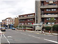
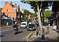
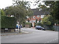
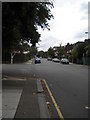
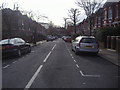
Photos of NW2 3NY


Area Information
Living in NW2 3NY means residing within a compact residential cluster that covers just 2,676 square metres. This highly concentrated area supports a population of 1,657 people, creating a tightly knit neighbourhood where residents are neighbours in the truest sense. The location sits in England, offering a specific postcode environment that appeals to those seeking a defined community rather than a sprawling suburb. Daily life here revolves around immediate proximity to transport hubs and essential services, given the area's small footprint. You will find that the neighbourhood is characterised by a high density of occupancy relative to its land mass. This setting suitably balances the need for local convenience with the quiet of a semi-private residential zone. The area provides a grounded foundation for city living without the extensive disposable land of larger districts.
- Area Type
- Postcode
- Area Size
- 2676 m²
- Population
- 1657
- Population Density
- 5412 people/km²
The property market in NW2 3NY reflects the unique character of a small residential cluster. You are overwhelmingly looking at flats, as this is the stated predominant accommodation type for the area. Only 57% of households own their homes, indicating that rental activity is a significant part of the local market alongside ownership. Because the area covers merely 2,676 square metres, the housing stock is condensed and likely appeals to urban professionals requiring flat living. This concentration of flats shapes the buying experience into one focused on smaller, potentially converted, or purpose-built units. Buyers should anticipate a market driven by flats rather than detached or semi-detached houses. The mix suggests that while ownership is common at 57%, the architectural form remains distinctively urban. Investors and residents seeking flat living will find this postcode central to their search for homes in NW2 3NY.
House Prices in NW2 3NY
No properties found in this postcode.
Energy Efficiency in NW2 3NY
Your daily lifestyle in NW2 3NY benefits from immediate access to a notable range of amenities within practical reach. Retail options are well represented with five nearby stores, including prominent locations such as Co-op Cricklewood, Iceland Cricklewood, and another Co-op outlet. Transport connectivity is extensive, with five rail stations nearby including Cricklewood, Brondesbury Station, and West Hampstead Thameslink Railway Station. You also have access to five metro stations such as Kilburn Station, Dollis Hill Station, and Hampstead Station. Water transport is available via five ferry points including London Zoo Waterbus Stop, Little Venice Waterbus Stop, and Camden Lock Water. Furthermore, bus services are integrated with three major coach station connections including London Victoria Coach Station Arrivals. This network provides you with unparalleled convenience for shopping, commuting, and leisure activities directly from your doorstep.
Amenities
Schools
Education options near NW2 3NY are represented by a single named institution in the provided data. Hampstead School operates nearby and holds a primary education type classification. The school carries a Good Ofsted rating, confirming its quality under government inspection. For families living in this postcode, you have direct access to a primary school with demonstrated standards. The presence of only one listed primary school means you should verify further education options based on your specific travel times and child's needs. This specific educational anchor provides a clear reference point for local family considerations. When evaluating homes in NW2 3NY, the proximity to Hampstead School serves as a key practical factor in your decision-making process for schools near the area.
| Rank | School | Type | Entry gender | Ages |
|---|---|---|---|---|
| 1 | Hampstead School | primary | N/A | N/A |
Explore more schools in this area
Go to Schools tabDemographics
The community in NW2 3NY is defined by a mature demographic presence. The median age stands at 47, with adults aged between 30 and 64 years representing the most common age range. This profile suggests a stable population often settled in long-term family homes or seeking stability in retirement. Home ownership levels are robust, with 57% of residents owning their property outright or through a mortgage compared to tenants. Flats constitute the primary form of accommodation within this postcode sector. While White residents form the predominant ethnic group, the stated figures confirm a clear majority. These demographics paint a picture of an established neighbourhood where professional adults and families dominate the housing scenes. The age profile implies a shift away from transient living towards more permanent settlement patterns within this specific stretch of London.
Household Size
Accommodation Type
Tenure
Ethnic Group
Religion
Household Composition
Age
Household Deprivation
NS-SEC
Explore more demographic insights in this area
Go to Demographics tabPlanning
Planning Constraints
- Flood RiskPremium
- Ramsar Wetland SitesPremium
- Area of Outstanding Natural BeautyPremium
- Protected Nature ReservePremium
- Protected WoodlandPremium
- Crime RiskPremium