Area Overview for NW2 3NL
Photos of NW2 3NL


Area Information
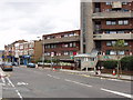
Living in NW2 3NL means residing within a specific residential cluster defined by the postcode, covering just 4,693 square metres. This small area serves as a dense pocket of housing within the wider London landscape, catering to a population of 1,740 people. The high population density of 370,737 people per square kilometre reflects a built-up environment where properties sit close together. You will find this postcode acts as a convenient base for accessing larger transport hubs and shopping districts nearby. Daily life here involves navigating a compact space that prioritises proximity over sprawling gardens. The cluster is situated in North West London, placing you minutes from Kilburn and Cricklewood. Residents benefit from immediate access to major road networks and public transit links. While the area lacks extensive green space within its tiny footprint, its location ensures you are never far from parks or recreation grounds. The distinct character of NW2 3NL comes from its integration into the larger Kilburn and Finchley Road corridor. It is a pragmatic choice for those seeking a direct connection to city life without the need for long commutes across the capital.
- Area Type
- Postcode
- Area Size
- 4693 m²
- Population
- 1740
- Population Density
- 11837 people/km²
The property market in NW2 3NL is dominated by flats, which serve as the primary accommodation type for the local population. Only 26 per cent of residents own their homes, highlighting a strong presence of private renting and alternative tenures. This tenure mix is typical for high-density urban pockets where space is at a premium and budgets vary widely. The small area size of 4,693 square metres restricts new development but maintains value through consistent demand from commuters seeking proximity to Kilburn Station and Finchley Road. Buyers looking at NW2 3NL should expect a landscape of balcony apartments and communal living spaces rather than semi-detached houses. The low ownership rate implies that sellers are often landlords liquidating assets or seeking better opportunities locally. For tenants, the concentration of flats offers a convenient lifestyle with shared services and maintenance. The market reflects the broader trends of inner-tier London postcodes where land value outweighs potential for traditional housing forms. Expect competition for smaller units as they appeal to professionals working in nearby business districts.
House Prices in NW2 3NL
Showing 48 properties
| Address | Type | Beds | Baths | Last Sale Price | Last Sale Date | |
|---|---|---|---|---|---|---|
| Flat A, 116 Fordwych Road, London, NW2 3NL | Flat | 2 | 1 | - | - | |
| Flat 9, 118 Fordwych Road, London, NW2 3NL | Flat | 2 | 1 | - | - | |
| Flat B, 116 Fordwych Road, London, NW2 3NL | Flat | 2 | 1 | - | - | |
| Flat A, 114 Fordwych Road, London, NW2 3NL | Flat | 1 | 1 | - | - | |
| Flat 8, 118 Fordwych Road, London, NW2 3NL | Flat | - | - | - | - | |
| Basement Flat, 118 Fordwych Road, London, NW2 3NL | Flat | 14 | - | - | - | |
| Basement Flat, 112 Fordwych Road, London, NW2 3NL | Flat | 3 | 2 | - | - | |
| Flat 3, 106 Fordwych Road, London, NW2 3NL | Flat | - | - | - | - | |
| Flat 4, 106 Fordwych Road, London, NW2 3NL | Flat | - | - | - | - | |
| Flat 6, 118 Fordwych Road, London, NW2 3NL | Flat | - | - | - | - |
Energy Efficiency in NW2 3NL
Residents of NW2 3NL enjoy immediate access to significant retail and transport hubs despite the small size of their postcode. Five supermarket options are within practical reach, including Co-op Cricklewood, Tesco Kilburn, and Sainsburys Kilburn. These large chains offer comprehensive grocery ranges along with hot food counters and pharmacy services. Your daily shopping needs are met without the need for extensive travel. Transport options are equally diverse with five metro stations and five rail stops nearby. You can reach Kilburn Station, Finchley Road Station, and Kilburn Park Station for underground travel. Meanwhile, Brondesbury Station and West Hampstead Thameslink Railway Station provide direct links to central London via the Thameslink network. A dedicated ferry service adds a unique leisure angle with stops at London Zoo Waterbus, Little Venice Waterbus, and Camden Lock Waterbus. Although bus services in the immediate vicinity are fewer at three, major coach terminals like London Victoria Coach Station are noted for cross-country travel. This wealth of amenities ensures you have restaurants, cinemas, and shops just across the station boundary.
Amenities
Schools
Families living in NW2 3NL have access to The Mulberry House School, located near the postcode. This institution operates as an independent school, offering an alternative to state-funded education. Independent schools often command higher fees but provide smaller class sizes and additional extracurricular facilities. The presence of just one named school in the immediate vicinity suggests residents rely on this specific option or travel further for state education. Choosing an independent school aligns with a preference for a structured curriculum and separate governance from the local council. For parents evaluating living in NW2 3NL, this singular option represents a clear path for children who do not reside in mainstream local authority catchment zones. The school's independent status means admissions are often needs-based rather than strictly geographic. You will find few other educational institutions listed for this specific cluster, making The Mulberry House School a standout facility for the local community.
| Rank | School | Type | Entry gender | Ages |
|---|
Explore more schools in this area
Go to Schools tabDemographics
The community in NW2 3NL has a mature demographic profile with a median age of 47. The most common age range for residents falls between 30 and 64 years, indicating a population of working adults and established families. Home ownership stands at 26 per cent, meaning the majority of residents live in the private rental sector or through other tenure types such as licensing agreements. Flats constitute the predominant accommodation type, shaping the social fabric into a more compact, vertical living arrangement. The predominant ethnic group is White, forming the backbone of the local community. With a median age approaching 50, the area attracts seniors and professionals who value stability near major transport links. This age profile often correlates with higher disposable income, supporting demand for nearby high-quality amenities. The relatively low rate of home ownership suggests a dynamic market where tenants move with regularity. This turnover keeps the rental supply active and diverse. You will encounter a neighbourhood accustomed to the rhythm of city workers and professionals who utilise the extensive rail and bus networks surrounding the postcode.
Household Size
Accommodation Type
Tenure
Ethnic Group
Religion
Household Composition
Age
Household Deprivation
NS-SEC
Explore more demographic insights in this area
Go to Demographics tabPlanning
Planning Constraints
- Flood RiskPremium
- Ramsar Wetland SitesPremium
- Area of Outstanding Natural BeautyPremium
- Protected Nature ReservePremium
- Protected WoodlandPremium