Area Overview for NW2 3BG
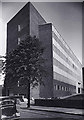
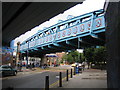
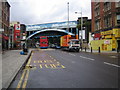
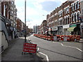
Photos of NW2 3BG
Area Information
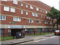
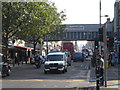
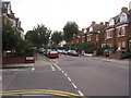
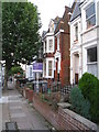
NW2 3BG is a specific postcode area covering a small residential cluster in northwest London. This compact zone spans just 249 square metres and holds a population of 1,937 residents. Living in NW2 3BG means experiencing a densely populated environment where space is at a premium. The location sits within a zone of 777,824,48 people per square kilometre, indicating high population density. Despite its small footprint, the area connects to a wider network of London's transport and retail hubs. You will find yourself close to major stations and supermarkets that serve the Kilburn and Cricklewood neighbourhoods. Daily life here involves navigating a tight-knit residential setting while having immediate access to broader city amenities. The area functions as a satellite point for出行 and shopping needs without requiring long commutes to central services. It is a place defined by its concentration of people and proximity to established transport nodes. ### The community in NW2 3BG is defined by a mature age profile. The median age of residents is 47 years, with adults between 30 and 64 years being the most common age range. This demographic indicates a population that has settled in the area for a significant period. Home ownership stands at 25%, meaning the vast majority of residents rent their accommodation. The predominant accommodation type consists of flats, reflecting the urban density of the postcode. White residents form the predominant ethnic group within this specific cluster. Safety presents a notable consideration for families; crime risk is rated as medium with a score of 44 out of 100. This level suggests that while the area is not exceptionally dangerous, standard security precautions are advisable. The combination of older residents, high rental occupancy, and rental-heavy flats creates a specific dynamic. You are looking at an area where long-term tenancies mix with a demographic that has moved here at mid-life. ### The property market in NW2 3BG is characterised by a high proportion of rental accommodation. Only 25% of residents own their homes, which indicates a predominantly private rental sector or potentially shared living arrangements rather than traditional family estates. Flats are the predominant accommodation type, confirming that the housing stock consists of multi-storey buildings rather than detached houses or semi-detached villas. This structure limits options for buyers seeking single-family homes with private gardens within the immediate boundary of the postcode. If you are looking at homes in NW2 3BG, expect to find units designed for density and efficient use of space rather than sprawling properties. The area functions as a residential cluster where the majority of occupants are tenants. This market composition often appeals to professionals or those seeking flexibility. You will find that search results for this postcode will heavily weight towards flats. The local supply reflects a focus on accessibility and urban living rather than suburban sprawl. ### Digital connectivity in NW2 3BG supports high-performance remote working and modern daily life. The fixed broadband quality score reaches an excellent level of 95 out of 100, ensuring fast internet speeds for streaming or business use. Your mobile coverage is also strong, with a score of 85 out of 100, which classifies as good reliability for a city centre location. These ratings mean you can expect minimal dropouts during critical calls or large file uploads. For residents, this infrastructure removes barriers to work-from-home lifestyles. You do not need to worry about connectivity issues disrupting your online presence. The physical transport network further supports this connectivity. Nearby Kilburn Station, Kilburn Park Station, and Finchley Road Station provide comprehensive transport options. You also have access to Brondesbury Station and Brondesbury Park Station for rail connectivity. Shopping trips are equally convenient with five supermarket options including Co-op Cricklewood, Tesco Kilburn, and Sainsburys Kilburn within practical reach. ### Living in NW2 3BG offers immediate access to a wide variety of services and leisure options. Your daily grocery shopping is simplified by the presence of Co-op Cricklewood, Tesco Kilburn, and Sainsburys Kilburn, all located within a short walk or tube ride. These retail outlets ensure you can pick up essentials without traveling far. Beyond shopping, the area benefits from excellent public transport links that touch on five metro stations and five rail stations. You can walk to London Zoo Waterbus Stop, Little Venice Waterbus Stop, and Camden Lock Waterbus for unique leisure experiences on the Regent's Canal. Financial management of commuting is further supported by the presence of London Victoria Coach Station Arrivals, Victoria Coach Station, and Green Line Coach Station nearby. This density of transport modes means you can choose the right vehicle for every journey. Whether you need to rush to work or commute to the border, the infrastructure is extensive. The lifestyle here is one of convenience, where retail and transport intersect in the immediate vicinity. ### Safety assessments for NW2 3BG reveal a mixed picture requiring practical awareness. The crime risk rating is medium, with a safety score of 44 out of 100. This indicates that crime rates are around average for London but are not negligible. You should adopt standard security precautions when living here, such as locking doors and being mindful of your surroundings. Fortunately, environmental hazards are non-existent in this specific postcode. The area passes safety checks for flood risk, with a score of 0 indicating low flood risk coverage. There is no Ramsar wetland site coverage, no Area of Outstanding Natural Beauty, and no protected nature reserve or woodland within the boundaries. These passing scores mean you face no planning constraints or environmental prohibitions regarding construction or land use. You can build or renovate without worrying about protected natural features. However, the medium crime score remains the primary safety concern for potential residents. It is a factor to weigh against the convenience of the area's location. ### What is the home ownership rate in NW2 3BG?Only 25% of residents own their homes, meaning the area is predominantly a rental market with the majority of people renting flats. How reliable is the internet for working from home?Digital infrastructure is excellent, with a fixed broadband score of 95 and a mobile coverage score of 85, ensuring fast speeds and strong signals. Is living in NW2 3BG safe?The crime risk is rated medium with a score of 44 out of 100. While there are no environmental hazards, standard security precautions are advisable. Where can I find shops and supermarkets nearby?Residents have access to Co-op Cricklewood, Tesco Kilburn, and Sainsburys Kilburn, alongside extensive public transport links at six nearby stations. Who typically lives in this area?The population has a median age of 47, with adults between 30 and 64 being the most common age group in this 1,937-person community.
- Area Type
- Postcode
- Area Size
- 249 m²
- Population
- 1937
- Population Density
- 16415 people/km²
The property market in NW2 3BG is characterised by a high proportion of rental accommodation. Only 25% of residents own their homes, which indicates a predominantly private rental sector or potentially shared living arrangements rather than traditional family estates. Flats are the predominant accommodation type, confirming that the housing stock consists of multi-storey buildings rather than detached houses or semi-detached villas. This structure limits options for buyers seeking single-family homes with private gardens within the immediate boundary of the postcode. If you are looking at homes in NW2 3BG, expect to find units designed for density and efficient use of space rather than sprawling properties. The area functions as a residential cluster where the majority of occupants are tenants. This market composition often appeals to professionals or those seeking flexibility. You will find that search results for this postcode will heavily weight towards flats. The local supply reflects a focus on accessibility and urban living rather than suburban sprawl. ### Digital connectivity in NW2 3BG supports high-performance remote working and modern daily life. The fixed broadband quality score reaches an excellent level of 95 out of 100, ensuring fast internet speeds for streaming or business use. Your mobile coverage is also strong, with a score of 85 out of 100, which classifies as good reliability for a city centre location. These ratings mean you can expect minimal dropouts during critical calls or large file uploads. For residents, this infrastructure removes barriers to work-from-home lifestyles. You do not need to worry about connectivity issues disrupting your online presence. The physical transport network further supports this connectivity. Nearby Kilburn Station, Kilburn Park Station, and Finchley Road Station provide comprehensive transport options. You also have access to Brondesbury Station and Brondesbury Park Station for rail connectivity. Shopping trips are equally convenient with five supermarket options including Co-op Cricklewood, Tesco Kilburn, and Sainsburys Kilburn within practical reach. ### Living in NW2 3BG offers immediate access to a wide variety of services and leisure options. Your daily grocery shopping is simplified by the presence of Co-op Cricklewood, Tesco Kilburn, and Sainsburys Kilburn, all located within a short walk or tube ride. These retail outlets ensure you can pick up essentials without traveling far. Beyond shopping, the area benefits from excellent public transport links that touch on five metro stations and five rail stations. You can walk to London Zoo Waterbus Stop, Little Venice Waterbus Stop, and Camden Lock Waterbus for unique leisure experiences on the Regent's Canal. Financial management of commuting is further supported by the presence of London Victoria Coach Station Arrivals, Victoria Coach Station, and Green Line Coach Station nearby. This density of transport modes means you can choose the right vehicle for every journey. Whether you need to rush to work or commute to the border, the infrastructure is extensive. The lifestyle here is one of convenience, where retail and transport intersect in the immediate vicinity. ### Safety assessments for NW2 3BG reveal a mixed picture requiring practical awareness. The crime risk rating is medium, with a safety score of 44 out of 100. This indicates that crime rates are around average for London but are not negligible. You should adopt standard security precautions when living here, such as locking doors and being mindful of your surroundings. Fortunately, environmental hazards are non-existent in this specific postcode. The area passes safety checks for flood risk, with a score of 0 indicating low flood risk coverage. There is no Ramsar wetland site coverage, no Area of Outstanding Natural Beauty, and no protected nature reserve or woodland within the boundaries. These passing scores mean you face no planning constraints or environmental prohibitions regarding construction or land use. You can build or renovate without worrying about protected natural features. However, the medium crime score remains the primary safety concern for potential residents. It is a factor to weigh against the convenience of the area's location. ### What is the home ownership rate in NW2 3BG?Only 25% of residents own their homes, meaning the area is predominantly a rental market with the majority of people renting flats. How reliable is the internet for working from home?Digital infrastructure is excellent, with a fixed broadband score of 95 and a mobile coverage score of 85, ensuring fast speeds and strong signals. Is living in NW2 3BG safe?The crime risk is rated medium with a score of 44 out of 100. While there are no environmental hazards, standard security precautions are advisable. Where can I find shops and supermarkets nearby?Residents have access to Co-op Cricklewood, Tesco Kilburn, and Sainsburys Kilburn, alongside extensive public transport links at six nearby stations. Who typically lives in this area?The population has a median age of 47, with adults between 30 and 64 being the most common age group in this 1,937-person community.
House Prices in NW2 3BG
Showing 11 properties
Energy Efficiency in NW2 3BG
Living in NW2 3BG offers immediate access to a wide variety of services and leisure options. Your daily grocery shopping is simplified by the presence of Co-op Cricklewood, Tesco Kilburn, and Sainsburys Kilburn, all located within a short walk or tube ride. These retail outlets ensure you can pick up essentials without traveling far. Beyond shopping, the area benefits from excellent public transport links that touch on five metro stations and five rail stations. You can walk to London Zoo Waterbus Stop, Little Venice Waterbus Stop, and Camden Lock Waterbus for unique leisure experiences on the Regent's Canal. Financial management of commuting is further supported by the presence of London Victoria Coach Station Arrivals, Victoria Coach Station, and Green Line Coach Station nearby. This density of transport modes means you can choose the right vehicle for every journey. Whether you need to rush to work or commute to the border, the infrastructure is extensive. The lifestyle here is one of convenience, where retail and transport intersect in the immediate vicinity. ### Safety assessments for NW2 3BG reveal a mixed picture requiring practical awareness. The crime risk rating is medium, with a safety score of 44 out of 100. This indicates that crime rates are around average for London but are not negligible. You should adopt standard security precautions when living here, such as locking doors and being mindful of your surroundings. Fortunately, environmental hazards are non-existent in this specific postcode. The area passes safety checks for flood risk, with a score of 0 indicating low flood risk coverage. There is no Ramsar wetland site coverage, no Area of Outstanding Natural Beauty, and no protected nature reserve or woodland within the boundaries. These passing scores mean you face no planning constraints or environmental prohibitions regarding construction or land use. You can build or renovate without worrying about protected natural features. However, the medium crime score remains the primary safety concern for potential residents. It is a factor to weigh against the convenience of the area's location. ### What is the home ownership rate in NW2 3BG?Only 25% of residents own their homes, meaning the area is predominantly a rental market with the majority of people renting flats. How reliable is the internet for working from home?Digital infrastructure is excellent, with a fixed broadband score of 95 and a mobile coverage score of 85, ensuring fast speeds and strong signals. Is living in NW2 3BG safe?The crime risk is rated medium with a score of 44 out of 100. While there are no environmental hazards, standard security precautions are advisable. Where can I find shops and supermarkets nearby?Residents have access to Co-op Cricklewood, Tesco Kilburn, and Sainsburys Kilburn, alongside extensive public transport links at six nearby stations. Who typically lives in this area?The population has a median age of 47, with adults between 30 and 64 being the most common age group in this 1,937-person community.
Amenities
Schools
| Rank | School | Type | Entry gender | Ages |
|---|
Explore more schools in this area
Go to Schools tabDemographics
The community in NW2 3BG is defined by a mature age profile. The median age of residents is 47 years, with adults between 30 and 64 years being the most common age range. This demographic indicates a population that has settled in the area for a significant period. Home ownership stands at 25%, meaning the vast majority of residents rent their accommodation. The predominant accommodation type consists of flats, reflecting the urban density of the postcode. White residents form the predominant ethnic group within this specific cluster. Safety presents a notable consideration for families; crime risk is rated as medium with a score of 44 out of 100. This level suggests that while the area is not exceptionally dangerous, standard security precautions are advisable. The combination of older residents, high rental occupancy, and rental-heavy flats creates a specific dynamic. You are looking at an area where long-term tenancies mix with a demographic that has moved here at mid-life. ### The property market in NW2 3BG is characterised by a high proportion of rental accommodation. Only 25% of residents own their homes, which indicates a predominantly private rental sector or potentially shared living arrangements rather than traditional family estates. Flats are the predominant accommodation type, confirming that the housing stock consists of multi-storey buildings rather than detached houses or semi-detached villas. This structure limits options for buyers seeking single-family homes with private gardens within the immediate boundary of the postcode. If you are looking at homes in NW2 3BG, expect to find units designed for density and efficient use of space rather than sprawling properties. The area functions as a residential cluster where the majority of occupants are tenants. This market composition often appeals to professionals or those seeking flexibility. You will find that search results for this postcode will heavily weight towards flats. The local supply reflects a focus on accessibility and urban living rather than suburban sprawl. ### Digital connectivity in NW2 3BG supports high-performance remote working and modern daily life. The fixed broadband quality score reaches an excellent level of 95 out of 100, ensuring fast internet speeds for streaming or business use. Your mobile coverage is also strong, with a score of 85 out of 100, which classifies as good reliability for a city centre location. These ratings mean you can expect minimal dropouts during critical calls or large file uploads. For residents, this infrastructure removes barriers to work-from-home lifestyles. You do not need to worry about connectivity issues disrupting your online presence. The physical transport network further supports this connectivity. Nearby Kilburn Station, Kilburn Park Station, and Finchley Road Station provide comprehensive transport options. You also have access to Brondesbury Station and Brondesbury Park Station for rail connectivity. Shopping trips are equally convenient with five supermarket options including Co-op Cricklewood, Tesco Kilburn, and Sainsburys Kilburn within practical reach. ### Living in NW2 3BG offers immediate access to a wide variety of services and leisure options. Your daily grocery shopping is simplified by the presence of Co-op Cricklewood, Tesco Kilburn, and Sainsburys Kilburn, all located within a short walk or tube ride. These retail outlets ensure you can pick up essentials without traveling far. Beyond shopping, the area benefits from excellent public transport links that touch on five metro stations and five rail stations. You can walk to London Zoo Waterbus Stop, Little Venice Waterbus Stop, and Camden Lock Waterbus for unique leisure experiences on the Regent's Canal. Financial management of commuting is further supported by the presence of London Victoria Coach Station Arrivals, Victoria Coach Station, and Green Line Coach Station nearby. This density of transport modes means you can choose the right vehicle for every journey. Whether you need to rush to work or commute to the border, the infrastructure is extensive. The lifestyle here is one of convenience, where retail and transport intersect in the immediate vicinity. ### Safety assessments for NW2 3BG reveal a mixed picture requiring practical awareness. The crime risk rating is medium, with a safety score of 44 out of 100. This indicates that crime rates are around average for London but are not negligible. You should adopt standard security precautions when living here, such as locking doors and being mindful of your surroundings. Fortunately, environmental hazards are non-existent in this specific postcode. The area passes safety checks for flood risk, with a score of 0 indicating low flood risk coverage. There is no Ramsar wetland site coverage, no Area of Outstanding Natural Beauty, and no protected nature reserve or woodland within the boundaries. These passing scores mean you face no planning constraints or environmental prohibitions regarding construction or land use. You can build or renovate without worrying about protected natural features. However, the medium crime score remains the primary safety concern for potential residents. It is a factor to weigh against the convenience of the area's location. ### What is the home ownership rate in NW2 3BG?Only 25% of residents own their homes, meaning the area is predominantly a rental market with the majority of people renting flats. How reliable is the internet for working from home?Digital infrastructure is excellent, with a fixed broadband score of 95 and a mobile coverage score of 85, ensuring fast speeds and strong signals. Is living in NW2 3BG safe?The crime risk is rated medium with a score of 44 out of 100. While there are no environmental hazards, standard security precautions are advisable. Where can I find shops and supermarkets nearby?Residents have access to Co-op Cricklewood, Tesco Kilburn, and Sainsburys Kilburn, alongside extensive public transport links at six nearby stations. Who typically lives in this area?The population has a median age of 47, with adults between 30 and 64 being the most common age group in this 1,937-person community.
Household Size
Accommodation Type
Tenure
Ethnic Group
Religion
Household Composition
Age
Household Deprivation
NS-SEC
Explore more demographic insights in this area
Go to Demographics tabPlanning
Planning Constraints
- Flood RiskPremium
- Ramsar Wetland SitesPremium
- Area of Outstanding Natural BeautyPremium
- Protected Nature ReservePremium
- Protected WoodlandPremium