Area Overview for NW2 3AR
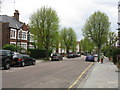
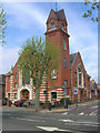
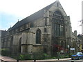
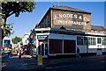
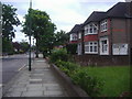
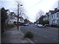
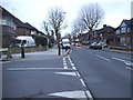
Photos of NW2 3AR

Area Information
Living in NW2 3AR offers a distinct experience within a small residential cluster. This specific postcode covers an area of 743 m², accommodating a population of 1,865 people. The high population density suggests a compact living environment where neighbours are likely close at hand. Despite its small geographical scale, the area supports a full range of daily needs for its residents. Daily life here revolves around the immediate surroundings, with access to essential transport links and local retail outlets always within practical reach. The area is situated in England, characterised by its urban residential nature rather than open green space. You will find that life in this cluster is defined by efficiency and convenience. The compact size means you are never far from your nearest station or shop. While the space is limited, the functionality serves the needs of a modern household well. The character of the neighbourhood is shaped by its density and the specific mix of properties found within these boundaries. It is a place where convenience is paramount, suited to those who value proximity to services over expansive grounds.
- Area Type
- Postcode
- Area Size
- 743 m²
- Population
- 1865
- Population Density
- 15899 people/km²
The property market in NW2 3AR is defined by its housing stock and tenure status. Flats constitute the primary accommodation type, reflecting the area's status as a small residential cluster. This housing format is well-suited to the high population density and urban location. With home ownership standing at 27%, the area operates largely as a rental market. You will encounter more private tenants than owner-occupiers when viewing properties here. This high rental demand often sustains property values and ensures active turnover in the housing stock. The 743 m² area size limits the physical footprint of the development, reinforcing the need for multi-storied flats rather than standalone houses. Buyers looking at this postcode should expect to compete with tenants seeking stability or investors looking for yield. The concentration of flats in a compact space creates a tenant community that moves with the changing demands of the working population. Understanding the 27% ownership figure helps you gauge the area's character as a hub for renters and landlords rather than long-term families. The market moves efficiently thanks to the clear demand for flat living in this central postcode.
House Prices in NW2 3AR
Showing 6 properties
| Address | Type | Beds | Baths | Last Sale Price | Last Sale Date | |
|---|---|---|---|---|---|---|
| 1, Doral Court, 79 Chichele Road, London, NW2 3AR | Flat | 2 | 1 | - | - | |
| 6, Doral Court, 79 Chichele Road, London, NW2 3AR | Flat | - | - | - | - | |
| 4, Doral Court, 79 Chichele Road, London, NW2 3AR | Flat | - | - | - | - | |
| 2, Doral Court, 79 Chichele Road, London, NW2 3AR | Flat | - | - | - | - | |
| 5, Doral Court, 79 Chichele Road, London, NW2 3AR | Flat | - | - | - | - | |
| 3, Doral Court, 79 Chichele Road, London, NW2 3AR | Flat | - | - | - | - |
Energy Efficiency in NW2 3AR
Daily life in NW2 3AR benefits from a wealth of nearby amenities within practical reach of residents. Retail options are plentiful, with five shops noting Iceland Cricklewood and two locations of Co-op Cricklewood. For active travel enthusiasts, five rail stations and five metro stations are accessible, including Kilburn Station and Neasden Station. Five waterbus stops operate along The Regent's Canal, with facilities at Little Venice Waterbus Stop, London Zoo Waterbus Stop, and Camden Lock Waterbus. If taking a coach, three major hubs exist nearby, including London Victoria Coach Station Arrivals and Green Line Coach Station. This dense network of hotels and transport nodes means you are never stuck in an area without services. The presence of these specific venues enhances the convenience of living in this compact postcode. Whether you need essentials before breakfast or a commute to work in the morning, the infrastructure supports you. The proximity to London Zoo and Camden Lock also adds leisure value, allowing quick access to London's iconic attractions. Your lifestyle is enriched by being so close to these key districts and commercial hubs.
Amenities
Schools
Families considering living in NW2 3AR have access to specific educational institutions nearby. Anson Primary School is the only primary school listed in the immediate vicinity. It holds a 'good' Ofsted rating, indicating a solid standard of education for young children. As there are no secondary schools listed in the provided data, families with older children may need to look beyond this immediate 743 m² cluster for comprehensive education. The presence of Anson Primary School suggests that families with young offspring exist within or very close to this postcode. The single primary option highlighted in the data points to a specific educational provision for the area. You cannot assume the existence of other schools without further research, but Anson Primary serves the junior needs of students in the area. The 'good' rating provides reassurance regarding the quality of early education available to residents of NW2 3AR. For those with teenagers, you will need to investigate school catchment areas further as this data does not cover secondary provision.
| Rank | School | Type | Entry gender | Ages |
|---|
Explore more schools in this area
Go to Schools tabDemographics
The community in NW2 3AR reflects a mature population profile. The median age stands at 47 years, with the most common age range falling between 30 and 64 years. This indicates a neighbourhood dominated by adults rather than young families or retirees. Consequently, the area appeals to professionals and established households seeking stability. Home ownership accounts for 27% of residents, meaning the majority of your neighbours belong to the private rental sector. This dynamic shapes the resident profile, attracting tenants who prefer flexibility over long-term ties. The predominant ethnic group is White, forming the core of the local demographic makeup. The accommodation type is primarily flats, which aligns with the high-density population figure of 2,511,360 people per km². This housing style suits the urban setting and supports the needs of the working-age majority. You will find a community of adults navigating their careers and personal lives within a compact urban footprint. The 27% ownership rate suggests a vibrant rental market where incomes and lifestyles determine residency.
Household Size
Accommodation Type
Tenure
Ethnic Group
Religion
Household Composition
Age
Household Deprivation
NS-SEC
Explore more demographic insights in this area
Go to Demographics tabPlanning
Planning Constraints
- Flood RiskPremium
- Ramsar Wetland SitesPremium
- Area of Outstanding Natural BeautyPremium
- Protected Nature ReservePremium
- Protected WoodlandPremium