Area Overview for NW2 2AA
Photos of NW2 2AA
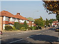
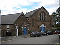
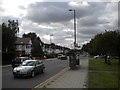
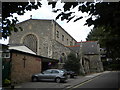
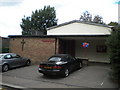
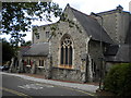


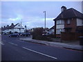
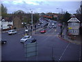
100 photos from this area
Area Information
Key information about the NW2 2AA including its size, population, and administrative classification.
- Area Type
- Postcode
- Area Size
- 7213 m²
- Population
- 1957
- Population Density
- 13423 people/km²
House Prices in NW2 2AA
81
Properties
£470,500
Average Sold Price
£122,000
Lowest Price
£1,010,000
Highest Price
Showing 81 properties
| Address | Type | Beds | Baths | Last Sale Price | Last Sale Date | |
|---|---|---|---|---|---|---|
| 10 Crewys Road, Cricklewood, London, NW2 2AA | Flat | 4 | 1 | £430,000 | Dec 2024 | |
| 32 Crewys Road, Cricklewood, London, NW2 2AA | Terraced | 3 | 2 | £820,000 | Feb 2021 | |
| 26 Crewys Road, Cricklewood, London, NW2 2AA | house | 4 | 2 | £1,010,000 | Jul 2019 | |
| 34 Crewys Road, Cricklewood, London, NW2 2AA | Terraced | 4 | - | £247,500 | Aug 2013 | |
| 36 Crewys Road, Cricklewood, London, NW2 2AA | Terraced | - | - | £455,000 | Jan 2009 | |
| 40 Crewys Road, Cricklewood, London, NW2 2AA | house | - | - | £400,000 | May 2008 | |
| 16 Crewys Road, Cricklewood, London, NW2 2AA | house | - | - | £375,000 | Nov 2006 | |
| 38 Crewys Road, Cricklewood, London, NW2 2AA | house | - | - | £375,000 | Sep 2006 | |
| 42 Crewys Road, Cricklewood, London, NW2 2AA | house | - | - | £122,000 | Jul 1997 | |
| Flat 3, Tudor Court, 2 Crewys Road, Cricklewood, London, NW2 2AA | Flat | 1 | 1 | - | - |
Page 1 of 9
Energy Efficiency in NW2 2AA
Amenities
Schools
| Rank | School | Type | Entry gender | Ages |
|---|
Explore more schools in this area
Go to Schools tabDemographics
Household Size
Two person
most common
Accommodation Type
Flats
most common
Tenure
43
majority
Ethnic Group
White
most common
Religion
N/A
most common
Household Composition
N/A
most common
Age
47
median
Adults (30-64 years)
most common
Household Deprivation
N/A
with no deprivation
NS-SEC
47
in Lower managerial occupations
Explore more demographic insights in this area
Go to Demographics tabPlanning
Planning Constraints
- Flood RiskPremium
- Ramsar Wetland SitesPremium
- Area of Outstanding Natural BeautyPremium
- Protected Nature ReservePremium
- Protected WoodlandPremium