Area Overview for NW2 1EL
Photos of NW2 1EL
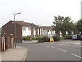
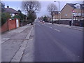
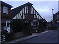


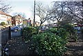

100 photos from this area
Area Information
Key information about the NW2 1EL including its size, population, and administrative classification.
- Area Type
- Postcode
- Area Size
- 7723 m²
- Population
- 1692
- Population Density
- 10542 people/km²
House Prices in NW2 1EL
28
Properties
£502,921
Average Sold Price
£125,000
Lowest Price
£745,000
Highest Price
Showing 28 properties
| Address | Type | Beds | Baths | Last Sale Price | Last Sale Date | |
|---|---|---|---|---|---|---|
| 60 Cumbrian Gardens, Cricklewood, London, NW2 1EL | Semi-detached | 3 | 2 | £640,000 | Sep 2025 | |
| 58 Cumbrian Gardens, Cricklewood, London, NW2 1EL | house | - | - | £667,500 | May 2024 | |
| 72 Cumbrian Gardens, Cricklewood, London, NW2 1EL | Semi-detached | - | - | £263,625 | Apr 2022 | |
| 98 Cumbrian Gardens, Cricklewood, London, NW2 1EL | house | - | - | £745,000 | Dec 2020 | |
| 88 Cumbrian Gardens, Cricklewood, London, NW2 1EL | Semi-detached | 4 | 2 | £710,000 | Aug 2019 | |
| 78 Cumbrian Gardens, Cricklewood, London, NW2 1EL | Semi-detached | 4 | 2 | £672,500 | Jul 2019 | |
| 104 Cumbrian Gardens, Cricklewood, London, NW2 1EL | Semi-detached | 5 | 3 | £700,000 | Mar 2018 | |
| 62 Cumbrian Gardens, Cricklewood, London, NW2 1EL | Semi-detached | 3 | 1 | £600,000 | Aug 2017 | |
| 74 Cumbrian Gardens, Cricklewood, London, NW2 1EL | Semi-detached | 4 | 3 | £650,000 | Sep 2015 | |
| 70 Cumbrian Gardens, Cricklewood, London, NW2 1EL | Semi-detached | - | - | £372,275 | Jun 2007 |
Page 1 of 3
Energy Efficiency in NW2 1EL
Amenities
Schools
| Rank | School | Type | Entry gender | Ages |
|---|
Explore more schools in this area
Go to Schools tabDemographics
Household Size
Family (3-5 people)
most common
Accommodation Type
Houses
most common
Tenure
53
majority
Ethnic Group
White
most common
Religion
N/A
most common
Household Composition
N/A
most common
Age
47
median
Adults (30-64 years)
most common
Household Deprivation
N/A
with no deprivation
NS-SEC
30
in Lower managerial occupations
Explore more demographic insights in this area
Go to Demographics tabPlanning
Planning Constraints
- Flood RiskPremium
- Ramsar Wetland SitesPremium
- Area of Outstanding Natural BeautyPremium
- Protected Nature ReservePremium
- Protected WoodlandPremium