Area Overview for NW11 8LD
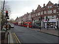
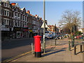
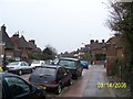
Photos of NW11 8LD


Area Information
NW11 8LD represents a very specific residential cluster in England, covering an area of just 6,073 square metres. This compact footprint supports a population of 1,660 people, creating a dense living environment with a population density of 273,357 people per square kilometre. Living in this postcode means you are part of a tightly packed neighbourhood where space is at a premium. The area functions as a residential hub within a larger urban context, distinguished by its intense concentration of people in a relatively small footprint. While the physical area is modest, the connectivity to surrounding transport and retail nodes makes it a practical location for those who commute or rely on public services. You will find yourself in a zone defined by high occupancy and a mix of flats that cater to varied household needs. This 25,000-year-old community type creates a dynamic daily life where neighbours are rarely far away. The sheer density dictates the character of the street, where accessibility often tracts over open land. For anyone considering homes in this postcode, understanding the scale is essential; you are buying into a micro-community that punches far above its weight in terms of activity levels. The location offers immediate proximity to major town centres, ensuring that daily errands do not require travel far from your doorstep. This balance of density and connectivity defines the experience of residing in NW11 8LD.
- Area Type
- Postcode
- Area Size
- 6073 m²
- Population
- 1660
- Population Density
- 8380 people/km²
The property market in NW11 8LD is heavily skewed towards rental arrangements rather than home ownership. Only 29% of the population owns their homes, meaning that 71% of residents are tenants. This disparity indicates a landlord-heavy area where leasehold flats dominate the skyline. The predominant accommodation type is flats, which suits the high density of this 6,073 square metre zone. Living in NW11 8LD often involves navigating a leasehold structure, as freehold flats are rare in such dense urban clusters. For buyers, this implies a focus on acquiring new-build flats or investing in buy-to-let schemes rather than purchasing an existing family home with a private garden. The market dynamics suggest that demand for flats exceeds supply in this specific postcode, driven by the need to house a population of 1,660 people in a very small area. You will find a limited range of property types, concentrated almost entirely within the existing flat structures. The high population density ensures that any new development or renovation would be immediately absorbed by the local market. Prospective owners must consider the implications of renting in an area where the majority of neighbours are tenants themselves. This market structure offers stability for landlords but less flexibility for first-time buyers seeking to settle down. The distinction between owner-occupied and rental zones is blurred here due to the high commute rate and young demographic profile common in similar nearby areas.
House Prices in NW11 8LD
Showing 7 properties
| Address | Type | Beds | Baths | Last Sale Price | Last Sale Date | |
|---|---|---|---|---|---|---|
| 42A Golders Green Crescent, Golders Green, London, NW11 8LD | Flat | - | - | £430,000 | May 2020 | |
| 46 Golders Green Crescent, Golders Green, London, NW11 8LD | Detached | - | - | £885,250 | Jan 2006 | |
| 44C Golders Green Crescent, Golders Green, London, NW11 8LD | Flat | - | - | - | - | |
| 44B Golders Green Crescent, Golders Green, London, NW11 8LD | Flat | - | - | - | - | |
| 44A Golders Green Crescent, Golders Green, London, NW11 8LD | Flat | - | - | - | - | |
| 42B Golders Green Crescent, Golders Green, London, NW11 8LD | Flat | - | - | - | - | |
| 42C Golders Green Crescent, Golders Green, London, NW11 8LD | Flat | - | - | - | - |
Energy Efficiency in NW11 8LD
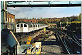
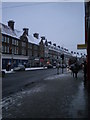
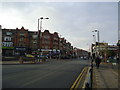
Your daily life in NW11 8LD revolves around unparalleled convenience due to the concentration of retail and transport hubs within walking distance. Residents have immediate access to five retail outlets, including notable locations such as Sainsburys Golders Green and Tesco Golders. This proximity ensures you can manage groceries and essential shopping without leaving the locality. Transport links are extensive, featuring access to five Metro destinations including Golders Green Station and five Rail stations like Cricklewood. Furthermore, five ferry stops such as the London Zoo Waterbus Stop and Camden Lock Waterbus are within practical reach, adding a unique leisure dimension to your lifestyle. You can choose to commute via bus from nearby termini like London Victoria Coach Station or travel directly to shops from your doorstep. Leisure options are equally accessible, with the London Zoo Waterbus Stop providing easy tours of the park. The presence of five rail stations including Finchley Road & Frognal Station ensures you can navigate the city efficiently. Whether you visit Tesco Golders or explore the area around Brent Cross Station, your needs are met quickly. The density of amenities means you spend less time travelling and more time engaging with your community. This variety of transport and retail options creates a self-contained lifestyle where everything you need is already available.
Amenities
Schools
| Rank | School | Type | Entry gender | Ages |
|---|
Explore more schools in this area
Go to Schools tabDemographics
The community in NW11 8LD is defined by a mature population profile, with a median age of 47 years. Adults aged between 30 and 64 years represent the most common age range within this cluster, suggesting a neighbourhood dominated by working-age families and established professionals. Housing statistics reveal that only 29% of residents own their homes outright, indicating that the majority of the population rents their accommodation. The predominant accommodation type consists of flats, which aligns with the high-density nature of this 6,073 square metre area. This prevalence of rental flats suggests a market characterised by short-term tenancies or shared living arrangements rather than single-family ownership. The predominant ethnic group in the area is White, though the high density and rental nature likely introduce a diverse mix of occupants within individual buildings. Given the high population density of 273,357 people per square kilometre, you will experience close community interaction despite the urban setting. The demographic profile points to a stable population of middle-aged adults who balance professional lives with domestic responsibilities. The low rate of home ownership at 29% signals that investing in freehold properties here is less common than in suburban locales. Instead, the housing stock reflects a pragmatic approach to living in a high-demand zone where flats provide the necessary efficiency for a large number of residents.
Household Size
Accommodation Type
Tenure
Ethnic Group
Religion
Household Composition
Age
Household Deprivation
NS-SEC
Explore more demographic insights in this area
Go to Demographics tabPlanning
Planning Constraints
- Flood RiskPremium
- Ramsar Wetland SitesPremium
- Area of Outstanding Natural BeautyPremium
- Protected Nature ReservePremium
- Protected WoodlandPremium