Area Overview for NW11 7NA
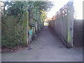
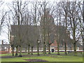
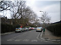
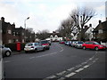
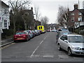
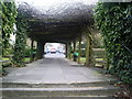
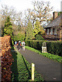
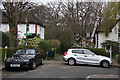
Photos of NW11 7NA


Area Information
Living in NW11 7NA means residing in a very small, residential cluster covering just 8779 square metres. This tight concentration houses 1347 people, creating a neighbourhood with a population density of 153426 people per square kilometre. You will find yourself in a setting defined by specific postcodes rather than expansive streets or grand estates. The area is entirely English and operates as a focused pocket of domestic life where every resident is likely to cross paths with many others daily. Daily routines here revolve around this compact footprint, meaning you can walk to most services or utilise immediate transport links without covering significant ground. The character of NW11 7NA is straightforward and efficient, lacking the sprawl of larger districts. Instead, it offers a concentrated environment where community interaction is high by necessity of space. Prospective buyers should understand they are entering a micro-community where the pace of life is dictated by proximity rather than distance. This small scale ensures that noise travels fast and local events impact the entire zone immediately. It is a place for those who prefer a contained lifestyle within recognised postcode boundaries.
- Area Type
- Postcode
- Area Size
- 8779 m²
- Population
- 1347
- Population Density
- 3873 people/km²
The property market in NW11 7NA is characterised by a strong inclination towards ownership rather than renting. Approximately 61% of homes here are owner-occupied, meaning the local housing stock is dominated by families and individuals who have purchased their residences. This statistic defines the area as a desirable spot for first-time buyers or those looking to settle down, although the specific size of the postcode suggests limited volume compared to broader districts. The predominant accommodation type consists of Houses, which aligns with the preference for traditional and often larger living spaces found in such established areas. If you are searching for homes in NW11 7NA, you are competing against a market where many sellers are current owners rather than landlords. This dynamic often creates more stable property values and reduces the turnover rate compared to rental-heavy zones. The low density of the 8779 square metre area implies that every available house is likely unique or specific to its location. Buyers interested in this area should expect a market focused on permanence. The high ownership rate signals that the community is built on a foundation of invested residents who view their homes as long-term assets. When viewing properties, remember that the majority of the stock reflects this owner-occupied mindset.
House Prices in NW11 7NA
Showing 5 properties
| Address | Type | Beds | Baths | Last Sale Price | Last Sale Date | |
|---|---|---|---|---|---|---|
| 2 St Edwards Close, Golders Green, London, NW11 7NA | Detached | 5 | 3 | - | - | |
| 1 St Edwards Close, Golders Green, London, NW11 7NA | Detached | 2 | 1 | - | - | |
| 4 St Edwards Close, Golders Green, London, NW11 7NA | Detached | - | - | - | - | |
| 3 St Edwards Close, Golders Green, London, NW11 7NA | Detached | - | - | - | - | |
| 1A St Edwards Close, Golders Green, London, NW11 7NA | Terraced | - | - | - | - |
Energy Efficiency in NW11 7NA
Your everyday lifestyle in NW11 7NA benefits from immediate access to major retail hubs and transport nodes within practical reach. You can shop at Tesco Golders or either of the two Sainsburys locations listed on the edges of Golders Green and Golders Green Central. These supermarkets provide all your grocery needs without requiring a long journey. Transport connectivity is exceptional, with five metro stations nearby including Golders Green, Brent Cross, and Hendon Central. Buses and rail services from Hendon Central and Brent Cross West add further flexibility to your commute. If you wish to see London different, the waterbus network offers immediate access to stops like London Zoo Waterbus, Camden Lock, and Little Venice. This unique transport option allows you to explore North London waterways directly from nearby hubs. You also have access to London Victoria Coach Station and Green Line services for long-distance travel. This blend of local shops and extensive transport links means you can live locally while accessing global opportunities. The density of these amenities makes daily life convenient and varied.
Amenities
Schools
| Rank | School | Type | Entry gender | Ages |
|---|
Explore more schools in this area
Go to Schools tabDemographics
The community in NW11 7NA reflects a mature population, with a median age of 47 years. Most residents are adults between 30 and 64 years old, forming the backbone of the local economy and household dynamics. This age profile suggests a neighbourhood dominated by those seeking stability over the energy typically associated with younger families. House ownership stands at 61%, indicating that the majority of occupants are buying into this postcode rather than renting. This high level of ownership often correlates with long-term residents who have established roots in the area. The predominant ethnic group is White, which shapes the cultural atmosphere and local interactions within the cluster. Accommodation types are primarily Houses, fitting the expectation of a established residential zone rather than a dense housing estate. When considering quality of life, the data points to a stable, settled community where long-term tenancies and owned homes prevail. There is no indication of high deprivation within the provided figures, suggesting residents enjoy a standard of living consistent with a majority-owner neighbourhood. The demographic makeup confirms this is a mature district where generations have intertwined through shared ownership and neighbourhood history.
Household Size
Accommodation Type
Tenure
Ethnic Group
Religion
Household Composition
Age
Household Deprivation
NS-SEC
Explore more demographic insights in this area
Go to Demographics tabPlanning
Planning Constraints
- Flood RiskPremium
- Ramsar Wetland SitesPremium
- Area of Outstanding Natural BeautyPremium
- Protected Nature ReservePremium
- Protected WoodlandPremium