Area Overview for NW11 7JS
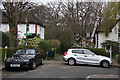
Photos of NW11 7JS


Area Information
Living in NW11 7JS offers a residential experience defined by its compact and highly structured nature. Located in England, this small postcode cluster covers just 2,661 square metres of land. Thirty-four individuals per hectare of total area would occupy a tiny fraction of the 1,347 residents currently calling this location home. The population density stands at 506,274 people per square kilometre, a figure that underscores the intense concentration of households within these specific boundaries. This high density reflects a small residential cluster rather than a sprawling settlement. You are entering a distinct neighbourhood where space is at a premium and local exposure to neighbours is unavoidable. The area serves as a specific geographic point within a larger postcode district, likely nestled between larger thoroughfares or commercial zones. Your daily life here involves navigating tight streets and utilising shared communal resources efficiently. Understanding the scale of this postcode is vital when considering homes in NW11 7JS, as the physical footprint is minimal compared to the number of people living here. This density suggests a community where local decisions and infrastructure pressures are felt acutely by every resident.
- Area Type
- Postcode
- Area Size
- 2661 m²
- Population
- 1347
- Population Density
- 3873 people/km²
Homes in NW11 7JS exist within a market defined by private ownership and traditional housing styles. The accommodation type is exclusively houses, confirming that flats or other modern housing developments do not dominate this specific cluster. With 61 per cent of residents being homeowners, the area functions largely as an established owner-occupied zone rather than a dynamic rental hub. Prospective buyers should view this area as a place where properties change hands less frequently, resulting in a stable but potentially less liquid market. The small size of the postcode, covering only 2,661 square metres, means the available stock is extremely limited, likely comprising a handful of individual properties. You cannot wander far from your property before reaching the same residential cluster or neighbouring zones. This concentration implies that valuation comparisons will be tightly linked to immediate neighbours. The lack of flats suggests limited options for young professionals or multi-generational setups requiring shared spaces. When evaluating homes in NW11 7JS, you are buying into a traditional landlord model where maintenance and long-term investment are the primary concerns for the majority of owners.
House Prices in NW11 7JS
Showing 3 properties
| Address | Type | Beds | Baths | Last Sale Price | Last Sale Date | |
|---|---|---|---|---|---|---|
| 12 Meadway, Golders Green, London, NW11 7JS | Detached | 4 | 2 | £1,999,995 | Nov 2013 | |
| 14 Meadway, Golders Green, London, NW11 7JS | Detached | - | - | £1,200,000 | Jun 2003 | |
| 16 Meadway, Golders Green, London, NW11 7JS | Detached | - | - | - | - |
Energy Efficiency in NW11 7JS
Daily life in NW11 7JS benefits from exceptional access to amenities, despite the small size of the residential cluster itself. You have five metro stations within easy reach, including Golders Green Station and East Finchley, which serve as gateways to the wider city. Retail options are plentiful, with local shoppers accessing M&S Temple Fortune SF and two distinct Sainsburys locations at Golders Green and Golders. These supermarkets provide fresh groceries and household essentials without a lengthy journey required. Five railway stations, such as Brent Cross West Station and Hampstead Heath Station, are also on your radar for daily commuting or short trips. For leisure travel, five ferry stops are accessible, including Camden Lock Waterbus and London Zoo Waterbus Stop, adding variety to your transport choices if you prefer water buses over trains. You can reach London Victoria Coach Station via three bus routes, giving you flexible arrival and departure points for long-distance travel. This density of services means most daily errands can be completed locally while the best options await a short tube ride. Living here ensures you remain connected to the broader metropolis while enjoying the convenience of having major supermarkets and transport links just steps away from your door.
Amenities
Schools
| Rank | School | Type | Entry gender | Ages |
|---|
Explore more schools in this area
Go to Schools tabDemographics
The community profile of NW11 7JS is characterised by a mature population living in conventional housing. The median age for residents in this postcode is 47 years, indicating that the area caters primarily to middle-aged adults. Most households fall within the 30 to 64 years age range, creating a stable demographic base for family life or empty-nester activities. Secure tenure is common, with home ownership levels reaching 61 per cent of the population. This majority ownership figure contrasts with higher rental markets, suggesting residents have a long-term stake in the property they inhabit. Houses form the predominant accommodation type, aligning with the preferences of this age group for detached or semi-detached living arrangements rather than high-rise flats. The area remains predominantly White in terms of ethnicity, reflecting a specific cultural composition common to certain parts of London. For those seeking homes in NW11 7JS, the demographic data predicts a quiet, settled environment where neighbours likely know one another well. The age profile suggests schools near NW11 7JS will mainly serve teenagers rather than very young infants.
Household Size
Accommodation Type
Tenure
Ethnic Group
Religion
Household Composition
Age
Household Deprivation
NS-SEC
Explore more demographic insights in this area
Go to Demographics tabPlanning
Planning Constraints
- Flood RiskPremium
- Ramsar Wetland SitesPremium
- Area of Outstanding Natural BeautyPremium
- Protected Nature ReservePremium
- Protected WoodlandPremium