Area Overview for NW11 7DL
Photos of NW11 7DL

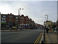
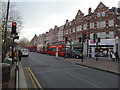
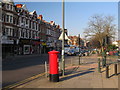
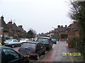
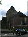
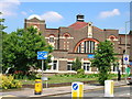
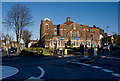
100 photos from this area
Area Information
Key information about the NW11 7DL including its size, population, and administrative classification.
- Area Type
- Postcode
- Area Size
- 2.0 hectares
- Population
- 1627
- Population Density
- 4911 people/km²
House Prices in NW11 7DL
25
Properties
£1,320,795
Average Sold Price
£25,000
Lowest Price
£2,750,000
Highest Price
Showing 25 properties
| Address | Type | Beds | Baths | Last Sale Price | Last Sale Date | |
|---|---|---|---|---|---|---|
| 107 Corringham Road, Golders Green, London, NW11 7DL | Terraced | 6 | 3 | £2,750,000 | Jul 2024 | |
| 89 Corringham Road, Golders Green, London, NW11 7DL | Semi-detached | 4 | 1 | £1,325,000 | Nov 2022 | |
| 101 Corringham Road, Golders Green, London, NW11 7DL | Retail | 6 | 1 | £2,030,000 | Dec 2021 | |
| 79 Corringham Road, Golders Green, London, NW11 7DL | house | 5 | 3 | £1,550,000 | Jun 2020 | |
| 69 Corringham Road, Golders Green, London, NW11 7DL | Semi-detached | 6 | 2 | £1,815,000 | Jan 2019 | |
| 109 Corringham Road, Golders Green, London, NW11 7DL | Terraced | 5 | 3 | £2,145,000 | Aug 2018 | |
| 115 Corringham Road, Golders Green, London, NW11 7DL | Cottage | 5 | 3 | £1,894,000 | Sep 2017 | |
| 91 Corringham Road, Golders Green, London, NW11 7DL | Detached | 5 | 2 | £1,735,000 | Aug 2017 | |
| 105 Corringham Road, Golders Green, London, NW11 7DL | Semi-detached | 5 | 2 | £2,225,000 | Nov 2015 | |
| 83 Corringham Road, Golders Green, London, NW11 7DL | house | 4 | - | £1,130,000 | Nov 2013 |
Page 1 of 3
Energy Efficiency in NW11 7DL
Amenities
Schools
| Rank | School | Type | Entry gender | Ages |
|---|
Explore more schools in this area
Go to Schools tabDemographics
Household Size
One person
most common
Accommodation Type
Flats
most common
Tenure
48
majority
Ethnic Group
White
most common
Religion
N/A
most common
Household Composition
N/A
most common
Age
47
median
Adults (30-64 years)
most common
Household Deprivation
N/A
with no deprivation
NS-SEC
56
in Lower managerial occupations
Explore more demographic insights in this area
Go to Demographics tabPlanning
Planning Constraints
- Flood RiskPremium
- Ramsar Wetland SitesPremium
- Area of Outstanding Natural BeautyPremium
- Protected Nature ReservePremium
- Protected WoodlandPremium