Area Overview for NW11 6AG
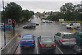
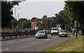
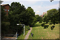
Photos of NW11 6AG

Area Information
Living in NW11 6AG means residing within a compact residential cluster covering 3222 square metres. You will find a tightly knit community of 2128 people concentrated in this specific postcode area. The location serves as a small residential hub with a very high population density of 660,463 people per square kilometre. This figure highlights the intense urban nature of the site, which corresponds to specific flat developments rather than detached houses. Daily life here is defined by proximity to major transport nodes and essential services. The area functions as a distinct postcode zone where space is at a premium but convenience is high. Residents benefit from immediate access to multiple railway and metro stations located just outside their immediate boundaries. The character of the neighbourhood is shaped by its density and its position within the wider London network. You are looking at a defined slice of urban living rather than a broad suburban district. The environment is strictly residential yet surrounded by the vibrant activity of nearby boroughs. This specific address represents a slice of London life where large numbers of people occupy a relatively small geographic footprint. It is an area where community boundaries are clear and defined by postcodes rather than sprawling geography. Expect a fast-paced environment where access to amenities outweighs the availability of private open space.
- Area Type
- Postcode
- Area Size
- 3222 m²
- Population
- 2128
- Population Density
- 7761 people/km²
The property market in NW11 6AG is distinctively shaped by a scarcity of owner-occupied homes. Only 34% of residents own their properties, meaning the vast majority of the housing stock consists of rental units. This high rental proportion points to a market driven by investment landlords or corporate tenancies rather than traditional owner-occupiers. The predominant accommodation type is flats, which limits the scope for buyers seeking detached or semi-detached houses. You are looking at a market where freehold properties are rare and leaseholders face standard regulatory frameworks. The small area size of 3222 square metres further constrains the variety of property types available. Potential buyers should anticipate a competitive environment where flats command the majority of market activity. This concentration of flats often results in higher property prices per square metre due to the scarcity of alternative housing forms. Investors may find opportunities in this dense cluster, but families looking for single-family homes will find little suitable stock locally. The market reflects a typical urban postcode where land value drives the prominence of multi-unit buildings. Your search for properties here must focus entirely on flats or small-scale residential complexes.
House Prices in NW11 6AG
Showing 18 properties
Energy Efficiency in NW11 6AG
Residents of NW11 6AG enjoy extensive access to retail and transport amenities within practical reach. Grocery shopping is convenient with Waitrose, M&S Temple Fortune SF, and Morrisons Daily Finchley all located nearby. These five major retail venues provide a wide selection of food and daily essentials without requiring long journeys. Transport links are equally robust, with five metro stations including Finchley Central Station, Brent Cross Station, and Golders Green Station available. You can also access five rail stations such as Brent Cross West, Hendon, and Cricklewood for regional travel. A unique feature of the local lifestyle includes water bus services, with three ferry stops including London Zoo Waterbus Stop and Camden Lock Waterbus offering scenic river crossings. This combination of high-street shopping and diverse transport modes creates a highly serviced environment. You do not need to travel far for essential goods or public transport connections. The presence of multiple station names indicates excellent connectivity to the wider London network. Shopping combined with easy rail and underground access defines the daily convenience available to those living in this postcode.
Amenities
Schools
Families considering NW11 6AG will have access to several educational institutions within the neighbourhood. Garden Suburb Infant School and Garden Suburb Junior School both hold an Ofsted rating of good. These two schools share a similar name and collective rating, offering a consistent standard of primary education for young learners. Independent education options are also available nearby, including Lubavitch Senior Boys School and Lubavitch Yeshiva Ketanah of London. The Yeshiva holds a satisfactory Ofsted rating, while the Senior Boys School operates without a current rating listed in the data. This mix of state and independent provision gives parents flexibility in choosing educational paths. You can find both mainstream state education and faith-based private schooling within easy reach of the postcode. The presence of these institutions supports the adult population profile, as parents in the 30 to 64 age range would benefit from local schooling choices. Schools near NW11 6AG cater to a specific demographic need for primary and secondary education close to home. This selection ensures that residents do not need to travel far to secure quality learning environments for their children.
| Rank | School | Type | Entry gender | Ages |
|---|
Explore more schools in this area
Go to Schools tabDemographics
The community in NW11 6AG is predominantly made up of adults aged between 30 and 64 years. This age range represents the most common group living in the area, suggesting a population focused on established careers and family life. The median age stands at 47 years, confirming that the demographic leans heavily towards middle and older adulthood. Home ownership figures show that only 34% of residents own their homes outright. This indicates that the majority of the population lives in rented accommodation or shared ownership schemes. The primary accommodation type found in this postcode is flats, which aligns with the high-density nature of the site. You will find a significant proportion of the local population identifies as White, which remains the predominant ethnic group in the area. There is no data available regarding specific deprivation measures, so quality of life assessments must rely on the housing type and transport access rather than income metrics. The mix of renters and owners creates a dynamic environment where landlords and long-term tenants coexist. Understanding that most people cannot claim ownership here helps frame your expectations for property investment or rental agreements in this specific zone.
Household Size
Accommodation Type
Tenure
Ethnic Group
Religion
Household Composition
Age
Household Deprivation
NS-SEC
Explore more demographic insights in this area
Go to Demographics tabPlanning
Planning Constraints
- Flood RiskPremium
- Ramsar Wetland SitesPremium
- Area of Outstanding Natural BeautyPremium
- Protected Nature ReservePremium
- Protected WoodlandPremium