Area Overview for NW10 8BB
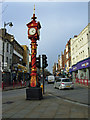
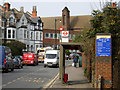
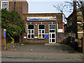
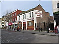
Photos of NW10 8BB


Area Information
NW10 8BB occupies a compact residential cluster covering just 1.8 hectares within England. This small postcode serves a population of 1,827 people, creating a densely packed living environment with 1,817 people per square kilometre. The area functions as a concentrated neighbourhood where residents rely on proximity to major transport hubs for their daily routines. Because the land area is limited, building density is high, meaning every household is likely within walking distance of core amenities found in the surrounding Harlesden and Willesden districts. The sheer scale of the postcode area means that long commutes to central London are unnecessary for many. Instead, daily life revolves around the immediate interactions with neighbours and the efficient use of public transport connections. You will find that this specific cluster offers a distinct disconnect on maps, yet it is thoroughly integrated into the wider fabric of northwest London. The population figures confirm that you are stepping into a mature community settled within these tight geographical boundaries.
- Area Type
- Postcode
- Area Size
- 1.8 hectares
- Population
- 1827
- Population Density
- 1817 people/km²
Homes in NW10 8BB cater largely to a renting population rather than owner-occupiers. With home ownership standing at just 28%, the market is predominantly characterised by tenants seeking flats within this small residential cluster. The accommodation type data confirms that flats are the standard offering, meaning you will not find traditional brick semis or detached villas as the main stock. This high density across 1.8 hectares dictates a property style suited for limited land, favouring multi-storey blocks over sprawling suburban developments. If you are looking to buy, competition for freehold flats here will be fierce given the low ownership rate. Alternatively, renting offers an easier entry point into this specific postcode. The market reflects a pragmatic approach to living where space is at a premium. Buyers should focus their search on the immediate surroundings, as the housing stock within this specific boundary is naturally constrained by the small geographical footprint of the area.
House Prices in NW10 8BB
Showing 19 properties
| Address | Type | Beds | Baths | Last Sale Price | Last Sale Date | |
|---|---|---|---|---|---|---|
| 16 Harley Road, London, NW10 8BB | Flat | 4 | 2 | £580,000 | Apr 2014 | |
| 2 Harley Road, London, NW10 8BB | house | - | - | £340,000 | Oct 2007 | |
| 32 Harley Road, London, NW10 8BB | Terraced | 3 | 1 | - | - | |
| 36 Harley Road, London, NW10 8BB | Terraced | 3 | - | - | - | |
| 34A Harley Road, London, NW10 8BB | Flat | - | - | - | - | |
| 26 Harley Road, London, NW10 8BB | Semi-detached | - | - | - | - | |
| 34B Harley Road, London, NW10 8BB | Flat | - | - | - | - | |
| 30 Harley Road, London, NW10 8BB | house | - | - | - | - | |
| 20 Harley Road, London, NW10 8BB | Semi-detached | - | - | - | - | |
| 18 Harley Road, London, NW10 8BB | Semi-detached | - | - | - | - |
Energy Efficiency in NW10 8BB
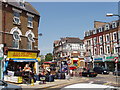
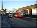
Living in NW10 8BB places you centrally among essential services and leisure facilities. Retrans details five key retail outlets, including Iceland Harlesden, Tesco Harlesden, and a second Tesco Harlesden, ensuring daily shopping needs are met without leaving the local vicinity. Public transport links are abundant, with five rail stations and five metro hubs nearby to facilitate daily commutes. The area connects easily to London Victoria Coach Station and the Green Line Coach Station for national travel. For leisure, residents have access to three bus routes and specific waterbus stops like the Little Venice Waterbus Stop and London Zoo Waterbus Stop. You can reach Kew Pier for park views and day trips with equal ease. The concentration of amenities around this 1.8-hectare site means you do not need a car for most tasks. Shops and transport hubs are all within a short walk. Your daily routine benefits from this diversity, allowing you to shop, travel, and relax using well-established local infrastructure.
Amenities
Schools
| Rank | School | Type | Entry gender | Ages |
|---|
Explore more schools in this area
Go to Schools tabDemographics
The community profile within NW10 8BB reflects a mature demographic with a median age of 47 years. Most commonly, adults between 30 and 64 years old make up the resident base. This age distribution suggests a neighbourhood populated by established families and older professionals rather than a youth-dominated zone. Household tenure reveals a significant rental market, as only 28% of residents own their homes. Consequently, the majority of the population rents, which typically indicates a mix of private and social housing stock. The predominant ethnic group is White, aligning with the broader statistical trends of the surrounding borough. Accommodation type data indicates that flats are the primary style of housing in this postcode. You should anticipate a vertical living experience rather than detached houses. The demographic data paints a picture of a stable, diverse neighbourhood where long-term residents coexist with tenants seeking flexibility in a high-density location.
Household Size
Accommodation Type
Tenure
Ethnic Group
Religion
Household Composition
Age
Household Deprivation
NS-SEC
Explore more demographic insights in this area
Go to Demographics tabPlanning
Planning Constraints
- Flood RiskPremium
- Ramsar Wetland SitesPremium
- Area of Outstanding Natural BeautyPremium
- Protected Nature ReservePremium
- Protected WoodlandPremium