Area Overview for NW10 7JA
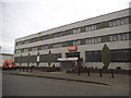
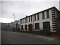
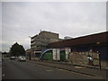
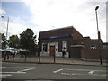
Photos of NW10 7JA


Area Information
Living in NW10 7JA means residing in a compact residential cluster defined by postcode specifications in England. This small area covers only 2341 m², creating a dense environment where the population density reaches 1999 people per square kilometre. With 2269 residents within these boundaries, daily life is characterised by proximity and a shared sense of local identity. The physical footprint is limited compared to larger neighbourhoods, meaning you will encounter many neighbours within a short walking distance. This postcodes serves as a specific address for a tight-knit community where services and amenities are within practical reach. You are not looking at sprawling suburbs here; instead, you are evaluating a concentrated living space where every square metre counts. The area functions as a distinct residential unit rather than a vast district, which influences how you experience the local environment. When considering a home in NW10 7JA, you are choosing an entry point into a defined pocket of London with clear geographical boundaries.
- Area Type
- Postcode
- Area Size
- 2341 m²
- Population
- 2269
- Population Density
- 1999 people/km²
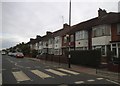
Homes in NW10 7JA present a specific opportunity for buyers to secure a property within a highly concentrated zone. The housing stock is overwhelmingly composed of Houses, meaning you will not find rows of terraced flats or modern high-rise blocks dominating the skyline. Instead, the area delivers a suburban feel within a very small geographical footprint of 2341 m². Currently, 49% of residents are owner-occupied, suggesting a robust market where many families have established long-term roots. This high ownership rate indicates that the neighbourhood has drawn steadier buyers rather than short-term tenants. When searching for properties, your options will focus on detached or semi-detached homes rather than apartments. The small land area implies that grounds and boundaries are at a premium, and likely no other homes will be found within immediate walking distance unless you expand your search radius. Sellers in this postcode have the patience of established residents who value their homes. You are entering a market where inventory is scarce due to the tiny catchment area, requiring a strategic approach to your purchase.
House Prices in NW10 7JA
No properties found in this postcode.
Energy Efficiency in NW10 7JA
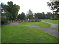
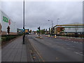
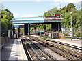
Residents of NW10 7JA enjoy immediate access to a wide variety of essential services and leisure facilities. For shopping needs, notable venues include Asda Park, M&S Western Avenue BP, and Sainsburys North, all within practical reach for weekly runs. Public transport links are extensive, with five nearby metro stations including North Acton Station, Park Royal, and West Acton. You can also access three main rail hubs such as Acton Main Line Station, Harlesden Station, and Willesden Junction Station. For those who prefer water-based travel, options exist via Kew Pier, Little Venice Waterbus Stop, and London Zoo Waterbus Stop. Additionally, three major coach stations serve Victoria Coach Station Arrivals, Victoria Coach Station, and Green Line Coach Station. This密度 of transport nodes ensures you can leave quickly for further afield or travel across London. The concentration of retailers and transit points means you do not need to drive often to reach daily necessities.
Amenities
Schools
| Rank | School | Type | Entry gender | Ages |
|---|
Explore more schools in this area
Go to Schools tabDemographics
The community in NW10 7JA is dominated by adults, with the most common age range falling between 30 and 64 years. The median age stands at 47, indicating a mature population rather than a youthful demographic. Nearly half of the residents, representing 49% of the households, are either mortgage holders or outright owners. These figures suggest a mixed market where established families and longer-term residents maintain a significant presence. Suburban housing forms the backbone of the area, with Houses being the predominant accommodation type. White residents constitute the majority of the population, reflecting the established character of this postcode. The high density of 1999 people per km² means that interactions with neighbours happen frequently, fostering a close social fabric. You are likely to engage with a community where generations of adults have settled over time. This demographic profile offers stability, though it also means the area may appeal more to families seeking space than to young singles. The household composition reflects a middle-aged population managing careers and local responsibilities within this small footprint.
Household Size
Accommodation Type
Tenure
Ethnic Group
Religion
Household Composition
Age
Household Deprivation
NS-SEC
Explore more demographic insights in this area
Go to Demographics tabPlanning
Planning Constraints
- Flood RiskPremium
- Ramsar Wetland SitesPremium
- Area of Outstanding Natural BeautyPremium
- Protected Nature ReservePremium
- Protected WoodlandPremium