Area Overview for NW10 6LP
Photos of NW10 6LP


Area Information
NW10 6LP is a compact residential cluster situated in north-west London, covering a total area of 6513 square metres. You can consider this postcode a defined pocket within the wider Acton and Harlesden districts, rather than a sprawling suburb. The location hosts a population of 1481 people, creating an environment where residents are likely to know their neighbours. Living in NW10 6LP means dealing with high population density, calculated at 227,405 people per square kilometre. This figure indicates a tightly packed neighbourhood where space is at a premium. You should expect a neighbourhood defined by proximity rather than expansive gardens or wide boulevards. The area functions as a specific dwelling location for those seeking a station to a larger London network. Daily life here revolves around accessing the amenities and transport links that surround this small footprint. The postcode represents a concentrated block of housing where the primary characteristic is its density and precise geographical definition.
- Area Type
- Postcode
- Area Size
- 6513 m²
- Population
- 1481
- Population Density
- 3567 people/km²
The housing stock in NW10 6LP is overwhelmingly composed of flats. This architectural type dominates the 6513 square metres of land available in the postcode. With home ownership standing at 32%, the market largely consists of renters. You should approach the purchase or rental of property here with the understanding that multi-storey blocks and apartment complexes form the norm. This density is typical for inner and outer London suburbs where land value dictates building height rather than spread. The low proportion of owner-occupied homes indicates that many residents access this accommodation through the private or social rented sectors. If you are looking to buy a home, flats command the premium for their limited size and location convenience. The area does not feature detached houses or semi-detached terraced homes as primary stock types. Consequently, expectations for garden space or large internal layouts must adapt to the reality of flat living.
House Prices in NW10 6LP
Showing 36 properties
| Address | Type | Beds | Baths | Last Sale Price | Last Sale Date | |
|---|---|---|---|---|---|---|
| 133 Shaftesbury Gardens, Park Royal, NW10 6LP | Flat | 2 | 1 | £370,000 | May 2025 | |
| 125 Shaftesbury Gardens, Park Royal, NW10 6LP | Flat | - | - | £202,000 | Jul 2024 | |
| 103 Shaftesbury Gardens, Park Royal, NW10 6LP | Flat | 2 | 1 | £350,000 | Dec 2022 | |
| 102 Shaftesbury Gardens, Park Royal, NW10 6LP | Flat | - | - | £370,000 | Feb 2022 | |
| 111 Shaftesbury Gardens, Park Royal, NW10 6LP | Flat | 2 | - | £343,000 | Jun 2021 | |
| 129 Shaftesbury Gardens, Park Royal, NW10 6LP | Flat | 2 | 1 | £375,000 | Oct 2018 | |
| 99 Shaftesbury Gardens, Park Royal, NW10 6LP | Flat | 2 | 1 | £375,000 | Jul 2018 | |
| 123 Shaftesbury Gardens, Park Royal, NW10 6LP | Flat | - | - | £330,000 | May 2017 | |
| 118 Shaftesbury Gardens, Park Royal, NW10 6LP | Flat | - | - | £380,000 | Nov 2016 | |
| 109 Shaftesbury Gardens, Park Royal, NW10 6LP | Flat | - | - | £310,000 | Jul 2015 |
Energy Efficiency in NW10 6LP
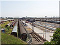
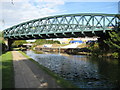
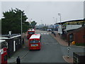
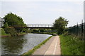
Daily life in NW10 6LP is supported by a wide array of practical amenities within close reach, despite the small size of the postcode itself. You are situated near five notable rail stations, including Willesden Junction Station and Harlesden Station. Access to five metro stations such as North Acton Station provides frequent tube access into central London. Retail options include Sainsburys North, Tesco Acton, and Iceland Harlesden, ensuring your daily shopping needs are met locally. For leisure and water-based recreation, Little Venice Waterbus Stop serves the area alongside Kew Pier and London Zoo Waterbus Stop. This ferry access connects you to unique London landmarks. You also have access to bus services that link to London Victoria Coach Station. Living in NW10 6LP offers a blend of urban convenience and specific leisure destinations like London Zoo within a practical commute. The variety of transport modes ensures you have options for every journey.
Amenities
Schools
Families living in NW10 6LP rely on John Perryn Primary School for early education. This institution serves the community as a primary provider and holds an Ofsted rating of good. The presence of a single noted school in the immediate vicinity highlights the specific educational infrastructure supporting this small 1481-person population. You must verify catchment areas and specific intakes with the school directly, as data for secondary education nearby is not provided in this summary. The good rating from Ofsted indicates a standard of education that meets regulatory expectations. Living in NW10 6LP means having a local primary option with a positive statutory assessment. The concentration of one school to such a large population density of 227405 people per square kilometre suggests that many families likely travel to institutions outside the immediate border for secondary education or other primary choices. The mix of school types is here limited to a single primary provider with a good standing.
| Rank | School | Type | Entry gender | Ages |
|---|
Explore more schools in this area
Go to Schools tabDemographics
The community within NW10 6LP is mature, centred on adults aged between 30 and 64 years. You will find the median age of the population is 47, reflecting a settled demographic with established lifestyles. Home ownership stands at 32%, meaning the majority of households are likely to be renting. This statistic suggests a rental market where tenants may move with different regularity than in owner-occupier dominated zones. The predominant accommodation type in this postcode is flats. This aligns with the high density of 227,405 people per square kilometre and the limited land area of 6513 square metres. White residents form the predominant ethnic group in the area. The age profile reinforces that this is often an area sought by older professionals or families who have children at home. Understanding that three out of ten residents own their home helps you gauge the stability of the local market. You should anticipate a community where long-term renting is as common as owning a freehold or leasehold property.
Household Size
Accommodation Type
Tenure
Ethnic Group
Religion
Household Composition
Age
Household Deprivation
NS-SEC
Explore more demographic insights in this area
Go to Demographics tabPlanning
Planning Constraints
- Flood RiskPremium
- Ramsar Wetland SitesPremium
- Area of Outstanding Natural BeautyPremium
- Protected Nature ReservePremium
- Protected WoodlandPremium