Area Overview for NW10 5YL
Photos of NW10 5YL

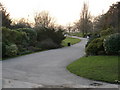

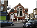
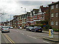
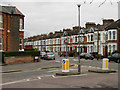
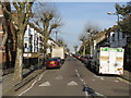
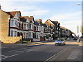
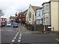
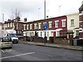
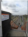
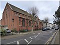
90 photos from this area
Area Information
Key information about the NW10 5YL including its size, population, and administrative classification.
- Area Type
- Postcode
- Area Size
- 7779 m²
- Population
- 2053
- Population Density
- 10920 people/km²
House Prices in NW10 5YL
31
Properties
£331,714
Average Sold Price
£120,000
Lowest Price
£705,000
Highest Price
Showing 31 properties
| Address | Type | Beds | Baths | Last Sale Price | Last Sale Date | |
|---|---|---|---|---|---|---|
| 30 Wrottesley Road, London, NW10 5YL | house | 4 | - | £705,000 | Jul 2013 | |
| 18 Wrottesley Road, London, NW10 5YL | Semi-detached | 4 | 2 | £482,000 | Feb 2010 | |
| 6 Wrottesley Road, London, NW10 5YL | Terraced | 4 | 1 | £369,000 | Feb 2004 | |
| 34 Wrottesley Road, London, NW10 5YL | Flat | - | - | £300,000 | Feb 2004 | |
| 14 Wrottesley Road, London, NW10 5YL | Unknown | - | - | £205,000 | Jul 2002 | |
| 8 Wrottesley Road, London, NW10 5YL | house | - | - | £120,000 | Nov 2001 | |
| 24 Wrottesley Road, London, NW10 5YL | Semi-detached | - | - | £141,000 | Aug 1997 | |
| 28B Wrottesley Road, London, NW10 5YL | Flat | 1 | 1 | - | - | |
| 28A Wrottesley Road, London, NW10 5YL | Flat | 2 | - | - | - | |
| 38 Wrottesley Road, London, NW10 5YL | Semi-detached | 4 | - | - | - |
Page 1 of 4
Energy Efficiency in NW10 5YL
Amenities
Schools
| Rank | School | Type | Entry gender | Ages |
|---|
Explore more schools in this area
Go to Schools tabDemographics
Household Size
Family (3-5 people)
most common
Accommodation Type
Flats
most common
Tenure
39
majority
Ethnic Group
White
most common
Religion
N/A
most common
Household Composition
N/A
most common
Age
47
median
Adults (30-64 years)
most common
Household Deprivation
N/A
with no deprivation
NS-SEC
32
in Lower managerial occupations
Explore more demographic insights in this area
Go to Demographics tabPlanning
Planning Constraints
- Flood RiskPremium
- Ramsar Wetland SitesPremium
- Area of Outstanding Natural BeautyPremium
- Protected Nature ReservePremium
- Protected WoodlandPremium