Area Overview for NW10 5XJ
Photos of NW10 5XJ
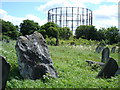
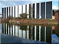
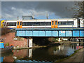
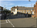

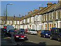
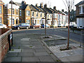
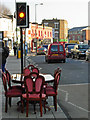
100 photos from this area
Area Information
Key information about the NW10 5XJ including its size, population, and administrative classification.
- Area Type
- Postcode
- Area Size
- 3657 m²
- Population
- 1799
- Population Density
- 16719 people/km²
House Prices in NW10 5XJ
34
Properties
£514,195
Average Sold Price
£58,000
Lowest Price
£1,100,000
Highest Price
Showing 34 properties
| Address | Type | Beds | Baths | Last Sale Price | Last Sale Date | |
|---|---|---|---|---|---|---|
| 44 Napier Road, London, NW10 5XJ | Terraced | 4 | 2 | £860,000 | Jan 2025 | |
| 2 Napier Road, London, NW10 5XJ | Terraced | 3 | 2 | £675,000 | Jun 2021 | |
| 24 Napier Road, London, NW10 5XJ | Terraced | 3 | - | £1,100,000 | Mar 2021 | |
| 10 Napier Road, London, NW10 5XJ | Terraced | 3 | 1 | £610,000 | May 2019 | |
| 46 Napier Road, London, NW10 5XJ | Terraced | 4 | 3 | £907,000 | Oct 2018 | |
| 50 Napier Road, London, NW10 5XJ | Terraced | 3 | 3 | £449,950 | Jun 2013 | |
| 12 Napier Road, London, NW10 5XJ | Terraced | - | - | £249,000 | Jun 2002 | |
| 20 Napier Road, London, NW10 5XJ | Terraced | 3 | 2 | £155,000 | Jan 2000 | |
| 18 Napier Road, London, NW10 5XJ | Terraced | - | - | £78,000 | Jun 1996 | |
| 28 Napier Road, London, NW10 5XJ | Terraced | 4 | 2 | £58,000 | Jun 1996 |
Page 1 of 4
Energy Efficiency in NW10 5XJ
Amenities
Schools
| Rank | School | Type | Entry gender | Ages |
|---|
Explore more schools in this area
Go to Schools tabDemographics
Household Size
One person
most common
Accommodation Type
Flats
most common
Tenure
31
majority
Ethnic Group
White
most common
Religion
N/A
most common
Household Composition
N/A
most common
Age
47
median
Adults (30-64 years)
most common
Household Deprivation
N/A
with no deprivation
NS-SEC
34
in Lower managerial occupations
Explore more demographic insights in this area
Go to Demographics tabPlanning
Planning Constraints
- Flood RiskPremium
- Ramsar Wetland SitesPremium
- Area of Outstanding Natural BeautyPremium
- Protected Nature ReservePremium
- Protected WoodlandPremium