Area Overview for NW10 5TB
Photos of NW10 5TB
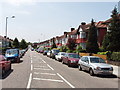
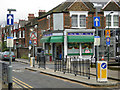
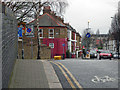
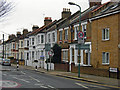
100 photos from this area
Area Information
Key information about the NW10 5TB including its size, population, and administrative classification.
- Area Type
- Postcode
- Area Size
- 9510 m²
- Population
- 1509
- Population Density
- 14693 people/km²
House Prices in NW10 5TB
52
Properties
£517,090
Average Sold Price
£86,000
Lowest Price
£1,275,000
Highest Price
Showing 52 properties
| Address | Type | Beds | Baths | Last Sale Price | Last Sale Date | |
|---|---|---|---|---|---|---|
| 74 Purves Road, London, NW10 5TB | Terraced | 3 | 1 | £845,000 | Mar 2023 | |
| 66 Purves Road, London, NW10 5TB | Terraced | 4 | 2 | £1,275,000 | Sep 2022 | |
| 96 Purves Road, London, NW10 5TB | Terraced | 4 | 3 | £1,050,000 | Jan 2021 | |
| 76 Purves Road, London, NW10 5TB | house | 3 | - | £645,000 | Apr 2019 | |
| 84 Purves Road, London, NW10 5TB | Flat | 2 | 1 | £447,900 | Jan 2016 | |
| 88 Purves Road, London, NW10 5TB | Flat | - | - | £244,000 | May 2007 | |
| 94 Purves Road, London, NW10 5TB | Flat | - | - | £245,000 | Feb 2007 | |
| 104 Purves Road, London, NW10 5TB | Flat | 1 | - | £165,000 | Nov 1999 | |
| 112 Purves Road, London, NW10 5TB | Terraced | 4 | 2 | £168,000 | Jan 1999 | |
| 86 Purves Road, London, NW10 5TB | Flat | - | - | £86,000 | Aug 1998 |
Page 1 of 6
Energy Efficiency in NW10 5TB
Amenities
Schools
| Rank | School | Type | Entry gender | Ages |
|---|
Explore more schools in this area
Go to Schools tabDemographics
Household Size
Family (3-5 people)
most common
Accommodation Type
Houses
most common
Tenure
42
majority
Ethnic Group
White
most common
Religion
N/A
most common
Household Composition
N/A
most common
Age
47
median
Adults (30-64 years)
most common
Household Deprivation
N/A
with no deprivation
NS-SEC
43
in Lower managerial occupations
Explore more demographic insights in this area
Go to Demographics tabPlanning
Planning Constraints
- Flood RiskPremium
- Ramsar Wetland SitesPremium
- Area of Outstanding Natural BeautyPremium
- Protected Nature ReservePremium
- Protected WoodlandPremium