Area Overview for NW10 4UY
Photos of NW10 4UY


Area Information
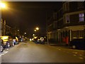
NW10 4UY represents a compact residential cluster defined by its specific postcode boundaries in England. This small area covers just 5.1 hectares, creating a tightly packed environment where 1,638 residents live in close proximity. With a population density reaching 32,395 people per square kilometre, daily life here is characterised by an intense concentration of households. You will find yourself in a setting where every street corner likely intersects with neighbours, removing the sense of isolation often found in larger, spread-out suburbs. The sheer number of people per unit of space suggests a self-contained community where local interactions are frequent by necessity rather than choice. For someone considering moving here, the physical footprint is minimal, meaning you are trading open space for efficiency and urban density. The area caters specifically to those who prefer a micro-community within the wider London landscape. Residents here operate within a confined zone where local shops and transport links are universally accessible, eliminating the need for long commutes to reach basic conveniences. This postcode offers a distinct living experience defined by its small scale and high occupancy rates.
- Area Type
- Postcode
- Area Size
- 5.1 hectares
- Population
- 1638
- Population Density
- 11336 people/km²
The housing market in NW10 4UY is defined by its overwhelming reliance on rental accommodation rather than owner-occupied homes. Only 24% of residents own their property, which means that 76% are tenants. If you are shopping for homes in this postcode, you will primarily encounter flats designed for high-density living. The accommodation type data confirms that flats are the standard offering, eliminating the search for detached or semi-detached properties entirely. This market profile often appeals to professionals, investors, or families who prefer the lower entry cost and flexibility of renting over the long-term commitment of buying. For buyers considering this specific cluster, the opportunity to purchase a freehold property is rare. The concentration of rental units suggests a market influenced by landlord portfolios rather than single-family home owners. When evaluating properties, you should expect to view self-contained apartments rather than character homes with private outdoor spaces. This distinction is crucial for anyone looking for a garden or a安静 perimeter for play. The property market here functions on volume and tenancy trends, reflecting the tight-knit, small-area nature of the 5.1-hectare zone.
House Prices in NW10 4UY
Showing 4 properties
| Address | Type | Beds | Baths | Last Sale Price | Last Sale Date | |
|---|---|---|---|---|---|---|
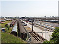
| 1 Station Approach, Harlesden, London, NW10 4UY | Industrial | - | - | - | - | |
| Metro Ticket Office, Station Approach, Harlesden, London, NW10 4UY | commercial | - | - | - | - | |
| Willesden Guards Social Club, Willesden Junction Station, Station Road, London, NW10 4UY | pub | - | - | - | - | |
| Willesden Junction Railway Station, Station Road, London, NW10 4UY | office_workshop | - | - | - | - |
Energy Efficiency in NW10 4UY
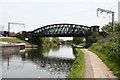
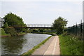
Living in NW10 4UY offers direct access to a wide array of transport and retail amenities within practical reach. You are close to five rail stations, including Willesden Junction Low Level and Harlesden Station, facilitating easy travel across the city. The area benefits from five Metro stations such as North Acton and East Acton, providing deep tube connectivity. Two bus stations, including London Victoria Coach Station and Green Line Coach Station, are nearby for inter-city travel. Retail options are immediate, with Iceland Harlesden and Tesco Harlesden offering everyday groceries and essentials just minutes away. A Co-op in Kensal adds further convenience to the shopping landscape. The presence of five ferry stops in the broader vicinity, including Little Venice and Kew Pier, hints at unique water-based leisure actions accessible to residents. This mix of rail, metro, bus, and ferry access ensures you rarely need a private vehicle for daily errands. The retail density supports a self-sufficient lifestyle where fresh produce and daily necessities are always close. You can walk to a major supermarket or step outside to catch a tube train without needing a road crossing further than a few minutes away.
Amenities
Schools
Families considering NW10 4UY have access to specific educational institutions, with Scott House School being the notable independent school in the immediate vicinity. While this is the only school explicitly listed in the local data, it offers an alternative education option for parents seeking independent schooling arrangements. The presence of just one named institution suggests that other families might travel to schools in neighbouring postcodes or rely on the school catchment areas of surrounding zones. You must verify the Ofsted rating and specific catchment rules for Scott House School directly, as these critical details are not included in the current summary. For those without independent school options, the limited local data implies a reliance on commuter schools or institutions in the wider borough. The school mix is currently sparse in the direct environment of NW10 4UY, so prospective homebuyers should plan their education strategy carefully. Researching public school catchment areas in the surrounding 0.5 mile radius will be essential to ensure you meet your children's educational needs. The limited choice highlights the importance of understanding what lies just outside the immediate postcode boundaries.
| Rank | School | Type | Entry gender | Ages |
|---|
Explore more schools in this area
Go to Schools tabDemographics
The community within NW10 4UY displays a clear demographic profile skewed towards established adults. Half of the population falls into the 30 to 64 years age range, indicating a cohort largely settled in their careers and family lives. The median age stands at 47, reinforcing the presence of a mature demographic rather than a transient student or young professional population. Home ownership stands at just 24%, meaning the vast majority of residents rent their accommodation. This high rental proportion suggests the area serves as a hub for tenants seeking stability within a specific local estate or development cluster. Predominantly White residents make up the majority of the ethnic groups living here, contributing to a relatively homogeneous community feel. The area is almost entirely composed of flats, catering to those who prefer apartment living over detached houses or semi-detached properties. You are unlikely to find traditional family homes with private gardens here. Instead, the housing stock is designed for higher-density living, aligning with the high population density of over 32,000 people per square kilometre. This structure supports a lifestyle where socialising occurs in shared common areas rather than private backyards.
Household Size
Accommodation Type
Tenure
Ethnic Group
Religion
Household Composition
Age
Household Deprivation
NS-SEC
Explore more demographic insights in this area
Go to Demographics tabPlanning
Planning Constraints
- Flood RiskPremium
- Ramsar Wetland SitesPremium
- Area of Outstanding Natural BeautyPremium
- Protected Nature ReservePremium
- Protected WoodlandPremium