Area Overview for NW10 3RW
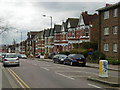
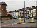
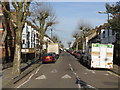
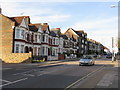
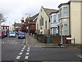
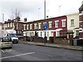
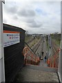
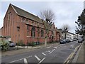
Photos of NW10 3RW
Area Information
Living in NW10 3RW means residing within a specific residential cluster in west London defined by this single postcode. This small area covers just 1497 square metres and houses 2243 residents, creating a compact community environment. The space is dense, with a population density that places the area firmly within the urban fabric of Willesden and Harlesden. You are situated close to significant transport hubs, including Willesden Junction and Kensal Rise stations, which connect you to the wider railway network. The location also offers access to London Overground services at Dollis Hill, Neasden, and Kilburn stations for those preferring the tube or street-level rail. Beyond transportation, the postcode provides practical access to the waterbus network between Little Venice, London Zoo, and Camden Lock. Retail options are within easy reach, with shops like Sainsburys Brent Willesden, Tesco Harlesden, and Iceland Harlesden serving daily needs. You live in an environment where major coach stations, including London Victoria Coach Station, are reachable for long-distance travel. This postcode represents a functional urban node rather than a sprawling suburb. It serves as a direct gateway to central London commerce and leisure while maintaining its own distinct character as a tightly knit residential pocket. Buyers interested in this location seek the convenience of urban proximity without the spread of larger districts.
- Area Type
- Postcode
- Area Size
- 1497 m²
- Population
- 2243
- Population Density
- 3924 people/km²
The property market in NW10 3RW is characterised by a distinct lack of private home ownership, with only 25% of residents owning their homes. This statistic defines the area as a primarily rental sector where the majority of buyers will be looking for properties to rent rather than purchase directly within this postcode. The predominant accommodation type is flats, which dominates the 1497 square metre cluster. You should expect to encounter a high volume of rental listings if you are seeking a home in this specific grid square. This contrasts sharply with areas where ownership exceeds 50%, indicating that wealthier, owner-occupied stock is absent here. The market composition suggests that landlords and estate agents managing multiple units will be the primary stakeholders you encounter. For those looking to buy a freehold or leasehold home, options within NW10 3RW specifically are extremely limited by comparison to the rental yield. However, the location near Willesden Junction and the access to major retailers like Tesco Harlesden makes it attractive to investors or those needing flexible arrangements. The prevalence of flats means you will not find detached or semi-detached houses in this specific postcode. Instead, the architecture reflects mid-rise or high-rise residential blocks common in Transport for London managed estates. If your priority is building equity through property purchase, you may need to look north or south for this percentage of ownership.
House Prices in NW10 3RW
Showing 19 properties
Energy Efficiency in NW10 3RW
Your daily life in NW10 3RW revolves around convenient access to key amenities just minutes away. Retail needs are met by five major locations including Sainsburys Brent Willesden, Tesco Harlesden, and Iceland Harlesden. These supermarkets provide essentials, fresh produce, and household goods without the need for extensive travel. Dining and leisure options include the waterbus network stopping at Little Venice and Camden Lock, which offers dining terraces and entertainment. You can easily reach London Zoo via the Little Venice Waterbus Stop for family outings. Transport interchanges at Willesden Junction and Kensal Rise also host various cafes, bars, and convenience stores catering to station crowds. The presence of London Victoria Coach Station and Green Line Coach Station nearby indicates good bus and coach connections to the rest of the UK. Your immediate neighbourhood includes three bus routes with direct links to London Victoria Coach Station Arrivals. Five rail and five metro stations are listed in practice, providing dense transit coverage. The density of amenities within a small postcode means you rarely face a decision to drive for routine errands. Shopping trips, banking, and leisure activities happen within a short walk or quick tube ride. The area balances residential calm with the energy of nearby commercial hubs. Residents enjoy the convenience of having supermarkets, tech parks, and transport hubs all within the same postal cluster. This proximity to Willesden Junction and the local shopping strips ensures that daily logistics are handled with efficiency.
Amenities
Schools
Families living in NW10 3RW have access to a mix of primary and secondary education providers within practical reach. Donnington Primary School operates as a primary institution with a Good Ofsted rating, offering assured education for younger children. Nearby, Willesden High School functions as a primary school providing early years schooling options. For secondary education, Harris Lowe Academy Willesden stands as a prominent academy also holding a Good Ofsted rating. This combination of schools suggests that residents can access government-sponsored academies with proven track records without commuting far. The proximity of these institutions means that children living in the residential clusters of NW10 3RW can benefit from established educational environments. You have two primary schools and one recognized secondary academy close by, which covers the full spectrum from early learning through to post-compulsory years. The presence of Harris Lowe Academy specifically indicates that state-funded large-scale education is available locally. While the data does not detail exam results or league table positions beyond Ofsted ratings, the Good status for both Donnington Primary School and Harris Lowe Academy provides a baseline of quality assurance. Parents can expect standardised teaching methods and regulatory oversight consistent with the London borough standards. The variety of school types allows families to choose between different pedagogical approaches available in the immediate vicinity.
| Rank | School | Type | Entry gender | Ages |
|---|
Explore more schools in this area
Go to Schools tabDemographics
The community in NW10 3RW reflects a mature demographic profile with a median age of 47 years. The majority of residents fall into the adult category between 30 and 64 years old, indicating an established population rather than a transient or student-heavy zone. Home ownership stands at 25%, meaning three quarters of the housing stock is rented. This high rental ratio suggests the area serves as a significant letting market for professionals or families seeking flexibility. The predominant accommodation type consists of flats, aligning with the density of the 1497 square metre postal area. While the data confirms White as the predominant ethnic group, the statistics highlight a diverse, urban setting typical of West London. The area does not showcase high levels of home purchase, distinguishing it from wealthier, owner-occupied grid squares. This structure influences the local economy and social fabric, with tenants often comprising young professionals, expatriates, and families moving between locations. For those considering moving here, the demographic skew towards adults implies a stable, working-age neighbourhood. The concentration of flats within such a small geographical footprint creates an environment that is busy but contained. You will interact with peers who are likely settled in their careers but dependent on the rental market. The age balance ensures a quiet period during school holidays yet maintains a steady stream of activity from working residents.
Household Size
Accommodation Type
Tenure
Ethnic Group
Religion
Household Composition
Age
Household Deprivation
NS-SEC
Explore more demographic insights in this area
Go to Demographics tabPlanning
Planning Constraints
- Flood RiskPremium
- Ramsar Wetland SitesPremium
- Area of Outstanding Natural BeautyPremium
- Protected Nature ReservePremium
- Protected WoodlandPremium