Area Overview for NW10 3PT
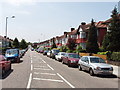
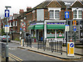
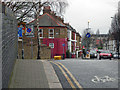
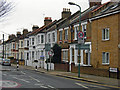
Photos of NW10 3PT
Area Information
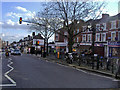
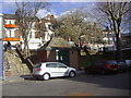
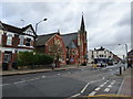
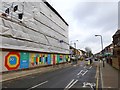
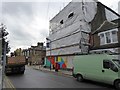
Living in NW10 3PT means residing within a precisely defined residential cluster covering just over five thousand square metres. This compact postcode serves 1,597 individuals, creating an environment where neighbours are often familiar faces due to the high population density of 316,165 people per square kilometre. The area functions as a tight-knit pocket of the wider London landscape, specifically within England. Residents experience the practicality of very small geography, where the boundary of your immediate post town envelope is extremely close. Daily life here is characterised by proximity, yet the low acreage suggests a sharp need to value every square inch of local space. You are situated in a setting that prioritises immediate access to services over expansive green lungroom within the specific limit of this postcode. The size of this cluster means that noise and activity from nearby streets permeate the area quickly, making it essential to consider the urban rhythm of Nelson Street and surrounding thoroughfares. This location offers a slice of suburban living without the buffer of vast distances to rail links or retail hubs.
- Area Type
- Postcode
- Area Size
- 5051 m²
- Population
- 1597
- Population Density
- 8531 people/km²
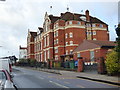
Homes in NW10 3PT are overwhelmingly owner-occupied, with 72 percent of residents holding the deeds to their properties. This statistic points to a market where stability is the norm, driven primarily by houses rather than flats or high-density apartments. You are not entering a rental-heavy zone where tenants turnover frequently; instead, you are looking at a stock suited for buyers intending to settle down. Because the accommodation type is listed strictly as houses, the area lacks the density of large urban conversions often found in neighbouring postcodes. The small physical size of the postcode suggests that supply is limited, yet the high ownership rate maintains value and security. When searching for properties, expect to find a mix of family homes and properties for retired professionals, given the median age of 47. The fact that three-quarters of households own their dwellings signals that prices here likely reflect long-term investment rather than speculative rental yields. This area represents a classic suburban holding, where the financial commitment to purchasing is the primary mode of occupation.
House Prices in NW10 3PT
Showing 43 properties
| Address | Type | Beds | Baths | Last Sale Price | Last Sale Date | |
|---|---|---|---|---|---|---|
| 26 Leighton Gardens, London, NW10 3PT | Flat | 2 | 1 | £715,000 | Jul 2025 | |
| 8 Leighton Gardens, London, NW10 3PT | Terraced | 4 | 1 | £1,100,000 | Jan 2025 | |
| 40 Leighton Gardens, London, NW10 3PT | house | - | - | £1,000,000 | Mar 2021 | |
| 26A Leighton Gardens, London, NW10 3PT | Flat | - | - | £547,000 | Jun 2014 | |
| 12 Leighton Gardens, London, NW10 3PT | Semi-detached | - | - | £138,000 | Jun 1997 | |
| 10B Leighton Gardens, London, NW10 3PT | Flat | 3 | 2 | - | - | |
| 30 Leighton Gardens, London, NW10 3PT | Terraced | 3 | 1 | - | - | |
| 14A Leighton Gardens, London, NW10 3PT | Flat | 2 | 1 | - | - | |
| 18A Leighton Gardens, London, NW10 3PT | Flat | 2 | 1 | - | - | |
| 34A Leighton Gardens, London, NW10 3PT | Flat | 2 | 1 | - | - |
Energy Efficiency in NW10 3PT
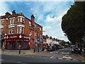
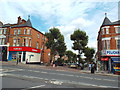
Access to amenities for those living in NW10 3PT is extensive due to the proximity of major transport hubs and retail parks nearby. Residents can reach Kensington Rise Station, Kensal Green Station, and Brondesbury Park Station for rail travel, while Kilburn Station, Dollis Hill Station, and Kilburn Park Station offer metro networks. The Little Venice Waterbus Stop, London Zoo Waterbus Stop, and Camden Lock Waterbus provide unique leisure routes across the canal system. Supermarket access is streamlined through Tesco Kensal, Tesco Kensal Rise, and Co-op Kensal, allowing for quick grocery runs without crossing town boundaries. Although the specific amenities count shows five for each category including buses and ferries, the notable names confirm a rich network of services. For example, you can access services linking to London Victoria Coach Station via local bus routes. This density of railway lines and retail parks means daily errands require minimal planning. You have the option of using the waterbus to reach attractions like Camden Lock or simply grabbing essentials at the Co-op.
Amenities
Schools
| Rank | School | Type | Entry gender | Ages |
|---|
Explore more schools in this area
Go to Schools tabDemographics
The community in NW10 3PT reflects a mature demographic profile, with a median age of 47 years. You are most likely to find adults aged between 30 and 64 years occupying the homes in this area. Analysis of the data confirms that 72 percent of households are owner-occupied, indicating a stable neighbourhood where long-term residents have invested in their property. The accommodation type is exclusively houses, which aligns with the maturity of the population and the high level of home ownership. Detached, semi-detached, or terraced properties rather than rentals dominate the landscape, suggesting families and independent dwellers are the primary demographic. White ethnic groups form the predominant community, consistent with typical patterns in this London postcode sector. There is no indication of significant deprivation data in the current report, but the high ownership rate and steady age profile suggest a settled, established community rather than a transient population. When contemplating homes in NW10 3PT, expect an environment populated by residents who have likely stayed through various market cycles, seeking the consistency found in this specific housing stock.
Household Size
Accommodation Type
Tenure
Ethnic Group
Religion
Household Composition
Age
Household Deprivation
NS-SEC
Explore more demographic insights in this area
Go to Demographics tabPlanning
Planning Constraints
- Flood RiskPremium
- Ramsar Wetland SitesPremium
- Area of Outstanding Natural BeautyPremium
- Protected Nature ReservePremium
- Protected WoodlandPremium