Area Overview for NW10 3EL
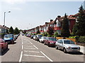
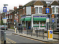
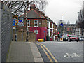
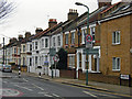
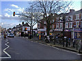
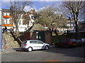
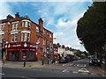
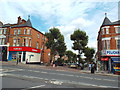
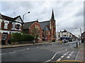
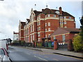
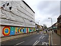
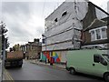
Photos of NW10 3EL
Area Information
Living in NW10 3EL means residing within a specific postcode covering a small residential cluster of 2.8 hectares. This compact area is home to 1,273 people, creating a densely populated yet intimate housing environment. With a population density of 45,878 people per square kilometre, the neighbourhood feels established and settled rather than sprawling. The high density stems from the limited land size, which concentrates households into a tightly knit community. Residents navigate streets where proximity is key, fostering a sense of familiarity among neighbours. This geographic constraint shapes daily life, as everything from local shops to transport links is within close reach. The area serves as a defined residential pocket, likely situated within the broader Willesden or Kensal Green neighbourhoods of London. Buyers seeking a characterful location outside central London but close to major hubs will find this postcode distinct from wider suburban sprawls. The concentration of homes suggests a mature settlement where growth has reached a natural limit. Each house or flat contributes to a cohesive whole, offering a living experience defined by closeness and community cohesion.
- Area Type
- Postcode
- Area Size
- 2.8 hectares
- Population
- 1273
- Population Density
- 8047 people/km²
The property market in NW10 3EL is predominantly owner-occupied, with home ownership standing at 69%. This high percentage indicates a stable housing stock where residents have invested in buying properties rather than renting. Homes in NW10 3EL are primarily houses, aligning with the demographic tendency towards family-sized or private residences. The small 2.8-hectare footprint limits the volume of available stock, making each property valuable. Buyers looking at this postcode should expect a market focused on established home ownership rather than high-turnover rentals. The accommodation type data confirms a preference for houses, suggesting limited availability of high-rise flats or purpose-built blocks. This structure benefits owners seeking privacy and space within a dense urban setting. Property values in this area likely reflect the scarcity of space combined with the high demand for house ownership. Prospective buyers entering this market will find a community where most neighbours are owners, creating a stable investment environment. The concentration of houses also means gardens or private outdoor spaces may be common features.
House Prices in NW10 3EL
Showing 29 properties
| Address | Type | Beds | Baths | Last Sale Price | Last Sale Date | |
|---|---|---|---|---|---|---|
| 50 Mount Pleasant Road, London, NW10 3EL | Semi-detached | 6 | 3 | £3,600,000 | Oct 2023 | |
| 14 Mount Pleasant Road, London, NW10 3EL | Semi-detached | 7 | 6 | £3,370,000 | May 2022 | |
| 38 Mount Pleasant Road, London, NW10 3EL | Detached | 4 | 1 | £1,520,000 | Jan 2021 | |
| 32 Mount Pleasant Road, London, NW10 3EL | Detached | 5 | 2 | £2,605,005 | Sep 2020 | |
| 28 Mount Pleasant Road, London, NW10 3EL | Detached | 6 | 2 | £2,300,000 | Jan 2016 | |
| 46 Mount Pleasant Road, London, NW10 3EL | Detached | 5 | 3 | £1,900,000 | Sep 2015 | |
| 52 Mount Pleasant Road, London, NW10 3EL | Semi-detached | - | - | £1,950,000 | Aug 2013 | |
| 44 Mount Pleasant Road, London, NW10 3EL | house | 5 | - | £1,530,000 | Aug 2012 | |
| 42 Mount Pleasant Road, London, NW10 3EL | Detached | 4 | 1 | £1,270,000 | Aug 2011 | |
| 34 Mount Pleasant Road, London, NW10 3EL | house | - | - | £1,485,000 | Sep 2010 |
Energy Efficiency in NW10 3EL
Residents of NW10 3EL enjoy excellent access to local amenities, all within practical reach of their homes. Five railway stations serve the area, including Kensal Rise Station, Brondesbury Park Station, and Kensal Green Station. This rail connectivity provides easy access to central London and other parts of the capital. Five metro options are nearby, such as Kilburn Station, Dollis Hill Station, and Kilburn Park Station, offering alternative routes and frequencies. Waterbus services operate from Little Venice Waterbus Stop, London Zoo Waterbus Stop, and Camden Lock Water. These river transport options add a unique leisure dimension to local travel. Five bus routes provide further flexibility, though three notable stops are listed, including links to the London Victoria Coach Station Arrivals and Green Line Coach Station. Five retail locations are close by, including Tesco Kensal and two Sainsburys branches in Willesden. This concentration of shops ensures daily necessities are always handy. The proximity of transport hubs and supermarkets makes independent living convenient without relying heavily on a car.
Amenities
Schools
| Rank | School | Type | Entry gender | Ages |
|---|
Explore more schools in this area
Go to Schools tabDemographics
The community in NW10 3EL reflects a mature demographic profile, with a median age of 47 years. Most residents fall into the adult age range of 30 to 64 years, indicating an established neighbourhood rather than one dominated by students or young professionals. Home ownership is robust, with 69% of households owning their property outright or with a mortgage. This suggests a stable population where people have long-term roots in the area. The predominant accommodation type consists of houses, appealing to families or individuals seeking standalone properties rather than shared blocks. White ethnicity is the predominant group among residents, though diverse communities often exist alongside in such established London suburbs. The lack of young children in the population data points toward a household composition favoured by working-age adults. This demographic mix influences local commerce, with shops likely catering to established families and professionals. The high ownership rate reduces tenant turnover, allowing the local character to remain consistent year after year.
Household Size
Accommodation Type
Tenure
Ethnic Group
Religion
Household Composition
Age
Household Deprivation
NS-SEC
Explore more demographic insights in this area
Go to Demographics tabPlanning
Planning Constraints
- Flood RiskPremium
- Ramsar Wetland SitesPremium
- Area of Outstanding Natural BeautyPremium
- Protected Nature ReservePremium
- Protected WoodlandPremium