Area Overview for NW10 3BX
Photos of NW10 3BX
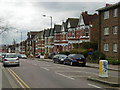
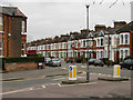
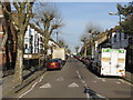
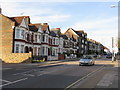
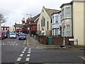
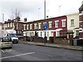
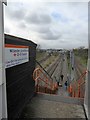
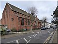
90 photos from this area
Area Information
Key information about the NW10 3BX including its size, population, and administrative classification.
- Area Type
- Postcode
- Area Size
- 1.1 hectares
- Population
- 1819
- Population Density
- 10347 people/km²
House Prices in NW10 3BX
55
Properties
£584,359
Average Sold Price
£98,500
Lowest Price
£1,495,000
Highest Price
Showing 55 properties
| Address | Type | Beds | Baths | Last Sale Price | Last Sale Date | |
|---|---|---|---|---|---|---|
| 59 Herbert Gardens, London, NW10 3BX | house | - | - | £1,200,000 | Feb 2025 | |
| 65 Herbert Gardens, London, NW10 3BX | Terraced | 3 | 1 | £1,050,000 | Feb 2024 | |
| 67 Herbert Gardens, London, NW10 3BX | Terraced | 5 | 2 | £1,495,000 | May 2023 | |
| 57 Herbert Gardens, London, NW10 3BX | house | 3 | 2 | £975,000 | Sep 2022 | |
| 11A Herbert Gardens, London, NW10 3BX | Flat | - | - | £525,000 | Aug 2022 | |
| 39 Herbert Gardens, London, NW10 3BX | Terraced | 4 | 2 | £1,200,000 | Mar 2015 | |
| 69 Herbert Gardens, London, NW10 3BX | Terraced | 5 | 2 | £689,000 | Jan 2011 | |
| 51 Herbert Gardens, London, NW10 3BX | Detached | 4 | 2 | £410,000 | Oct 2008 | |
| 7A Herbert Gardens, London, NW10 3BX | Flat | 2 | 1 | £325,000 | Sep 2008 | |
| 63 Herbert Gardens, London, NW10 3BX | Terraced | 3 | 2 | £395,000 | May 2006 |
Page 1 of 6
Energy Efficiency in NW10 3BX
Amenities
Schools
| Rank | School | Type | Entry gender | Ages |
|---|
Explore more schools in this area
Go to Schools tabDemographics
Household Size
Family (3-5 people)
most common
Accommodation Type
Houses
most common
Tenure
63
majority
Ethnic Group
White
most common
Religion
N/A
most common
Household Composition
N/A
most common
Age
47
median
Adults (30-64 years)
most common
Household Deprivation
N/A
with no deprivation
NS-SEC
44
in Lower managerial occupations
Explore more demographic insights in this area
Go to Demographics tabPlanning
Planning Constraints
- Flood RiskPremium
- Ramsar Wetland SitesPremium
- Area of Outstanding Natural BeautyPremium
- Protected Nature ReservePremium
- Protected WoodlandPremium