Area Overview for NW10 0NE
Photos of NW10 0NE
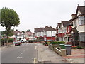
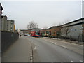
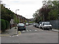
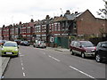
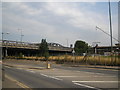
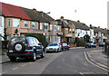
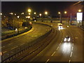

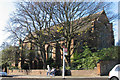
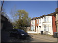

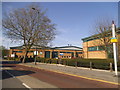
100 photos from this area
Area Information
Key information about the NW10 0NE including its size, population, and administrative classification.
- Area Type
- Postcode
- Area Size
- 6934 m²
- Population
- 2048
- Population Density
- 9280 people/km²
House Prices in NW10 0NE
22
Properties
£317,346
Average Sold Price
£90,000
Lowest Price
£750,000
Highest Price
Showing 22 properties
| Address | Type | Beds | Baths | Last Sale Price | Last Sale Date | |
|---|---|---|---|---|---|---|
| 22 Elm Way, London, NW10 0NE | house | 6 | 6 | £750,000 | Jan 2025 | |
| 16 Elm Way, London, NW10 0NE | Semi-detached | 3 | - | £640,000 | Jul 2022 | |
| 36 Elm Way, London, NW10 0NE | Terraced | 3 | 1 | £615,000 | Apr 2017 | |
| 18 Elm Way, London, NW10 0NE | house | 3 | - | £375,000 | Nov 2012 | |
| 30 Elm Way, London, NW10 0NE | Semi-detached | - | - | £380,000 | May 2007 | |
| 52 Elm Way, London, NW10 0NE | Semi-detached | 4 | 1 | £343,000 | May 2007 | |
| 14 Elm Way, London, NW10 0NE | Semi-detached | 2 | - | £280,000 | Apr 2005 | |
| 42 Elm Way, London, NW10 0NE | Semi-detached | - | - | £197,000 | Aug 2001 | |
| 50 Elm Way, London, NW10 0NE | Terraced | - | - | £117,000 | Jul 1998 | |
| 26 Elm Way, London, NW10 0NE | house | - | - | £110,500 | Mar 1998 |
Page 1 of 3
Energy Efficiency in NW10 0NE
Amenities
Schools
| Rank | School | Type | Entry gender | Ages |
|---|
Explore more schools in this area
Go to Schools tabDemographics
Household Size
Family (3-5 people)
most common
Accommodation Type
Houses
most common
Tenure
28
majority
Ethnic Group
White
most common
Religion
N/A
most common
Household Composition
N/A
most common
Age
47
median
Adults (30-64 years)
most common
Household Deprivation
N/A
with no deprivation
NS-SEC
16
in Lower managerial occupations
Explore more demographic insights in this area
Go to Demographics tabPlanning
Planning Constraints
- Flood RiskPremium
- Ramsar Wetland SitesPremium
- Area of Outstanding Natural BeautyPremium
- Protected Nature ReservePremium
- Protected WoodlandPremium